Islamabad to Abu Dhabi is 1,263 miles (2,033 km), a flight of about 3 hours 5 minutes.
The right side offers the Margalla Hills and Salt Range near departure plus a scenic coastal approach into Abu Dhabi, while the left side is dominated by flat plains and open Gulf water with little variation.
Flight Path
Arabian Sea crossing near the Makran coast, followed by open water across the Gulf of Oman approach toward the UAE coastline
Great circle distance and headings ›Phase by phase
Takeoff from ISB
RIGHTDeparting ISB to the southwest, the right side of the aircraft faces northwest, giving passengers a good look at the Margalla Hills right at the edge of Islamabad, then the rolling Potohar Plateau and the Salt Range as the plane climbs. The left side only shows the flatter plains toward the Indian border.
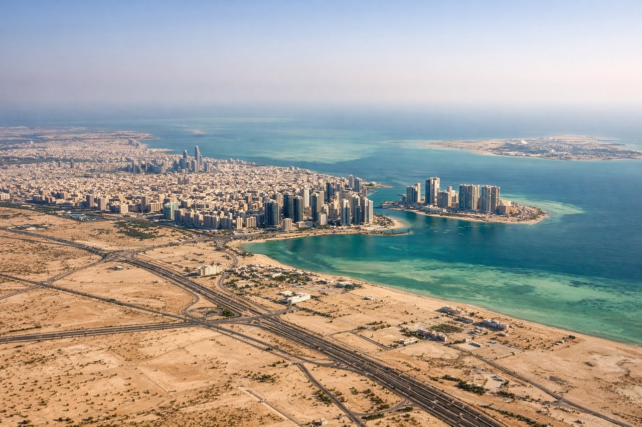
Landing at AUH
RIGHTOn approach into AUH from the northeast, the final turn typically swings passengers over Abu Dhabi's coastal development, giving the right side views of turquoise shallow waters, artificial islands, and the city's skyline before touchdown. The left side mostly faces open desert or empty Gulf water.
Landmarks on this routeAll landmarks →
Will your flight be in sunlight?
Pick a date and time in the Sun Map to watch the sun move across your whole flight.
About This Route
Which side of the plane should I sit on flying from Islamabad International Airport (ISB) to Abu Dhabi International (AUH)?
Sit on the Right side of the plane for the best views on flights from Islamabad to Abu Dhabi. The right side offers the Margalla Hills and Salt Range near departure plus a scenic coastal approach into Abu Dhabi, while the left side is dominated by flat plains and open Gulf water with little variation.
What can I see during takeoff from Islamabad International Airport in Islamabad?
During takeoff from Islamabad International Airport (ISB), sit on the Right side for the best views. Departing ISB to the southwest, the right side of the aircraft faces northwest, giving passengers a good look at the Margalla Hills right at the edge of Islamabad, then the rolling Potohar Plateau and the Salt Range as the plane climbs. The left side only shows the flatter plains toward the Indian border. Notable sights include: Margalla Hills, Potohar Plateau, Salt Range, Rawalpindi urban sprawl.
What can I see when landing at Abu Dhabi International in Abu Dhabi?
When landing at Abu Dhabi International (AUH), sit on the Right side for the best views. On approach into AUH from the northeast, the final turn typically swings passengers over Abu Dhabi's coastal development, giving the right side views of turquoise shallow waters, artificial islands, and the city's skyline before touchdown. The left side mostly faces open desert or empty Gulf water. Notable sights include: Abu Dhabi skyline, Yas Island, Saadiyat Island, turquoise coastal shallows.
How long is the flight from Islamabad to Abu Dhabi?
The flight from Islamabad International Airport (ISB) to Abu Dhabi International (AUH) takes about 3 hours 5 minutes. The shortest flight path between them is 1,263 miles (2,033 km); winds and air traffic control usually add a few percent.
What does the Islamabad to Abu Dhabi flight path pass over?
Arabian Sea crossing near the Makran coast, followed by open water across the Gulf of Oman approach toward the UAE coastline