The right side wins on both ends of the flight — dramatic hill and mountain terrain during the ISB departure and cruise over the Hindu Kush and Iranian/Anatolian highlands, plus a rare glimpse of London's skyline on the LGW approach.
Flown ISB to LGW? Did we get it right?
Flight Path
Islamabad to London is 3,754 miles (6,041 km), a flight of about 7 hours 55 minutes.
Hindu Kush mountain range, Iranian plateau, Zagros foothills, Anatolian highlands of Turkey
Great circle distance and headings ›


Phase by phase
Takeoff from ISB
RIGHTDeparting ISB on runway 28, the climb-out curves northwest with the Margalla Hills rising immediately on the right side, followed by the foothills of the Himalayas and Hindu Kush as the aircraft gains altitude. The left side shows the flatter Pothohar Plateau and Islamabad-Rawalpindi urban sprawl, which is less dramatic.
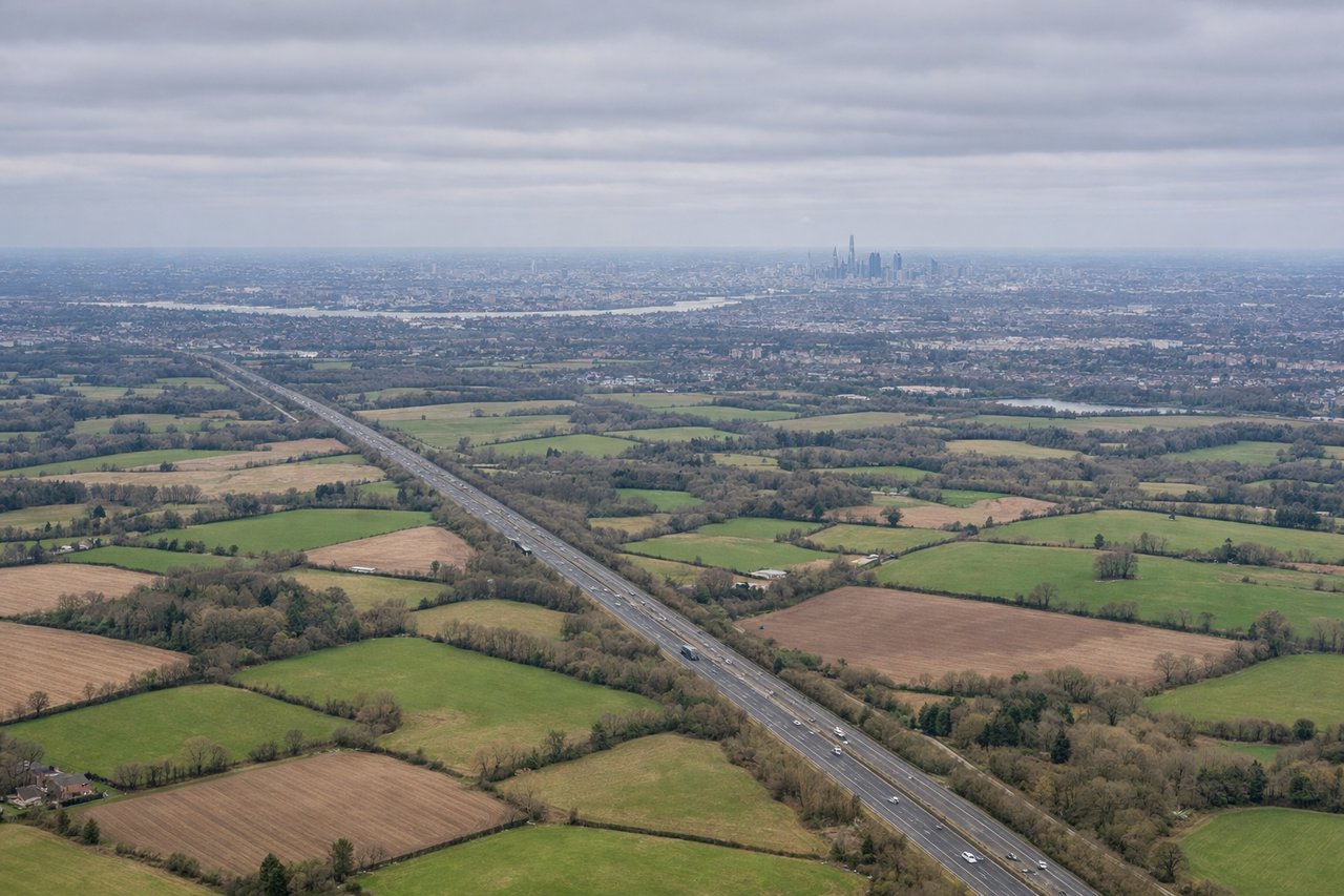
Landing at LGW
RIGHTOn the typical easterly approach into LGW runway 26, the flight path crosses Kent and Surrey before turning onto final, and passengers on the right side often get a clear view of London's skyline including the Docklands towers to the north before the turn south of the city. The left side mainly shows the quieter North Downs countryside.
Will your flight be in sunlight?
Pick a date and time in the Sun Map to watch the sun move across your whole flight.
About This Route
Which side of the plane should I sit on flying from Islamabad International Airport (ISB) to Gatwick (LGW)?
Sit on the Right side of the plane for the best views on flights from Islamabad to London. The right side wins on both ends of the flight — dramatic hill and mountain terrain during the ISB departure and cruise over the Hindu Kush and Iranian/Anatolian highlands, plus a rare glimpse of London's skyline on the LGW approach.
What can I see during takeoff from Islamabad International Airport in Islamabad?
During takeoff from Islamabad International Airport (ISB), sit on the Right side for the best views. Departing ISB on runway 28, the climb-out curves northwest with the Margalla Hills rising immediately on the right side, followed by the foothills of the Himalayas and Hindu Kush as the aircraft gains altitude. The left side shows the flatter Pothohar Plateau and Islamabad-Rawalpindi urban sprawl, which is less dramatic. Notable sights include: Margalla Hills, Islamabad's Margalla foothill ridgeline, distant Murree hill station, Pothohar Plateau edge.
What can I see when landing at Gatwick in London?
When landing at Gatwick (LGW), sit on the Right side for the best views. On the typical easterly approach into LGW runway 26, the flight path crosses Kent and Surrey before turning onto final, and passengers on the right side often get a clear view of London's skyline including the Docklands towers to the north before the turn south of the city. The left side mainly shows the quieter North Downs countryside. Notable sights include: River Thames, Canary Wharf towers, North Downs ridgeline, patchwork Surrey/Kent farmland.
How long is the flight from Islamabad to London?
The flight from Islamabad International Airport (ISB) to Gatwick (LGW) takes about 7 hours 55 minutes. The shortest flight path between them is 3,754 miles (6,041 km); winds and air traffic control usually add a few percent.
What does the Islamabad to London flight path pass over?
Hindu Kush mountain range, Iranian plateau, Zagros foothills, Anatolian highlands of Turkey