While left offers good Osaka departure views, right side dominates the longer Boston arrival sequence with extended views of the Atlantic, Cape Cod, and Boston Harbor—the most visually distinctive portion of this transpacific route.
Flight Path
The flight crosses the North Pacific, passing north of the Hawaiian Islands (typically 200+ miles north), then approaches North America over the Aleutian Islands region. The route crosses the International Date Line and traverses open ocean for the majority of the journey. No significant land features are visible for roughly 8-9 hours of the flight. Approaching North America, the aircraft passes over or near the Canadian Maritime provinces before descending toward Boston.
Great circle distance and headings ›
.jpeg?width=600)
Phase by phase
Takeoff from ITM
LEFTLeft side offers views of Osaka Bay and the Kobe-Osaka urban corridor as the aircraft climbs northwestward. Right side faces inland terrain with less distinctive visual interest during initial climb.
Landing at BOS
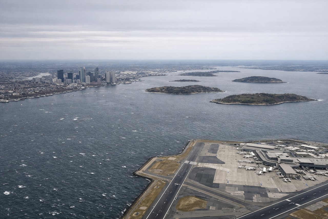
RIGHTRight side provides views of the Atlantic coastline, Boston Harbor, and Cape Cod as the aircraft descends toward Logan. Left side faces inland Massachusetts terrain with fewer distinctive water features during approach.
Landmarks on this routeAll landmarks →
Will your flight be in sunlight?
See exactly which side of the plane gets sun and shade at your departure time.
About This Route
Which side of the plane should I sit on flying from Osaka International (ITM) to General Edward Lawrence Logan International (BOS)?
Sit on the Right side of the plane for the best views on flights from Osaka to Boston. While left offers good Osaka departure views, right side dominates the longer Boston arrival sequence with extended views of the Atlantic, Cape Cod, and Boston Harbor—the most visually distinctive portion of this transpacific route.
What can I see during takeoff from Osaka International in Osaka?
During takeoff from Osaka International (ITM), sit on the Left side for the best views. Left side offers views of Osaka Bay and the Kobe-Osaka urban corridor as the aircraft climbs northwestward. Right side faces inland terrain with less distinctive visual interest during initial climb. Notable sights include: Osaka Bay (Osaka-wan), Kobe city waterfront, Rokko Mountains to the north, Awaji Island in the bay.
What can I see when landing at General Edward Lawrence Logan International in Boston?
When landing at General Edward Lawrence Logan International (BOS), sit on the Right side for the best views. Right side provides views of the Atlantic coastline, Boston Harbor, and Cape Cod as the aircraft descends toward Logan. Left side faces inland Massachusetts terrain with fewer distinctive water features during approach. Notable sights include: Atlantic Ocean and Boston Harbor, Cape Cod peninsula, Massachusetts Bay, Boston city skyline.
How long is the flight from Osaka to Boston?
The flight from Osaka International (ITM) to General Edward Lawrence Logan International (BOS) takes 11h 15m.
What does the Osaka to Boston flight path pass over?
The flight crosses the North Pacific, passing north of the Hawaiian Islands (typically 200+ miles north), then approaches North America over the Aleutian Islands region. The route crosses the International Date Line and traverses open ocean for the majority of the journey. No significant land features are visible for roughly 8-9 hours of the flight. Approaching North America, the aircraft passes over or near the Canadian Maritime provinces before descending toward Boston.