Right side captures Osaka Bay and urban Kansai during takeoff, then offers views of the North Pacific, Japanese islands, and Aleutian geography during cruise. While left side has Mount Rainier on approach, the extended right-side viewing during the majority of the flight duration makes it the better overall choice.
Flown ITM to SEA? Did we get it right?
Flight Path
Osaka to Seattle is 5,002 miles (8,050 km), a flight of about 11 hours.
Northern Honshu coastline (visible early climb), Sea of Japan, Hokkaido's southern coast, North Pacific open ocean (majority of cruise), Aleutian Islands chain (far northern route), Alaska panhandle mountains, British Columbia coastal ranges, Cascade Range (final descent approach)
Great circle distance and headings ›Phase by phase
Takeoff from ITM
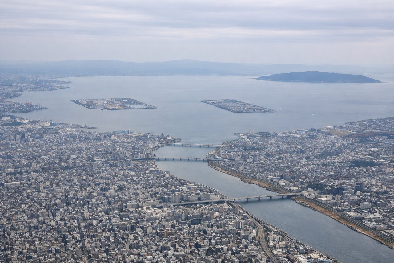
RIGHTRight side offers views of Osaka Bay and the Kobe-Osaka urban corridor as the aircraft climbs northwestward. Left side faces inland terrain with less dramatic scenery during the initial climb.
Landing at SEA
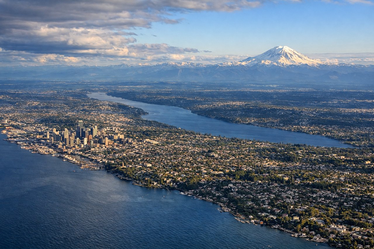
LEFTLeft side provides views of the Cascade Range and Mount Rainier during descent into Seattle. Right side faces Puget Sound but with less dramatic topography. Mount Rainier's prominence makes the left side the scenic winner for approach.
Will your flight be in sunlight?
Pick a date and time in the Sun Map to watch the sun move across your whole flight.
About This Route
Which side of the plane should I sit on flying from Osaka International (ITM) to Seattle Tacoma International (SEA)?
Sit on the Right side of the plane for the best views on flights from Osaka to Seattle. Right side captures Osaka Bay and urban Kansai during takeoff, then offers views of the North Pacific, Japanese islands, and Aleutian geography during cruise. While left side has Mount Rainier on approach, the extended right-side viewing during the majority of the flight duration makes it the better overall choice.
What can I see during takeoff from Osaka International in Osaka?
During takeoff from Osaka International (ITM), sit on the Right side for the best views. Right side offers views of Osaka Bay and the Kobe-Osaka urban corridor as the aircraft climbs northwestward. Left side faces inland terrain with less dramatic scenery during the initial climb. Notable sights include: Osaka Bay (immediate), Kobe skyline to the west, Akashi Strait, inland Kansai plains receding eastward.
What can I see when landing at Seattle Tacoma International in Seattle?
When landing at Seattle Tacoma International (SEA), sit on the Left side for the best views. Left side provides views of the Cascade Range and Mount Rainier during descent into Seattle. Right side faces Puget Sound but with less dramatic topography. Mount Rainier's prominence makes the left side the scenic winner for approach. Notable sights include: Mount Rainier (14,411 ft, visible 50+ miles away), Cascade Range foothills, Puget Sound waters, Seattle urban sprawl.
How long is the flight from Osaka to Seattle?
The flight from Osaka International (ITM) to Seattle Tacoma International (SEA) takes about 11 hours. The shortest flight path between them is 5,002 miles (8,050 km); winds and air traffic control usually add a few percent.
What does the Osaka to Seattle flight path pass over?
Northern Honshu coastline (visible early climb), Sea of Japan, Hokkaido's southern coast, North Pacific open ocean (majority of cruise), Aleutian Islands chain (far northern route), Alaska panhandle mountains, British Columbia coastal ranges, Cascade Range (final descent approach)