Right-side seats capture the more visually distinctive takeoff sequence from ITM with Lake Yodo and Kobe's urban density, though the landing view favors left. The takeoff experience is more dramatic and geographically informative for this northbound route.
Flown ITM to CTS? Did we get it right?
Flight Path
Osaka to Sapporo is 646 miles (1,040 km), a flight of about 1 hour 45 minutes.
The flight path crosses the Kii Peninsula's northern edge (visible as forested terrain), then transitions over the Ise Bay region and the Kiso Mountains. The route follows a generally north-northeast corridor across central Honshu, passing east of the Japanese Alps. The Ou Mountains appear as a distant ridge on the eastern horizon during cruise. Approaching Hokkaido, the Yufutsu Plain becomes visible before descent into the Ishikari Plain surrounding Sapporo.
Great circle distance and headings ›Phase by phase
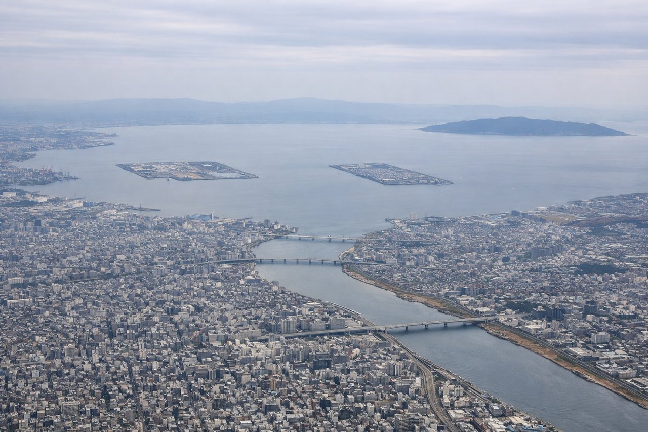
Takeoff from ITM
RIGHTITM typically departs to the north on runway 32L/32R. Right-side seats face northwest toward Lake Yodo and the Kobe-Osaka urban sprawl, offering immediate views of the densely populated Kansai region. Left seats see the inland Osaka Plain with less dramatic relief.
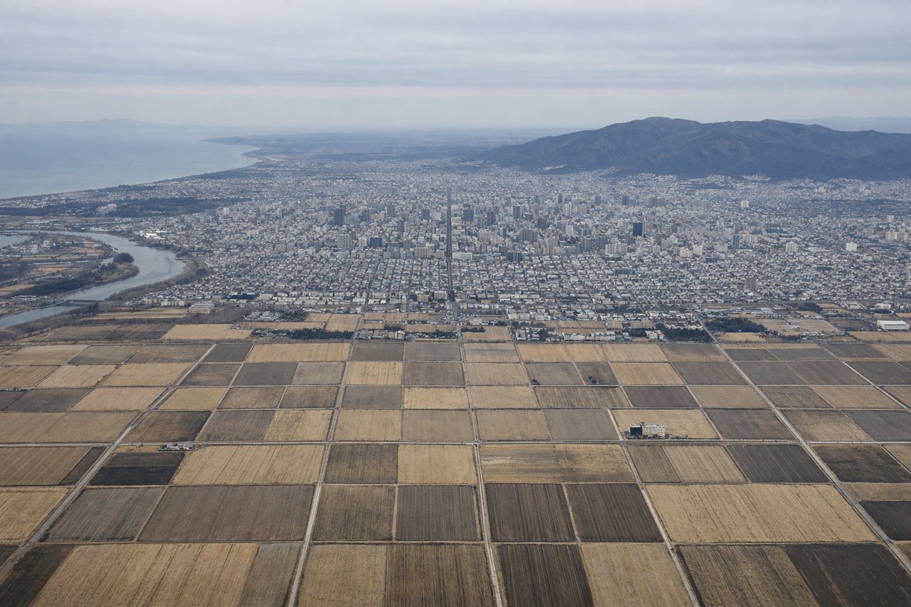
Landing at CTS
LEFTCTS approaches from the south on runway 19L/19R. Left-side seats descending toward Sapporo face east-southeast, providing views of the Ishikari Plain's agricultural landscape and the city's grid layout. Right seats see mostly the Ishikari Bay coastline and less distinctive terrain.
Will your flight be in sunlight?
Pick a date and time in the Sun Map to watch the sun move across your whole flight.
About This Route
Which side of the plane should I sit on flying from Osaka International (ITM) to Chitose International Airport (CTS)?
Sit on the Right side of the plane for the best views on flights from Osaka to Sapporo. Right-side seats capture the more visually distinctive takeoff sequence from ITM with Lake Yodo and Kobe's urban density, though the landing view favors left. The takeoff experience is more dramatic and geographically informative for this northbound route.
What can I see during takeoff from Osaka International in Osaka?
During takeoff from Osaka International (ITM), sit on the Right side for the best views. ITM typically departs to the north on runway 32L/32R. Right-side seats face northwest toward Lake Yodo and the Kobe-Osaka urban sprawl, offering immediate views of the densely populated Kansai region. Left seats see the inland Osaka Plain with less dramatic relief. Notable sights include: Lake Yodo (immediate northwest), Kobe city district (far northwest across Osaka Bay), Osaka urban grid (below and receding north), Ikoma Mountains (distant northeast horizon).
What can I see when landing at Chitose International Airport in Sapporo?
When landing at Chitose International Airport (CTS), sit on the Left side for the best views. CTS approaches from the south on runway 19L/19R. Left-side seats descending toward Sapporo face east-southeast, providing views of the Ishikari Plain's agricultural landscape and the city's grid layout. Right seats see mostly the Ishikari Bay coastline and less distinctive terrain. Notable sights include: Ishikari Plain (extensive agricultural grid), Sapporo urban area (geometric street pattern), Maruyama forested hill (distinctive landmark near city), Ishikari Bay (western horizon).
How long is the flight from Osaka to Sapporo?
The flight from Osaka International (ITM) to Chitose International Airport (CTS) takes about 1 hour 45 minutes. The shortest flight path between them is 646 miles (1,040 km); winds and air traffic control usually add a few percent.
What does the Osaka to Sapporo flight path pass over?
The flight path crosses the Kii Peninsula's northern edge (visible as forested terrain), then transitions over the Ise Bay region and the Kiso Mountains. The route follows a generally north-northeast corridor across central Honshu, passing east of the Japanese Alps. The Ou Mountains appear as a distant ridge on the eastern horizon during cruise. Approaching Hokkaido, the Yufutsu Plain becomes visible before descent into the Ishikari Plain surrounding Sapporo.