The right side wins mainly on the strength of the Himalayan departure view from Bagdogra, which is a genuinely dramatic and rare mountain vista rarely seen on domestic Indian routes, while the rest of the flight over the Deccan plateau is largely flat and unremarkable on both sides.
Flown IXB to BLR? Did we get it right?
Flight Path
Baghdogra to Bangalore is 1,158 miles (1,863 km), a flight of about 2 hours 50 minutes.
Flat agricultural plains of West Bengal and Odisha, the Eastern Ghats' low hill ranges near the Andhra Pradesh-Telangana border, and the beginning of the Deccan plateau's red-soil terrain
Great circle distance and headings ›Phase by phase
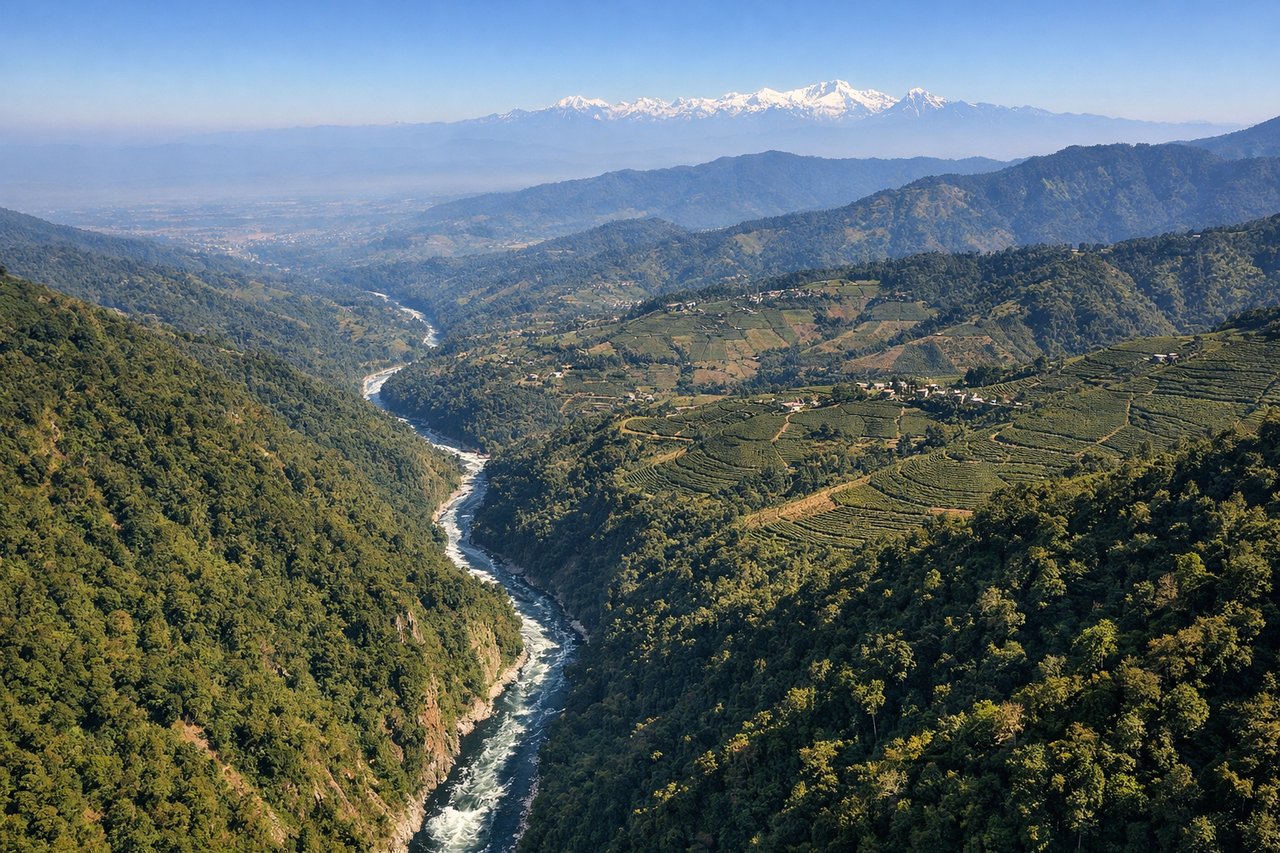
Takeoff from IXB
RIGHTDeparting Bagdogra, the aircraft climbs out with the Himalayan foothills and the Kanchenjunga massif visible to the northwest, which sits on the right side of the plane as it banks southward toward Bangalore. This is a rare high-mountain view for an Indian domestic departure.
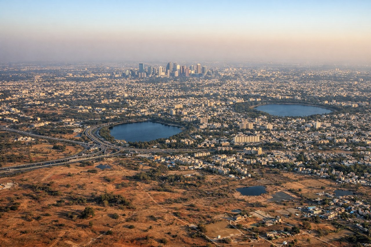
Landing at BLR
LEFTOn approach into Bangalore the typical descent path curves the aircraft so the city's northern IT corridor, tech park clusters, and scattered lakes appear on the left side just before touchdown. The Deccan plateau's flat but distinct patchwork of red-soil fields and reservoirs is more visible from this side during the final turn.
Will your flight be in sunlight?
Pick a date and time in the Sun Map to watch the sun move across your whole flight.
About This Route
Which side of the plane should I sit on flying from Bagdogra (IXB) to Kempegowda International Airport Bengaluru (BLR)?
Sit on the Right side of the plane for the best views on flights from Baghdogra to Bangalore. The right side wins mainly on the strength of the Himalayan departure view from Bagdogra, which is a genuinely dramatic and rare mountain vista rarely seen on domestic Indian routes, while the rest of the flight over the Deccan plateau is largely flat and unremarkable on both sides.
What can I see during takeoff from Bagdogra in Baghdogra?
During takeoff from Bagdogra (IXB), sit on the Right side for the best views. Departing Bagdogra, the aircraft climbs out with the Himalayan foothills and the Kanchenjunga massif visible to the northwest, which sits on the right side of the plane as it banks southward toward Bangalore. This is a rare high-mountain view for an Indian domestic departure. Notable sights include: Kanchenjunga range, Darjeeling hill ridges, Teesta River valley.
What can I see when landing at Kempegowda International Airport Bengaluru in Bangalore?
When landing at Kempegowda International Airport Bengaluru (BLR), sit on the Left side for the best views. On approach into Bangalore the typical descent path curves the aircraft so the city's northern IT corridor, tech park clusters, and scattered lakes appear on the left side just before touchdown. The Deccan plateau's flat but distinct patchwork of red-soil fields and reservoirs is more visible from this side during the final turn. Notable sights include: Bangalore IT corridor skyline, Hebbal and Bellandur lakes, Deccan plateau farmland patchwork.
How long is the flight from Baghdogra to Bangalore?
The flight from Bagdogra (IXB) to Kempegowda International Airport Bengaluru (BLR) takes about 2 hours 50 minutes. The shortest flight path between them is 1,158 miles (1,863 km); winds and air traffic control usually add a few percent.
What does the Baghdogra to Bangalore flight path pass over?
Flat agricultural plains of West Bengal and Odisha, the Eastern Ghats' low hill ranges near the Andhra Pradesh-Telangana border, and the beginning of the Deccan plateau's red-soil terrain