Right side scores higher due to superior landing scenery—Miami's urban skyline, Biscayne Bay's striking turquoise waters, and the dramatic contrast with the Everglades provide more visual variety and landmark density than the left side's extended ocean views. While both sides offer modest takeoff interest, the landing advantage on the right is decisive.
Flown KEF to MIA? Did we get it right?
Flight Path
Keflavik to Miami is 3,660 miles (5,890 km), a flight of about 7 hours 15 minutes.
The flight crosses the North Atlantic for approximately 5.5 hours with minimal visible landmarks—open ocean dominates the midpoint. Around 2 hours from Miami, the continental United States becomes visible: the Florida peninsula's distinctive shape, the Bahamas' shallow turquoise banks and islands, and the transition from deep Atlantic blue to coastal waters mark the approach to North American airspace.
Great circle distance and headings ›


Phase by phase
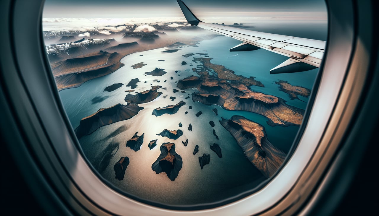
Takeoff from KEF
RIGHTRight side captures Iceland's dramatic volcanic and glacial terrain during departure. Keflavik sits on the Reykjanes Peninsula, and a right-side climb reveals the dark lava fields, coastal cliffs, and the geothermal landscape that defines southwestern Iceland's unique geology.
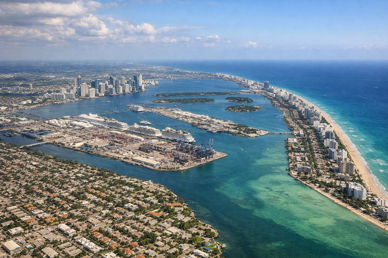
Landing at MIA
RIGHTRight side on approach to Miami offers the most dramatic urban and coastal scenery. The descent reveals Biscayne Bay's turquoise waters, the Miami skyline, barrier islands, and the contrast between developed coastal areas and the Everglades wetlands to the west—a visually rich finale after hours of ocean.
Will your flight be in sunlight?
Pick a date and time in the Sun Map to watch the sun move across your whole flight.
About This Route
Which side of the plane should I sit on flying from Keflavik Nas (KEF) to Miami International (MIA)?
Sit on the Right side of the plane for the best views on flights from Keflavik to Miami. Right side scores higher due to superior landing scenery—Miami's urban skyline, Biscayne Bay's striking turquoise waters, and the dramatic contrast with the Everglades provide more visual variety and landmark density than the left side's extended ocean views. While both sides offer modest takeoff interest, the landing advantage on the right is decisive.
What can I see during takeoff from Keflavik Nas in Keflavik?
During takeoff from Keflavik Nas (KEF), sit on the Right side for the best views. Right side captures Iceland's dramatic volcanic and glacial terrain during departure. Keflavik sits on the Reykjanes Peninsula, and a right-side climb reveals the dark lava fields, coastal cliffs, and the geothermal landscape that defines southwestern Iceland's unique geology. Notable sights include: Reykjanes Peninsula lava fields (dark volcanic terrain), Fagradalsfjall volcanic zone, Atlantic coastline with black sand beaches, Keflavik harbor and runway infrastructure.
What can I see when landing at Miami International in Miami?
When landing at Miami International (MIA), sit on the Right side for the best views. Right side on approach to Miami offers the most dramatic urban and coastal scenery. The descent reveals Biscayne Bay's turquoise waters, the Miami skyline, barrier islands, and the contrast between developed coastal areas and the Everglades wetlands to the west—a visually rich finale after hours of ocean. Notable sights include: Miami downtown skyline and Brickell district, Biscayne Bay with its shallow turquoise water, Miami Beach and barrier islands, Port of Miami container terminals.
How long is the flight from Keflavik to Miami?
The flight from Keflavik Nas (KEF) to Miami International (MIA) takes about 7 hours 15 minutes. The shortest flight path between them is 3,660 miles (5,890 km); winds and air traffic control usually add a few percent.
What does the Keflavik to Miami flight path pass over?
The flight crosses the North Atlantic for approximately 5.5 hours with minimal visible landmarks—open ocean dominates the midpoint. Around 2 hours from Miami, the continental United States becomes visible: the Florida peninsula's distinctive shape, the Bahamas' shallow turquoise banks and islands, and the transition from deep Atlantic blue to coastal waters mark the approach to North American airspace.