While left seats dominate the Icelandic departure with volcanic terrain, right seats offer superior views for the majority of the transatlantic flight and the entire approach into Calgary, including the Rocky Mountains and prairie landscape. The right side captures more of the journey's visual variety.
Flown KEF to YYC? Did we get it right?
Flight Path
Keflavik to Calgary is 3,188 miles (5,131 km), a flight of about 5 hours 30 minutes.
The flight path crosses the North Atlantic at high altitude (typically 33,000-35,000 feet), where few landmarks are visible except occasionally the southern tip of Greenland's ice sheet on the left side during the first 2-3 hours. The Davis Strait and Baffin Island's eastern coastline may be visible on the left during mid-flight if conditions permit. As the aircraft approaches North America, the Canadian Arctic islands and then the boreal forests of northern Canada become visible. The transition from ocean to land occurs roughly 2.5-3 hours into the flight. The flight then passes over the Canadian Shield and boreal forest regions before descending toward the prairies and Rocky Mountains visible on approach to Calgary.
Great circle distance and headings ›

Phase by phase
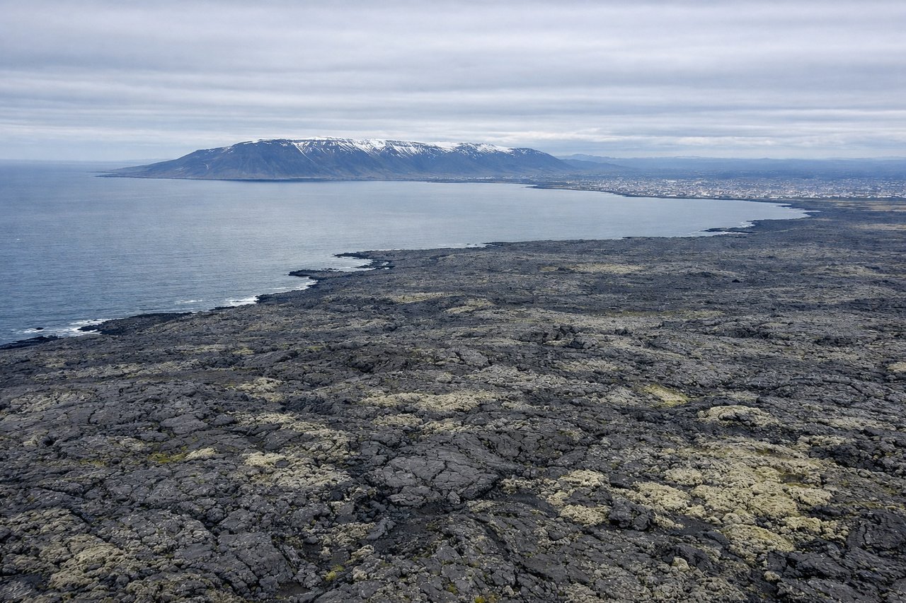
Takeoff from KEF
LEFTLeft seats offer views of Iceland's dramatic southwestern coastline and the Reykjanes Peninsula's volcanic terrain immediately after departure. The aircraft climbs northwest initially, giving left-side passengers direct views of the geothermal and lava fields characteristic of this region.
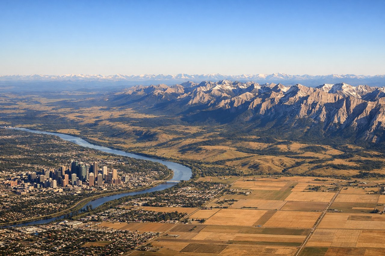
Landing at YYC
RIGHTRight seats provide excellent views during the descent into Calgary as the aircraft approaches from the northeast. Passengers see the Canadian Rocky Mountains in the distance and the transition from prairie grassland to the foothills, with the Bow River valley visible near the airport.
Will your flight be in sunlight?
Pick a date and time in the Sun Map to watch the sun move across your whole flight.
About This Route
Which side of the plane should I sit on flying from Keflavik Nas (KEF) to Calgary International (YYC)?
Sit on the Right side of the plane for the best views on flights from Keflavik to Calgary. While left seats dominate the Icelandic departure with volcanic terrain, right seats offer superior views for the majority of the transatlantic flight and the entire approach into Calgary, including the Rocky Mountains and prairie landscape. The right side captures more of the journey's visual variety.
What can I see during takeoff from Keflavik Nas in Keflavik?
During takeoff from Keflavik Nas (KEF), sit on the Left side for the best views. Left seats offer views of Iceland's dramatic southwestern coastline and the Reykjanes Peninsula's volcanic terrain immediately after departure. The aircraft climbs northwest initially, giving left-side passengers direct views of the geothermal and lava fields characteristic of this region. Notable sights include: Reykjanes Peninsula lava fields, Fagradalsfjall volcanic zone, Atlantic coastline with black sand beaches, Keflavik town and airport complex.
What can I see when landing at Calgary International in Calgary?
When landing at Calgary International (YYC), sit on the Right side for the best views. Right seats provide excellent views during the descent into Calgary as the aircraft approaches from the northeast. Passengers see the Canadian Rocky Mountains in the distance and the transition from prairie grassland to the foothills, with the Bow River valley visible near the airport. Notable sights include: Canadian Rocky Mountains (eastern front), Bow River valley, Calgary city sprawl and downtown core, foothills transition zone.
How long is the flight from Keflavik to Calgary?
The flight from Keflavik Nas (KEF) to Calgary International (YYC) takes about 5 hours 30 minutes. The shortest flight path between them is 3,188 miles (5,131 km); winds and air traffic control usually add a few percent.
What does the Keflavik to Calgary flight path pass over?
The flight path crosses the North Atlantic at high altitude (typically 33,000-35,000 feet), where few landmarks are visible except occasionally the southern tip of Greenland's ice sheet on the left side during the first 2-3 hours. The Davis Strait and Baffin Island's eastern coastline may be visible on the left during mid-flight if conditions permit. As the aircraft approaches North America, the Canadian Arctic islands and then the boreal forests of northern Canada become visible. The transition from ocean to land occurs roughly 2.5-3 hours into the flight. The flight then passes over the Canadian Shield and boreal forest regions before descending toward the prairies and Rocky Mountains visible on approach to Calgary.