While the takeoff from KIX offers compelling views of Japan's coastal geography, the landing approach into PHX on the left side provides more dramatic and visually distinctive scenery—the contrast between sprawling urban Phoenix and the surrounding desert mountains is more striking than the departure views. Left seats capture the Superstition Mountains and South Mountains effectively during approach.
Flight Path
This transpacific route crosses the North Pacific Ocean with no significant visible landmarks for roughly 8-9 hours of flight time. The aircraft typically departs KIX heading northeast, climbs to cruise altitude (35,000-37,000 feet), and follows a great circle route across the Pacific. Aleutian Islands (Alaska) may be visible as a faint landmass on the northern horizon during the mid-Pacific phase if flying at lower altitudes or during optimal lighting conditions, but most of the crossing is open ocean. As the flight approaches North America, the Alaska coast becomes visible, followed by the Canadian Rocky Mountains and Pacific Northwest terrain. The final descent into PHX occurs over Arizona's high desert plateau.
Great circle distance and headings ›


Phase by phase
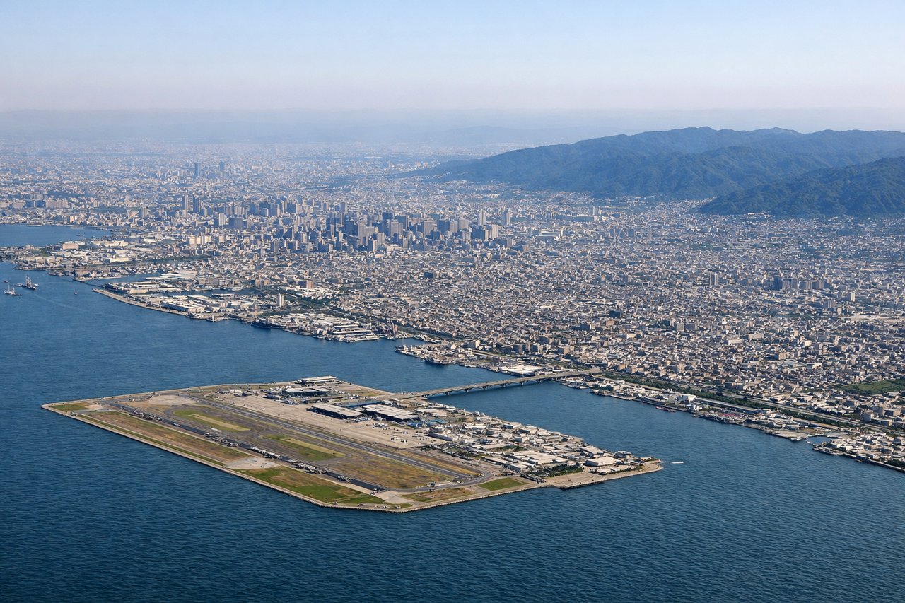
Takeoff from KIX
RIGHTRight side offers immediate views of Osaka Bay and the Kii Peninsula's mountainous terrain as the aircraft climbs northeastward from KIX. The bay's distinctive shape and surrounding urban sprawl provide strong visual reference points during the initial climb phase.

Landing at PHX
LEFTLeft side during approach to PHX provides excellent views of the Phoenix metropolitan area's urban grid, the Salt River valley, and the surrounding Sonoran Desert mountains. The city's distinctive sprawl pattern and nearby mountain ranges (South Mountains, Superstition Mountains) are prominent on the left during standard eastbound approaches.
Landmarks on this routeAll landmarks →
Will your flight be in sunlight?
See exactly which side of the plane gets sun and shade at your departure time.
About This Route
Which side of the plane should I sit on flying from Kansai International (KIX) to Phoenix Sky Harbor International (PHX)?
Sit on the Left side of the plane for the best views on flights from Osaka to Phoenix. While the takeoff from KIX offers compelling views of Japan's coastal geography, the landing approach into PHX on the left side provides more dramatic and visually distinctive scenery—the contrast between sprawling urban Phoenix and the surrounding desert mountains is more striking than the departure views. Left seats capture the Superstition Mountains and South Mountains effectively during approach.
What can I see during takeoff from Kansai International in Osaka?
During takeoff from Kansai International (KIX), sit on the Right side for the best views. Right side offers immediate views of Osaka Bay and the Kii Peninsula's mountainous terrain as the aircraft climbs northeastward from KIX. The bay's distinctive shape and surrounding urban sprawl provide strong visual reference points during the initial climb phase. Notable sights include: Osaka Bay, Kii Peninsula mountains, Wakayama coastal plains, Inland Sea (Seto Naikai) visible in distance.
What can I see when landing at Phoenix Sky Harbor International in Phoenix?
When landing at Phoenix Sky Harbor International (PHX), sit on the Left side for the best views. Left side during approach to PHX provides excellent views of the Phoenix metropolitan area's urban grid, the Salt River valley, and the surrounding Sonoran Desert mountains. The city's distinctive sprawl pattern and nearby mountain ranges (South Mountains, Superstition Mountains) are prominent on the left during standard eastbound approaches. Notable sights include: Phoenix urban sprawl, Salt River valley, South Mountains, Superstition Mountains.
How long is the flight from Osaka to Phoenix?
The flight from Kansai International (KIX) to Phoenix Sky Harbor International (PHX) takes Approximately 11-12 hours.
What does the Osaka to Phoenix flight path pass over?
This transpacific route crosses the North Pacific Ocean with no significant visible landmarks for roughly 8-9 hours of flight time. The aircraft typically departs KIX heading northeast, climbs to cruise altitude (35,000-37,000 feet), and follows a great circle route across the Pacific. Aleutian Islands (Alaska) may be visible as a faint landmass on the northern horizon during the mid-Pacific phase if flying at lower altitudes or during optimal lighting conditions, but most of the crossing is open ocean. As the flight approaches North America, the Alaska coast becomes visible, followed by the Canadian Rocky Mountains and Pacific Northwest terrain. The final descent into PHX occurs over Arizona's high desert plateau.