The left side captures the two most dramatic terrain moments of the flight: Hualalai volcano and the Kona coast during departure, and Kauai's interior peaks during arrival. The right side's inter-island views of Maui and Molokai during cruise are real but distant, roughly 60-70 nautical miles off the flight path, making them a secondary feature rather than the main scenic draw.
Flown KOA to LIH? Did we get it right?
Flight Path
Kona to Lihue is 263 miles (423 km), a flight of about 50 minutes.
Alenuihaha Channel between Big Island and Maui, Haleakala volcano on Maui's horizon, Molokai's sea cliffs, and the Kaiwi Channel toward Oahu, all visible in the distance to the right of the flight path
Great circle distance and headings ›


Phase by phase
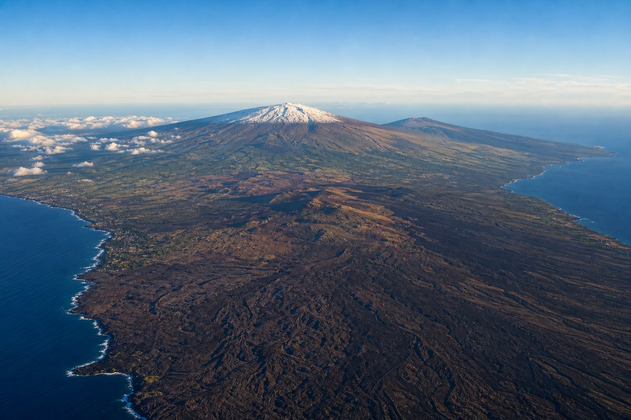
Takeoff from KOA
LEFTUnder standard trade-wind operations KOA departs south on Runway 17, putting Hualalai volcano's forested slopes and the Kona coffee belt on the left as the aircraft climbs along the coastline before turning northwest toward Kauai. The right side only shows open Pacific water during this phase.
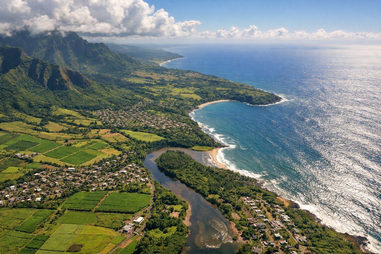
Landing at LIH
LEFTLIH's prevailing approach is Runway 03, arriving from the southwest and turning onto final over Kauai's south shore. This puts the island's dramatic interior peaks, including Mount Waialeale and the Hoary Head Ridge, on the left, while the right side faces only open ocean.
Will your flight be in sunlight?
Pick a date and time in the Sun Map to watch the sun move across your whole flight.
About This Route
Which side of the plane should I sit on flying from Kona International At Keahole (KOA) to Lihue (LIH)?
Sit on the Left side of the plane for the best views on flights from Kona to Lihue. The left side captures the two most dramatic terrain moments of the flight: Hualalai volcano and the Kona coast during departure, and Kauai's interior peaks during arrival. The right side's inter-island views of Maui and Molokai during cruise are real but distant, roughly 60-70 nautical miles off the flight path, making them a secondary feature rather than the main scenic draw.
What can I see during takeoff from Kona International At Keahole in Kona?
During takeoff from Kona International At Keahole (KOA), sit on the Left side for the best views. Under standard trade-wind operations KOA departs south on Runway 17, putting Hualalai volcano's forested slopes and the Kona coffee belt on the left as the aircraft climbs along the coastline before turning northwest toward Kauai. The right side only shows open Pacific water during this phase. Notable sights include: Hualalai volcano, Kailua-Kona town, Keahole Point lava fields, Kona coffee belt hillsides.
What can I see when landing at Lihue in Lihue?
When landing at Lihue (LIH), sit on the Left side for the best views. LIH's prevailing approach is Runway 03, arriving from the southwest and turning onto final over Kauai's south shore. This puts the island's dramatic interior peaks, including Mount Waialeale and the Hoary Head Ridge, on the left, while the right side faces only open ocean. Notable sights include: Mount Waialeale, Hoary Head Ridge, Nawiliwili Bay, Kauai south shore coastline.
How long is the flight from Kona to Lihue?
The flight from Kona International At Keahole (KOA) to Lihue (LIH) takes about 50 minutes. The shortest flight path between them is 263 miles (423 km); winds and air traffic control usually add a few percent.
What does the Kona to Lihue flight path pass over?
Alenuihaha Channel between Big Island and Maui, Haleakala volcano on Maui's horizon, Molokai's sea cliffs, and the Kaiwi Channel toward Oahu, all visible in the distance to the right of the flight path