Kathmandu to Kunming is 1,101 miles (1,773 km), a flight of about 2 hours 10 minutes.
The left side keeps the Himalayan foothills and Yunnan plateau terrain in view through both the departure and arrival phases, while the right side mostly faces flatter terrain and the plain southern approach corridor with fewer distinct landmarks.
Flight Path
Eastern Himalayan foothills giving way to the Tibetan Plateau's southeastern edge, the Hengduan Mountain ranges, and the upper valleys of the Mekong and Salween rivers before descending into the Yunnan plateau near Kunming.
Great circle distance and headings ›
.jpg?width=600)
Phase by phase
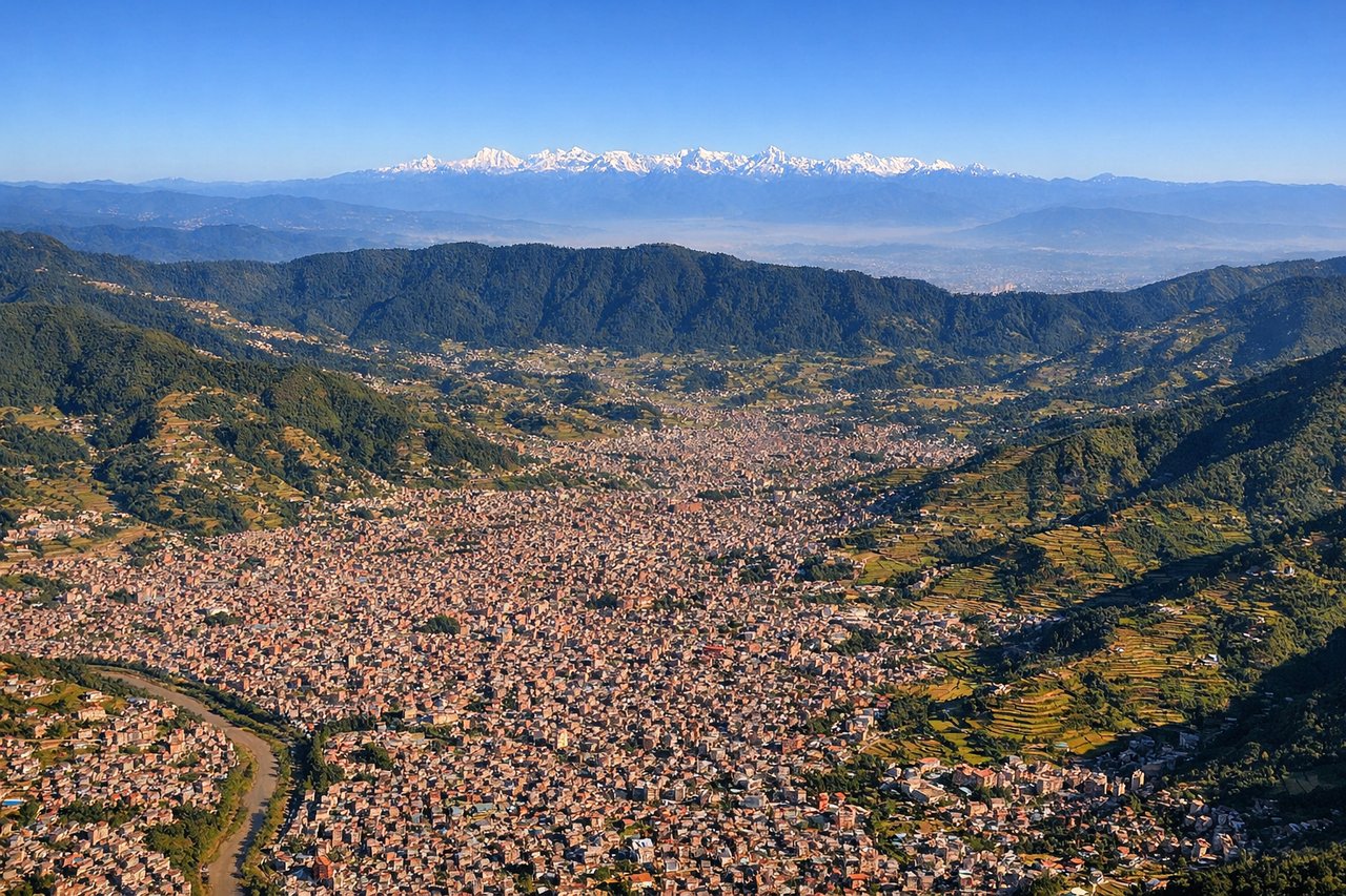
Takeoff from KTM
LEFTDeparting KTM to the south before turning east toward Kunming, the left side gives passengers a sweeping view back over the Kathmandu Valley with the snow-capped Himalayan wall—Ganesh Himal and Langtang Himal—rising on the northern horizon as the aircraft climbs and banks.
Landing at KMG
LEFTOn approach into Kunming, the flight path crosses the rugged Yunnan plateau and the northern side offers views of forested ridgelines and the edge of Dianchi Lake south of the city, giving more terrain variety than the flatter eastern approach corridor.
Landmarks on this routeAll landmarks →
Will your flight be in sunlight?
Pick a date and time in the Sun Map to watch the sun move across your whole flight.
About This Route
Which side of the plane should I sit on flying from Tribhuvan International (KTM) to Kunming Changshui International Airport (KMG)?
Sit on the Left side of the plane for the best views on flights from Kathmandu to Kunming. The left side keeps the Himalayan foothills and Yunnan plateau terrain in view through both the departure and arrival phases, while the right side mostly faces flatter terrain and the plain southern approach corridor with fewer distinct landmarks.
What can I see during takeoff from Tribhuvan International in Kathmandu?
During takeoff from Tribhuvan International (KTM), sit on the Left side for the best views. Departing KTM to the south before turning east toward Kunming, the left side gives passengers a sweeping view back over the Kathmandu Valley with the snow-capped Himalayan wall—Ganesh Himal and Langtang Himal—rising on the northern horizon as the aircraft climbs and banks. Notable sights include: Kathmandu Valley, Langtang Himal, Ganesh Himal, Bagmati River valley.
What can I see when landing at Kunming Changshui International Airport in Kunming?
When landing at Kunming Changshui International Airport (KMG), sit on the Left side for the best views. On approach into Kunming, the flight path crosses the rugged Yunnan plateau and the northern side offers views of forested ridgelines and the edge of Dianchi Lake south of the city, giving more terrain variety than the flatter eastern approach corridor. Notable sights include: Dianchi Lake, Yunnan plateau ridgelines, Kunming city outskirts.
How long is the flight from Kathmandu to Kunming?
The flight from Tribhuvan International (KTM) to Kunming Changshui International Airport (KMG) takes about 2 hours 10 minutes. The shortest flight path between them is 1,101 miles (1,773 km); winds and air traffic control usually add a few percent.
What does the Kathmandu to Kunming flight path pass over?
Eastern Himalayan foothills giving way to the Tibetan Plateau's southeastern edge, the Hengduan Mountain ranges, and the upper valleys of the Mekong and Salween rivers before descending into the Yunnan plateau near Kunming.