The right side benefits from a long, scenic cruise along the outer British Columbia and Southeast Alaska coastline, passing near Haida Gwaii and the glaciated Coast and St. Elias Mountains, then finishes with a close, dramatic view of the Chugach Mountains on descent into Anchorage. The left side's open Pacific Ocean stretch during cruise limits its scenic value despite a strong start over Red Rock Canyon.
Flown LAS to ANC? Did we get it right?
Flight Path
Las Vegas to Anchorage is 2,301 miles (3,703 km), a flight of about 4 hours 20 minutes.
The great-circle route runs offshore past Vancouver Island and Haida Gwaii (Queen Charlotte Islands), then up the Gulf of Alaska past the Southeast Alaska panhandle and the glaciated St. Elias Range near Yakutat before descending toward Anchorage.
Great circle distance and headings ›


Phase by phase

Takeoff from LAS
LEFTDeparting LAS on a northbound heading, the left side looks west over Red Rock Canyon's red sandstone escarpments and the Spring Mountains, including Mount Charleston, both rising dramatically right at the edge of the Las Vegas valley. The right side only offers the comparatively low, less distinctive Sunrise Mountain and Frenchman Mountain foothills.
Landing at ANC
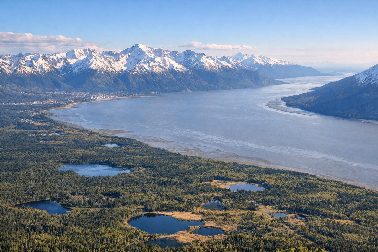
RIGHTOn approach into Anchorage, the right side faces south toward Turnagain Arm and the steep, glacier-carved Chugach Mountains, which rise abruptly just beyond the airport and dominate the view close-in. The left side mainly shows the flatter Cook Inlet shoreline and Mount Susitna, with Denali visible only far in the distance on rare clear days.
Will your flight be in sunlight?
Pick a date and time in the Sun Map to watch the sun move across your whole flight.
About This Route
Which side of the plane should I sit on flying from Mc Carran International (LAS) to Ted Stevens Anchorage International (ANC)?
Sit on the Right side of the plane for the best views on flights from Las Vegas to Anchorage. The right side benefits from a long, scenic cruise along the outer British Columbia and Southeast Alaska coastline, passing near Haida Gwaii and the glaciated Coast and St. Elias Mountains, then finishes with a close, dramatic view of the Chugach Mountains on descent into Anchorage. The left side's open Pacific Ocean stretch during cruise limits its scenic value despite a strong start over Red Rock Canyon.
What can I see during takeoff from Mc Carran International in Las Vegas?
During takeoff from Mc Carran International (LAS), sit on the Left side for the best views. Departing LAS on a northbound heading, the left side looks west over Red Rock Canyon's red sandstone escarpments and the Spring Mountains, including Mount Charleston, both rising dramatically right at the edge of the Las Vegas valley. The right side only offers the comparatively low, less distinctive Sunrise Mountain and Frenchman Mountain foothills. Notable sights include: Red Rock Canyon National Conservation Area, Spring Mountains, Mount Charleston, Las Vegas Valley floor.
What can I see when landing at Ted Stevens Anchorage International in Anchorage?
When landing at Ted Stevens Anchorage International (ANC), sit on the Right side for the best views. On approach into Anchorage, the right side faces south toward Turnagain Arm and the steep, glacier-carved Chugach Mountains, which rise abruptly just beyond the airport and dominate the view close-in. The left side mainly shows the flatter Cook Inlet shoreline and Mount Susitna, with Denali visible only far in the distance on rare clear days. Notable sights include: Chugach Mountains, Turnagain Arm, Cook Inlet tidal flats, Kenai Mountains skyline.
How long is the flight from Las Vegas to Anchorage?
The flight from Mc Carran International (LAS) to Ted Stevens Anchorage International (ANC) takes about 4 hours 20 minutes. The shortest flight path between them is 2,301 miles (3,703 km); winds and air traffic control usually add a few percent.
What does the Las Vegas to Anchorage flight path pass over?
The great-circle route runs offshore past Vancouver Island and Haida Gwaii (Queen Charlotte Islands), then up the Gulf of Alaska past the Southeast Alaska panhandle and the glaciated St. Elias Range near Yakutat before descending toward Anchorage.