The right side wins overall because the Las Vegas departure view — Strip, Red Rock Canyon, Spring Mountains — is genuinely spectacular and hard to beat. The Houston arrival on the left is good but the flat terrain offers less drama. Right side also tracks the southern edge of the flight path where the Texas Hill Country and Colorado River lakes are occasionally visible mid-flight.
Flown LAS to IAH? Did we get it right?
Flight Path
Las Vegas to Houston is 1,220 miles (1,963 km), a flight of about 2 hours 55 minutes.
The flight crosses the Mojave Desert, then the lower Colorado River valley near Needles, then the Sonoran Desert of Arizona. Over New Mexico the terrain rises through the Basin and Range province. Crossing into Texas the flight passes near the Guadalupe Mountains (highest point in Texas at 8,751 ft), then descends over the Edwards Plateau and Texas Hill Country where the Highland Lakes chain — Lyndon B. Johnson Lake, Lake Travis, and Lake Austin on the Colorado River — are visible as a string of blue reservoirs. The terrain then flattens dramatically into the Gulf Coastal Plain for the final 150 miles into Houston.
Great circle distance and headings ›


Phase by phase

Takeoff from LAS
RIGHTMcCarran's primary departure runway 26L/26R sends aircraft westward before turning southeast toward Houston. A right-side seat captures the Las Vegas Strip and downtown grid clearly below, plus the Spring Mountains and Red Rock Canyon escarpment to the west-southwest. Left side faces north toward the valley floor with less visual interest.
Landing at IAH
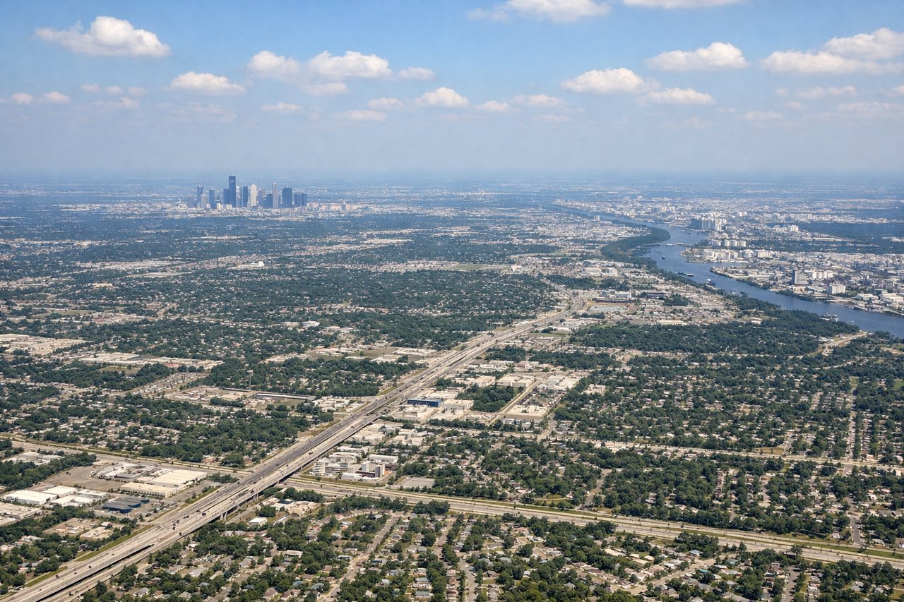
LEFTIAH typically uses runways 26L/26R or 27 for arrivals from the west, meaning the aircraft approaches from the west-northwest. A left-side seat on final approach looks south over downtown Houston's skyline, the ship channel, and the sprawling urban grid. Right side faces north toward less distinctive suburban sprawl.
Will your flight be in sunlight?
Pick a date and time in the Sun Map to watch the sun move across your whole flight.
About This Route
Which side of the plane should I sit on flying from Mc Carran International (LAS) to George Bush Intcntl Houston (IAH)?
Sit on the Right side of the plane for the best views on flights from Las Vegas to Houston. The right side wins overall because the Las Vegas departure view — Strip, Red Rock Canyon, Spring Mountains — is genuinely spectacular and hard to beat. The Houston arrival on the left is good but the flat terrain offers less drama. Right side also tracks the southern edge of the flight path where the Texas Hill Country and Colorado River lakes are occasionally visible mid-flight.
What can I see during takeoff from Mc Carran International in Las Vegas?
During takeoff from Mc Carran International (LAS), sit on the Right side for the best views. McCarran's primary departure runway 26L/26R sends aircraft westward before turning southeast toward Houston. A right-side seat captures the Las Vegas Strip and downtown grid clearly below, plus the Spring Mountains and Red Rock Canyon escarpment to the west-southwest. Left side faces north toward the valley floor with less visual interest. Notable sights include: Las Vegas Strip hotels and casino corridor, Red Rock Canyon escarpment, Spring Mountains (Charleston Peak at 11,918 ft), Lake Mead to the northeast visible during the turn.
What can I see when landing at George Bush Intcntl Houston in Houston?
When landing at George Bush Intcntl Houston (IAH), sit on the Left side for the best views. IAH typically uses runways 26L/26R or 27 for arrivals from the west, meaning the aircraft approaches from the west-northwest. A left-side seat on final approach looks south over downtown Houston's skyline, the ship channel, and the sprawling urban grid. Right side faces north toward less distinctive suburban sprawl. Notable sights include: Downtown Houston skyline, Houston Ship Channel, Galveston Bay visible to the south on clear days, White Oak Bayou and Buffalo Bayou drainage corridors cutting through the urban grid.
How long is the flight from Las Vegas to Houston?
The flight from Mc Carran International (LAS) to George Bush Intcntl Houston (IAH) takes about 2 hours 55 minutes. The shortest flight path between them is 1,220 miles (1,963 km); winds and air traffic control usually add a few percent.
What does the Las Vegas to Houston flight path pass over?
The flight crosses the Mojave Desert, then the lower Colorado River valley near Needles, then the Sonoran Desert of Arizona. Over New Mexico the terrain rises through the Basin and Range province. Crossing into Texas the flight passes near the Guadalupe Mountains (highest point in Texas at 8,751 ft), then descends over the Edwards Plateau and Texas Hill Country where the Highland Lakes chain — Lyndon B. Johnson Lake, Lake Travis, and Lake Austin on the Colorado River — are visible as a string of blue reservoirs. The terrain then flattens dramatically into the Gulf Coastal Plain for the final 150 miles into Houston.