While the takeoff from Las Vegas offers dramatic mountain scenery on the right, the landing approach into London City provides more sustained and distinctive views of major geographical and urban features. The Thames estuary and London's iconic skyline are more visually rewarding than the departure scenery, and left-side seats capture this better during the critical final descent phase.
Flown LAS to LCY? Did we get it right?
Flight Path
Las Vegas to London is 5,231 miles (8,419 km), a flight of about 10 hours 45 minutes.
The flight path crosses the North Atlantic, passing over Newfoundland and the Canadian Maritime provinces during the mid-Atlantic crossing. The Arctic and subarctic regions are traversed at high altitude with limited visual landmarks. Over the Atlantic, passengers may see the Greenland ice sheet's eastern edge if flying a more northerly route. As the aircraft approaches European airspace, the Scottish Highlands and Irish coastline become visible during descent. The flight typically follows a great-circle route that takes it over parts of Greenland, the North Atlantic, and the British Isles.
Great circle distance and headings ›


Phase by phase

Takeoff from LAS
RIGHTRight-side seats offer views of the Spring Mountains and Red Rock Canyon immediately west of Las Vegas during the initial climb-out. The dramatic escarpment and colorful rock formations are striking from altitude and visible within the first 10-15 minutes of flight.
Landing at LCY
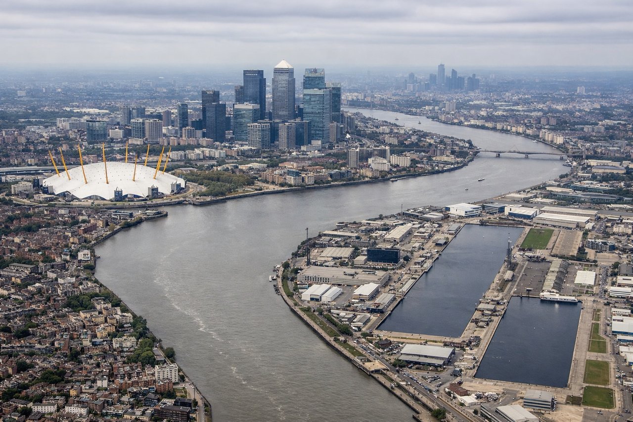
LEFTLeft-side seats provide views of the Thames estuary, the City of London skyline, and the distinctive bend of the Thames as the aircraft descends toward London City Airport. The river's serpentine path and the contrast between the urban core and surrounding areas are clearly visible during final approach.
Will your flight be in sunlight?
Pick a date and time in the Sun Map to watch the sun move across your whole flight.
About This Route
Which side of the plane should I sit on flying from Mc Carran International (LAS) to City (LCY)?
Sit on the Left side of the plane for the best views on flights from Las Vegas to London. While the takeoff from Las Vegas offers dramatic mountain scenery on the right, the landing approach into London City provides more sustained and distinctive views of major geographical and urban features. The Thames estuary and London's iconic skyline are more visually rewarding than the departure scenery, and left-side seats capture this better during the critical final descent phase.
What can I see during takeoff from Mc Carran International in Las Vegas?
During takeoff from Mc Carran International (LAS), sit on the Right side for the best views. Right-side seats offer views of the Spring Mountains and Red Rock Canyon immediately west of Las Vegas during the initial climb-out. The dramatic escarpment and colorful rock formations are striking from altitude and visible within the first 10-15 minutes of flight. Notable sights include: Spring Mountains, Red Rock Canyon, Las Vegas Valley floor, Lake Mead (visible further north).
What can I see when landing at City in London?
When landing at City (LCY), sit on the Left side for the best views. Left-side seats provide views of the Thames estuary, the City of London skyline, and the distinctive bend of the Thames as the aircraft descends toward London City Airport. The river's serpentine path and the contrast between the urban core and surrounding areas are clearly visible during final approach. Notable sights include: Thames estuary and river bend, City of London financial district, Greenwich Peninsula, Canary Wharf towers.
How long is the flight from Las Vegas to London?
The flight from Mc Carran International (LAS) to City (LCY) takes about 10 hours 45 minutes. The shortest flight path between them is 5,231 miles (8,419 km); winds and air traffic control usually add a few percent.
What does the Las Vegas to London flight path pass over?
The flight path crosses the North Atlantic, passing over Newfoundland and the Canadian Maritime provinces during the mid-Atlantic crossing. The Arctic and subarctic regions are traversed at high altitude with limited visual landmarks. Over the Atlantic, passengers may see the Greenland ice sheet's eastern edge if flying a more northerly route. As the aircraft approaches European airspace, the Scottish Highlands and Irish coastline become visible during descent. The flight typically follows a great-circle route that takes it over parts of Greenland, the North Atlantic, and the British Isles.