The right side wins on both ends of the flight: dramatic desert scenery near Las Vegas at departure and a scenic bay-and-skyline approach into San Diego, while the left side offers comparatively plainer desert and ocean views.
Flown LAS to NZY? Did we get it right?
Flight Path
Las Vegas to San Diego is 262 miles (421 km), a flight of about 1 hour 15 minutes.
Mojave Desert, Joshua Tree high desert terrain, and the San Bernardino/Peninsular mountain ranges before descent into coastal San Diego
Great circle distance and headings ›


Phase by phase
Takeoff from LAS
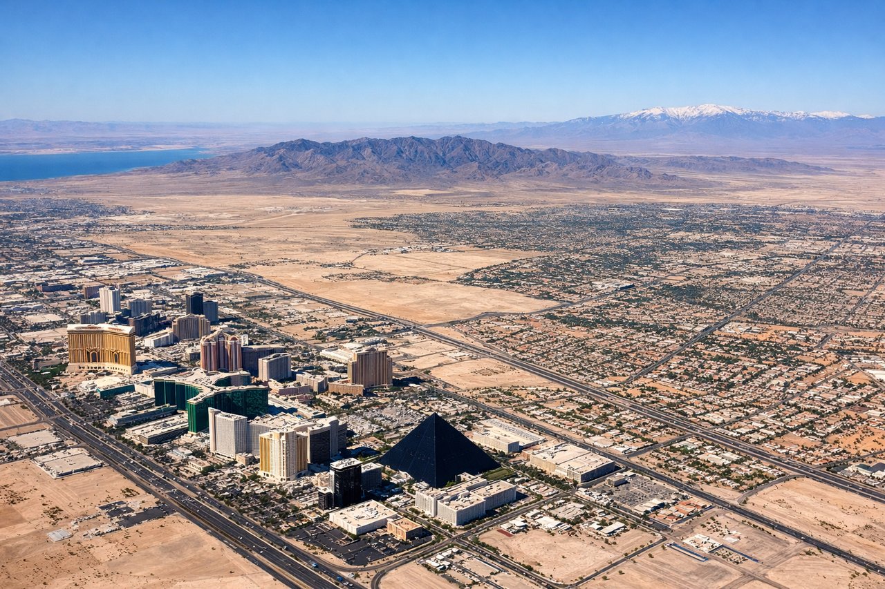
RIGHTDeparting LAS to the south before turning toward San Diego, the right side offers views of the Spring Mountains and the reddish sandstone cliffs of Red Rock Canyon, a dramatic contrast to the flat valley floor. The left side shows Lake Mead's blue waters in the distance but is farther away and less prominent on this route.
Landing at NZY
RIGHTOn final approach to North Island's runway 29, the aircraft flies westward over San Diego Bay, putting the downtown San Diego skyline and the Coronado Bay Bridge on the right side of the aircraft. The left side faces mostly open ocean and the tip of Point Loma, less visually rich than the bay and city view.
Will your flight be in sunlight?
Pick a date and time in the Sun Map to watch the sun move across your whole flight.
About This Route
Which side of the plane should I sit on flying from Mc Carran International (LAS) to North Island Nas (NZY)?
Sit on the Right side of the plane for the best views on flights from Las Vegas to San Diego. The right side wins on both ends of the flight: dramatic desert scenery near Las Vegas at departure and a scenic bay-and-skyline approach into San Diego, while the left side offers comparatively plainer desert and ocean views.
What can I see during takeoff from Mc Carran International in Las Vegas?
During takeoff from Mc Carran International (LAS), sit on the Right side for the best views. Departing LAS to the south before turning toward San Diego, the right side offers views of the Spring Mountains and the reddish sandstone cliffs of Red Rock Canyon, a dramatic contrast to the flat valley floor. The left side shows Lake Mead's blue waters in the distance but is farther away and less prominent on this route. Notable sights include: Spring Mountains, Red Rock Canyon National Conservation Area, Las Vegas Valley floor.
What can I see when landing at North Island Nas in San Diego?
When landing at North Island Nas (NZY), sit on the Right side for the best views. On final approach to North Island's runway 29, the aircraft flies westward over San Diego Bay, putting the downtown San Diego skyline and the Coronado Bay Bridge on the right side of the aircraft. The left side faces mostly open ocean and the tip of Point Loma, less visually rich than the bay and city view. Notable sights include: Downtown San Diego skyline, Coronado Bay Bridge, San Diego Bay, Coronado Island.
How long is the flight from Las Vegas to San Diego?
The flight from Mc Carran International (LAS) to North Island Nas (NZY) takes about 1 hour 15 minutes. The shortest flight path between them is 262 miles (421 km); winds and air traffic control usually add a few percent.
What does the Las Vegas to San Diego flight path pass over?
Mojave Desert, Joshua Tree high desert terrain, and the San Bernardino/Peninsular mountain ranges before descent into coastal San Diego