Las Vegas to Shreveport is 1,241 miles (1,997 km), a flight of about 3 hours 15 minutes.
Right-side seats provide superior views for the entire flight. The takeoff offers dramatic Spring Mountains scenery, and the eastbound flight path keeps the Ouachita Mountains and the transition from desert to forested terrain visible on the right side throughout the cruise phase.
Flight Path
The flight path crosses from the Mojave Desert through Arizona and New Mexico, then enters the forested regions of eastern Texas and western Louisiana. Notable features include the transition from high desert (around 5,000-6,000 feet elevation near Las Vegas) to the lower elevation pine and hardwood forests of the Ouachita Mountains region. The terrain gradually descends from west to east. The flight crosses over portions of the Ouachita National Forest and passes near the Louisiana-Texas border region where the landscape transitions from rolling forested hills to the flat Red River valley bottomlands approaching Shreveport.
Great circle distance and headings ›


.jpeg?width=600)

.jpg?width=600)
Phase by phase
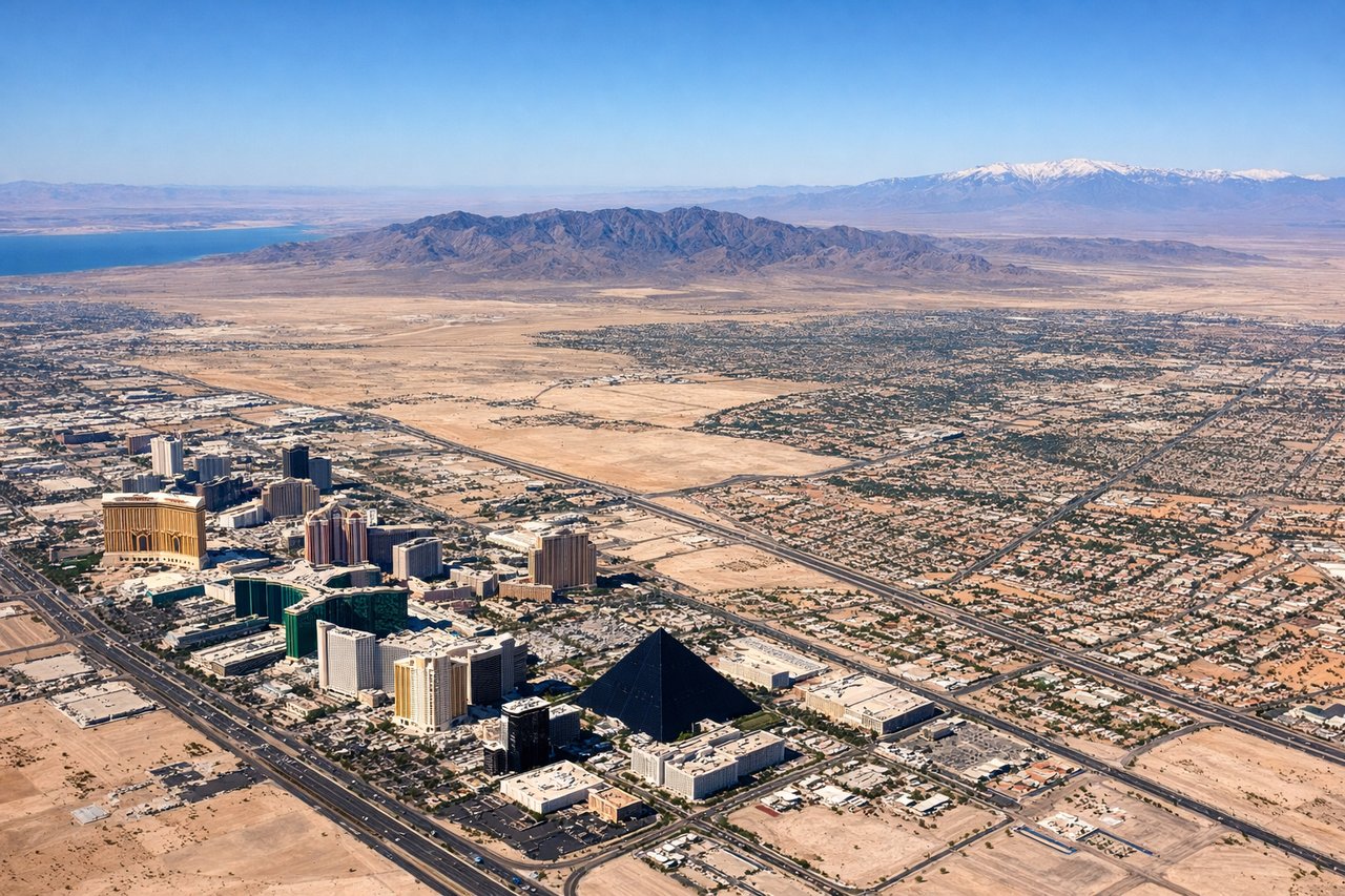
Takeoff from LAS
RIGHTRight-side seats capture the initial climb-out over the Spring Mountains and the Las Vegas Valley floor. You'll see the city grid and surrounding desert terrain receding beneath you as you gain altitude heading east-northeast.
Landing at SHV
LEFTLeft-side seats offer views during the descent approach into Shreveport. You'll see the Red River valley, the Cane River, and the city of Shreveport itself positioned on the river's bend as you descend from the west.
Landmarks on this routeAll landmarks →
Will your flight be in sunlight?
Pick a date and time in the Sun Map to watch the sun move across your whole flight.
About This Route
Which side of the plane should I sit on flying from Mc Carran International (LAS) to Shreveport Rgnl (SHV)?
Sit on the Right side of the plane for the best views on flights from Las Vegas to Shreveport. Right-side seats provide superior views for the entire flight. The takeoff offers dramatic Spring Mountains scenery, and the eastbound flight path keeps the Ouachita Mountains and the transition from desert to forested terrain visible on the right side throughout the cruise phase.
What can I see during takeoff from Mc Carran International in Las Vegas?
During takeoff from Mc Carran International (LAS), sit on the Right side for the best views. Right-side seats capture the initial climb-out over the Spring Mountains and the Las Vegas Valley floor. You'll see the city grid and surrounding desert terrain receding beneath you as you gain altitude heading east-northeast. Notable sights include: Spring Mountains (western edge of Las Vegas Valley), Las Vegas city grid and the Strip, Red Rock Canyon escarpment to the west.
What can I see when landing at Shreveport Rgnl in Shreveport?
When landing at Shreveport Rgnl (SHV), sit on the Left side for the best views. Left-side seats offer views during the descent approach into Shreveport. You'll see the Red River valley, the Cane River, and the city of Shreveport itself positioned on the river's bend as you descend from the west. Notable sights include: Red River (major waterway defining the approach corridor), Shreveport city center along the river, Cane River to the south, forested bottomlands of the Red River valley.
How long is the flight from Las Vegas to Shreveport?
The flight from Mc Carran International (LAS) to Shreveport Rgnl (SHV) takes about 3 hours 15 minutes. The shortest flight path between them is 1,241 miles (1,997 km); winds and air traffic control usually add a few percent.
What does the Las Vegas to Shreveport flight path pass over?
The flight path crosses from the Mojave Desert through Arizona and New Mexico, then enters the forested regions of eastern Texas and western Louisiana. Notable features include the transition from high desert (around 5,000-6,000 feet elevation near Las Vegas) to the lower elevation pine and hardwood forests of the Ouachita Mountains region. The terrain gradually descends from west to east. The flight crosses over portions of the Ouachita National Forest and passes near the Louisiana-Texas border region where the landscape transitions from rolling forested hills to the flat Red River valley bottomlands approaching Shreveport.