The right side combines the Las Vegas Strip skyline at departure with Sierra Nevada foothill glimpses en route and Sonoma wine country mountains on arrival, giving it more varied and dramatic scenery than the flatter desert and valley views on the left.
Flown LAS to STS? Did we get it right?
Flight Path
Las Vegas to Santa Rosa is 453 miles (729 km), a flight of about 1 hour 45 minutes.
Southern Sierra Nevada foothills, Owens Valley desert basins, and the northern San Joaquin/Sacramento Valley farmland before descending into Sonoma County
Great circle distance and headings ›


Phase by phase
Takeoff from LAS
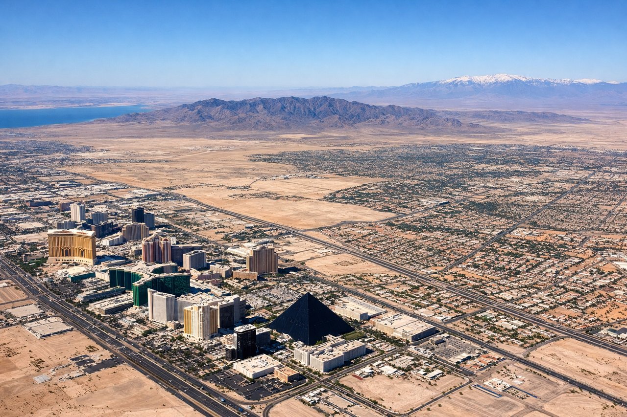
RIGHTDeparting LAS on the south-then-west turn, the Las Vegas Strip and downtown skyline sweep into view on the right side as the aircraft banks toward its northwest heading. The left side mostly shows featureless desert scrubland southeast of the city.
Landing at STS
RIGHTOn approach to STS from the southeast, the right side faces northeast toward the forested Mayacamas Mountains and the rolling vineyards of the Sonoma wine country, a much more dramatic and colorful landscape than the flatter valley floor and distant coastal hills visible on the left.
Will your flight be in sunlight?
Pick a date and time in the Sun Map to watch the sun move across your whole flight.
About This Route
Which side of the plane should I sit on flying from Mc Carran International (LAS) to Charles M. Schulz Sonoma County Airport (STS)?
Sit on the Right side of the plane for the best views on flights from Las Vegas to Santa Rosa. The right side combines the Las Vegas Strip skyline at departure with Sierra Nevada foothill glimpses en route and Sonoma wine country mountains on arrival, giving it more varied and dramatic scenery than the flatter desert and valley views on the left.
What can I see during takeoff from Mc Carran International in Las Vegas?
During takeoff from Mc Carran International (LAS), sit on the Right side for the best views. Departing LAS on the south-then-west turn, the Las Vegas Strip and downtown skyline sweep into view on the right side as the aircraft banks toward its northwest heading. The left side mostly shows featureless desert scrubland southeast of the city. Notable sights include: Las Vegas Strip, downtown Las Vegas skyline, Spring Mountains in the distance, Lake Mead's edge (far southeast).
What can I see when landing at Charles M. Schulz Sonoma County Airport in Santa Rosa?
When landing at Charles M. Schulz Sonoma County Airport (STS), sit on the Right side for the best views. On approach to STS from the southeast, the right side faces northeast toward the forested Mayacamas Mountains and the rolling vineyards of the Sonoma wine country, a much more dramatic and colorful landscape than the flatter valley floor and distant coastal hills visible on the left. Notable sights include: Mayacamas Mountains, Sonoma Valley vineyards, Santa Rosa city grid, Russian River valley.
How long is the flight from Las Vegas to Santa Rosa?
The flight from Mc Carran International (LAS) to Charles M. Schulz Sonoma County Airport (STS) takes about 1 hour 45 minutes. The shortest flight path between them is 453 miles (729 km); winds and air traffic control usually add a few percent.
What does the Las Vegas to Santa Rosa flight path pass over?
Southern Sierra Nevada foothills, Owens Valley desert basins, and the northern San Joaquin/Sacramento Valley farmland before descending into Sonoma County