Las Vegas to Fairfield is 402 miles (647 km), a flight of about 1 hour 10 minutes.
While takeoff on the right offers dramatic mountain views, the landing approach on the left provides more sustained scenic interest across the flight's second half. The Sacramento Valley's agricultural geometry and Sierra Nevada foothills offer distinctive visual variety that outweighs the initial Las Vegas departure scenery.
Flight Path
The flight path crosses the Sierra Nevada passes (likely Donner Pass area or similar northern route), transitioning from the Mojave Desert through the Central Valley. Notable midpoint features include the transition zone between high desert and agricultural land, scattered lakes and reservoirs in the foothills, and the gradual shift from sparse desert vegetation to dense valley farmland. The Mono Basin and eastern Sierra peaks may be visible to the east during the climb phase if the aircraft gains sufficient altitude before turning northwest.
Great circle distance and headings ›


Phase by phase
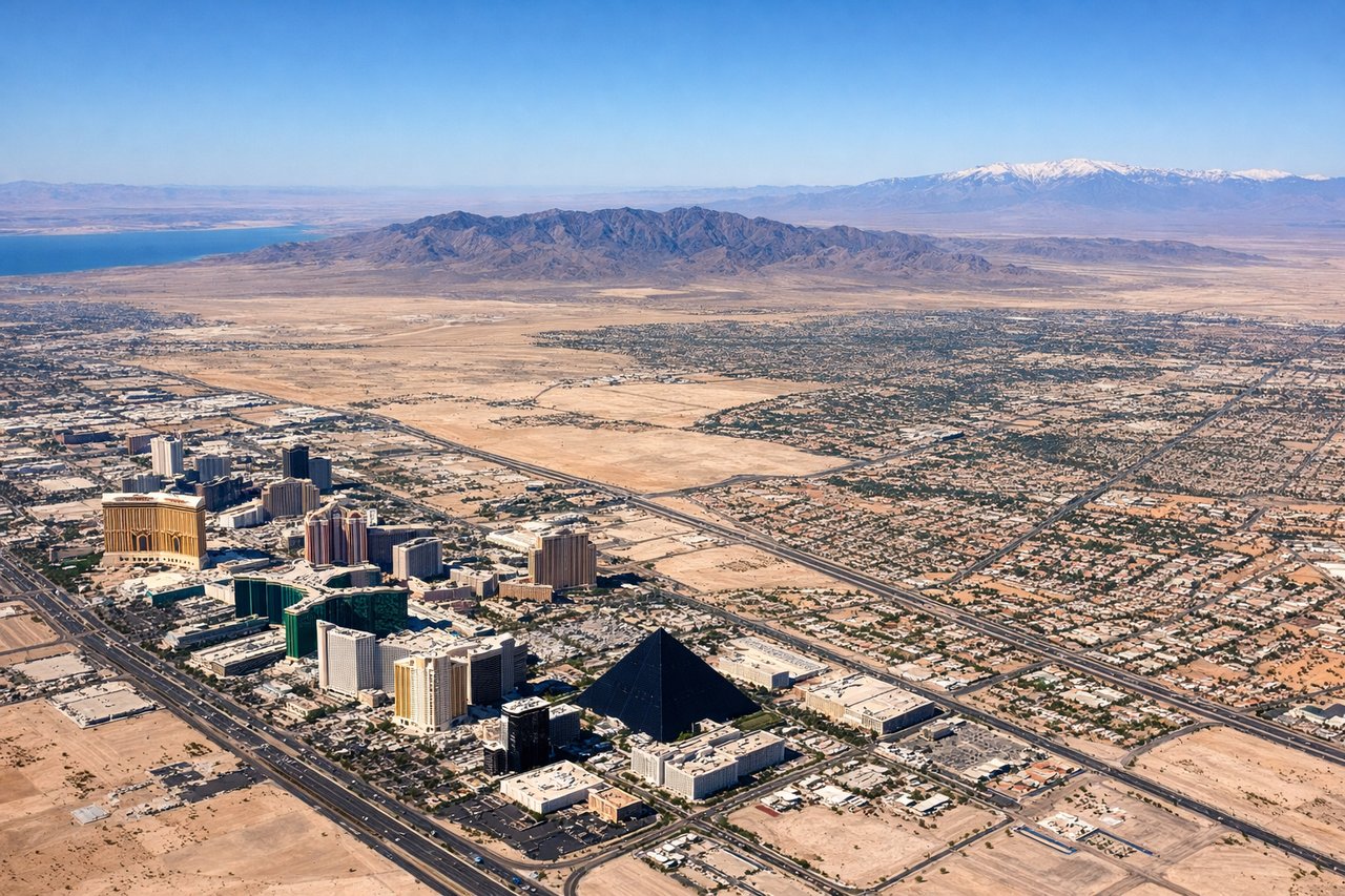
Takeoff from LAS
RIGHTRight side offers immediate views of the Spring Mountains and Las Vegas Valley floor. The aircraft climbs northwestward, so right-side seats capture the dramatic escarpment and urban sprawl of Las Vegas receding below.
Landing at SUU
LEFTLeft side provides views of the Sacramento Valley and the Sierra Nevada foothills as the aircraft descends toward Travis AFB. The approach path from the south gives left-side passengers clear sightlines of the valley's agricultural grid and the distant Sierra peaks.
Landmarks on this routeAll landmarks →
Will your flight be in sunlight?
Pick a date and time in the Sun Map to watch the sun move across your whole flight.
About This Route
Which side of the plane should I sit on flying from Mc Carran International (LAS) to Travis Afb (SUU)?
Sit on the Left side of the plane for the best views on flights from Las Vegas to Fairfield. While takeoff on the right offers dramatic mountain views, the landing approach on the left provides more sustained scenic interest across the flight's second half. The Sacramento Valley's agricultural geometry and Sierra Nevada foothills offer distinctive visual variety that outweighs the initial Las Vegas departure scenery.
What can I see during takeoff from Mc Carran International in Las Vegas?
During takeoff from Mc Carran International (LAS), sit on the Right side for the best views. Right side offers immediate views of the Spring Mountains and Las Vegas Valley floor. The aircraft climbs northwestward, so right-side seats capture the dramatic escarpment and urban sprawl of Las Vegas receding below. Notable sights include: Spring Mountains (west of the valley), Las Vegas Strip and downtown grid, Lake Mead (visible in distance to northeast), Red Rock Canyon formations.
What can I see when landing at Travis Afb in Fairfield?
When landing at Travis Afb (SUU), sit on the Left side for the best views. Left side provides views of the Sacramento Valley and the Sierra Nevada foothills as the aircraft descends toward Travis AFB. The approach path from the south gives left-side passengers clear sightlines of the valley's agricultural grid and the distant Sierra peaks. Notable sights include: Sacramento Valley agricultural fields (geometric grid pattern), Sierra Nevada foothills (eastern horizon), San Joaquin River or tributary channels (visible as linear water features), Suisun Bay and Carquinez Strait (western distance).
How long is the flight from Las Vegas to Fairfield?
The flight from Mc Carran International (LAS) to Travis Afb (SUU) takes about 1 hour 10 minutes. The shortest flight path between them is 402 miles (647 km); winds and air traffic control usually add a few percent.
What does the Las Vegas to Fairfield flight path pass over?
The flight path crosses the Sierra Nevada passes (likely Donner Pass area or similar northern route), transitioning from the Mojave Desert through the Central Valley. Notable midpoint features include the transition zone between high desert and agricultural land, scattered lakes and reservoirs in the foothills, and the gradual shift from sparse desert vegetation to dense valley farmland. The Mono Basin and eastern Sierra peaks may be visible to the east during the climb phase if the aircraft gains sufficient altitude before turning northwest.