Las Vegas to Earlton is 1,964 miles (3,160 km), a flight of about 4 hours 45 minutes.
While takeoff offers dramatic mountain views, the landing approach provides more sustained scenic interest over a longer portion of the flight. The left side captures the boreal forest transition and water features that define northern Ontario, making it the better choice for the overall journey.
Flight Path
The flight path crosses the Great Basin and Rocky Mountain region, then transitions into the Great Plains and Canadian Shield. Notable features include: the Sierra Nevada and Cascade ranges (if visible on the northern routing), the Columbia Plateau, the Canadian Prairies (Saskatchewan and Manitoba), and the transition zone into the boreal forest of Ontario. Lake Winnipeg may be visible on the left side during the mid-flight segment. The landscape gradually shifts from desert to grassland to forest as you travel northeast.
Great circle distance and headings ›


.jpg?width=600)

Phase by phase
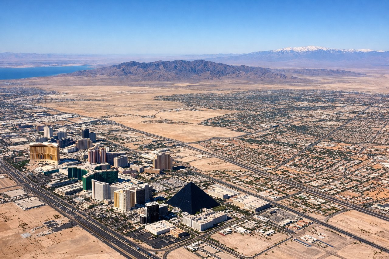
Takeoff from LAS
RIGHTRight-side seats capture the initial climb northeastward over the Spring Mountains and the Las Vegas Valley floor. You'll see the urban grid of Las Vegas receding below, with clear views of the mountain ranges that define the basin.
Landing at YXR
LEFTLeft-side seats offer the best views during descent into Timiskaming Regional. You'll see the transition from boreal forest to the Timiskaming area, with views of the Ottawa River valley and the lakes that dot northern Ontario.
Landmarks on this routeAll landmarks →
Will your flight be in sunlight?
Pick a date and time in the Sun Map to watch the sun move across your whole flight.
About This Route
Which side of the plane should I sit on flying from Mc Carran International (LAS) to Timiskaming Rgnl (YXR)?
Sit on the Left side of the plane for the best views on flights from Las Vegas to Earlton. While takeoff offers dramatic mountain views, the landing approach provides more sustained scenic interest over a longer portion of the flight. The left side captures the boreal forest transition and water features that define northern Ontario, making it the better choice for the overall journey.
What can I see during takeoff from Mc Carran International in Las Vegas?
During takeoff from Mc Carran International (LAS), sit on the Right side for the best views. Right-side seats capture the initial climb northeastward over the Spring Mountains and the Las Vegas Valley floor. You'll see the urban grid of Las Vegas receding below, with clear views of the mountain ranges that define the basin. Notable sights include: Spring Mountains (west of the valley), Las Vegas urban sprawl, Lake Mead (northeast, visible on clear days), Red Rock Canyon escarpment (northwest).
What can I see when landing at Timiskaming Rgnl in Earlton?
When landing at Timiskaming Rgnl (YXR), sit on the Left side for the best views. Left-side seats offer the best views during descent into Timiskaming Regional. You'll see the transition from boreal forest to the Timiskaming area, with views of the Ottawa River valley and the lakes that dot northern Ontario. Notable sights include: Ottawa River (major geographic feature defining the region), Timiskaming Lake (visible on approach), boreal forest canopy, Canadian Shield terrain.
How long is the flight from Las Vegas to Earlton?
The flight from Mc Carran International (LAS) to Timiskaming Rgnl (YXR) takes about 4 hours 45 minutes. The shortest flight path between them is 1,964 miles (3,160 km); winds and air traffic control usually add a few percent.
What does the Las Vegas to Earlton flight path pass over?
The flight path crosses the Great Basin and Rocky Mountain region, then transitions into the Great Plains and Canadian Shield. Notable features include: the Sierra Nevada and Cascade ranges (if visible on the northern routing), the Columbia Plateau, the Canadian Prairies (Saskatchewan and Manitoba), and the transition zone into the boreal forest of Ontario. Lake Winnipeg may be visible on the left side during the mid-flight segment. The landscape gradually shifts from desert to grassland to forest as you travel northeast.