While takeoff favors the right for the Andes escarpment, the landing view from the left is more rewarding and dramatic, featuring the high Cordillera Central and Bogota's mountain-ringed setting. The left side captures the more visually distinctive final approach.
Flown LIM to BOG? Did we get it right?
Flight Path
Lima to Bogota is 1,173 miles (1,888 km), a flight of about 3 hours.
The flight path crosses the Andes at approximately 11,000-13,000 feet, passing over the high plateau region between the Western and Central Cordilleras. The Cauca River valley becomes visible in the northern portion of the route. Cloud cover over the mountains is common, particularly in the afternoon. The terrain transitions from coastal desert to high-altitude tropical forest and agricultural zones as the aircraft moves northward into Colombia.
Great circle distance and headings ›

Phase by phase

Takeoff from LIM
RIGHTRight-side seats capture the dramatic western escarpment of the Andes as the aircraft climbs southeastward from Lima. The coastal plain and Pacific Ocean remain visible on the left, but the right side offers the more striking geological feature during the initial climb.
Landing at BOG
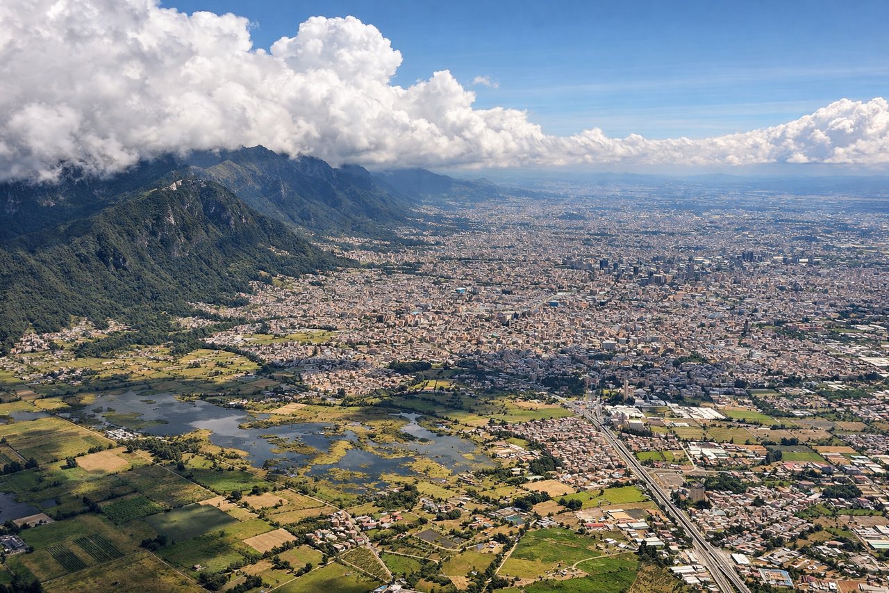
LEFTLeft-side seats provide the best view during descent into Bogota. Aircraft typically approach from the north or northeast, and left seats face the Cordillera Central and the high-altitude plateau where Bogota sits. The right side shows less dramatic terrain during the final approach.
Will your flight be in sunlight?
Pick a date and time in the Sun Map to watch the sun move across your whole flight.
About This Route
Which side of the plane should I sit on flying from Jorge Chávez International Airport (LIM) to Eldorado International (BOG)?
Sit on the Left side of the plane for the best views on flights from Lima to Bogota. While takeoff favors the right for the Andes escarpment, the landing view from the left is more rewarding and dramatic, featuring the high Cordillera Central and Bogota's mountain-ringed setting. The left side captures the more visually distinctive final approach.
What can I see during takeoff from Jorge Chávez International Airport in Lima?
During takeoff from Jorge Chávez International Airport (LIM), sit on the Right side for the best views. Right-side seats capture the dramatic western escarpment of the Andes as the aircraft climbs southeastward from Lima. The coastal plain and Pacific Ocean remain visible on the left, but the right side offers the more striking geological feature during the initial climb. Notable sights include: Pacific Ocean (west), Lima urban sprawl (immediate vicinity), Western Cordillera foothills (southeast), Callao port area (southwest).
What can I see when landing at Eldorado International in Bogota?
When landing at Eldorado International (BOG), sit on the Left side for the best views. Left-side seats provide the best view during descent into Bogota. Aircraft typically approach from the north or northeast, and left seats face the Cordillera Central and the high-altitude plateau where Bogota sits. The right side shows less dramatic terrain during the final approach. Notable sights include: Cordillera Central peaks (west/southwest), Bogota plateau and urban area (south), Sabana de Bogota agricultural plain (south), Monserrate peak (visible near city).
How long is the flight from Lima to Bogota?
The flight from Jorge Chávez International Airport (LIM) to Eldorado International (BOG) takes about 3 hours. The shortest flight path between them is 1,173 miles (1,888 km); winds and air traffic control usually add a few percent.
What does the Lima to Bogota flight path pass over?
The flight path crosses the Andes at approximately 11,000-13,000 feet, passing over the high plateau region between the Western and Central Cordilleras. The Cauca River valley becomes visible in the northern portion of the route. Cloud cover over the mountains is common, particularly in the afternoon. The terrain transitions from coastal desert to high-altitude tropical forest and agricultural zones as the aircraft moves northward into Colombia.