Takeoff offers superior views of the dramatic Andes transition zone, which is geographically more distinctive than São Paulo's urban approach. The coastal-to-mountain contrast at departure outweighs the river views at landing.
Flight Path
The flight crosses the Peruvian altiplano (high plateau) at 12,000-14,000 feet, then descends over the Ucayali and Madeira river systems in the Amazon basin. The Amazon rainforest canopy dominates the central route for roughly 2.5 hours—appearing as an unbroken green texture from altitude. As the flight approaches Brazil's interior, the terrain transitions from dense forest to more fragmented agricultural zones (deforestation patches visible as tan and brown clearings). The Brazilian Shield's rolling topography becomes apparent in the final hour before descent into São Paulo.
Great circle distance and headings ›


Phase by phase

Takeoff from LIM
RIGHTJorge Chavez typically departs to the south (Runway 15) over the Pacific coastal plain. Right-side seats face the Andes escarpment rising inland to the east, creating dramatic elevation contrast against the flat coastal strip. Left seats see only open ocean.
Landing at CGH
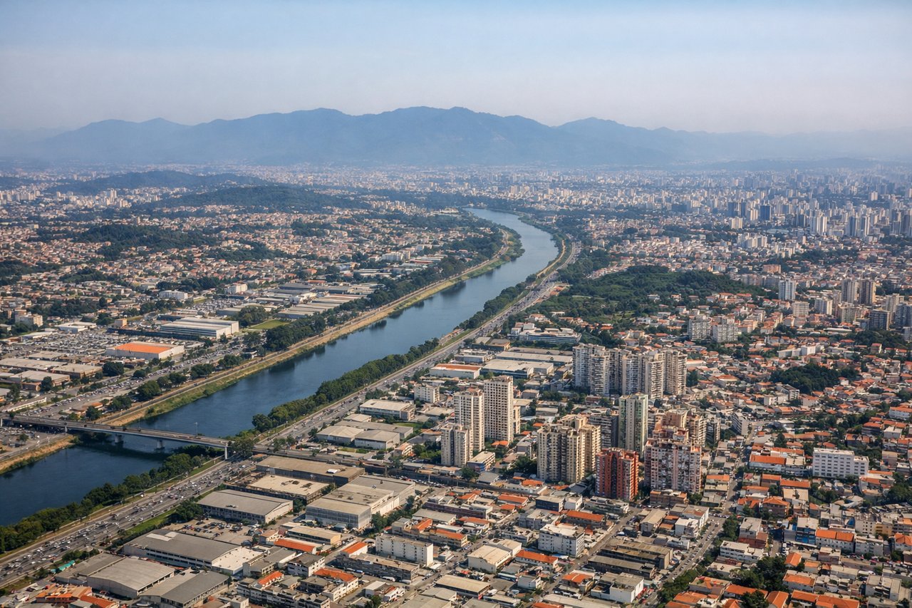
LEFTCongonhas approaches from the northeast (Runway 09L/09R typical). Left-side seats descend over the Tietê River valley and central São Paulo's dense urban fabric, including the distinctive high-rise clusters of Paulista Avenue and Pinheiros district. Right seats see only suburban sprawl and industrial zones.
Landmarks on this routeAll landmarks →
Will your flight be in sunlight?
See exactly which side of the plane gets sun and shade at your departure time.
About This Route
Which side of the plane should I sit on flying from Jorge Chávez International Airport (LIM) to Congonhas (CGH)?
Sit on the Right side of the plane for the best views on flights from Lima to Sao Paulo. Takeoff offers superior views of the dramatic Andes transition zone, which is geographically more distinctive than São Paulo's urban approach. The coastal-to-mountain contrast at departure outweighs the river views at landing.
What can I see during takeoff from Jorge Chávez International Airport in Lima?
During takeoff from Jorge Chávez International Airport (LIM), sit on the Right side for the best views. Jorge Chavez typically departs to the south (Runway 15) over the Pacific coastal plain. Right-side seats face the Andes escarpment rising inland to the east, creating dramatic elevation contrast against the flat coastal strip. Left seats see only open ocean. Notable sights include: Andes foothills (eastern horizon), Pacific coastline (immediate west), Lima urban sprawl (southern ground), Callao port district (southwest).
What can I see when landing at Congonhas in Sao Paulo?
When landing at Congonhas (CGH), sit on the Left side for the best views. Congonhas approaches from the northeast (Runway 09L/09R typical). Left-side seats descend over the Tietê River valley and central São Paulo's dense urban fabric, including the distinctive high-rise clusters of Paulista Avenue and Pinheiros district. Right seats see only suburban sprawl and industrial zones. Notable sights include: Tietê River (serpentine through city center), Pinheiros district high-rises, Imigrantes Highway corridor (south), Atlantic Plateau escarpment (distant south).
How long is the flight from Lima to Sao Paulo?
The flight from Jorge Chávez International Airport (LIM) to Congonhas (CGH) takes Approximately 4 hours 45 minutes.
What does the Lima to Sao Paulo flight path pass over?
The flight crosses the Peruvian altiplano (high plateau) at 12,000-14,000 feet, then descends over the Ucayali and Madeira river systems in the Amazon basin. The Amazon rainforest canopy dominates the central route for roughly 2.5 hours—appearing as an unbroken green texture from altitude. As the flight approaches Brazil's interior, the terrain transitions from dense forest to more fragmented agricultural zones (deforestation patches visible as tan and brown clearings). The Brazilian Shield's rolling topography becomes apparent in the final hour before descent into São Paulo.