Las Vegas to San Francisco is 416 miles (670 km), a flight of about 1 hour 15 minutes.
The left side wins throughout the flight: a scenic Las Vegas takeoff, Sierra Nevada crossing mid-flight, and a spectacular San Francisco Bay approach with the Golden Gate Bridge and city skyline, compared to the plainer desert basin and East Bay hills seen from the right.
Flight Path
Sierra Nevada high country near Mono Lake, Yosemite's eastern peaks, and the descent into California's Central Valley
Great circle distance and headings ›


Phase by phase
Takeoff from LSV
LEFTDeparting LSV to the northwest, the left side offers a view back over the Las Vegas Strip and the Spring Mountains rising sharply from the valley floor. The right side shows only the flatter, less distinctive terrain toward Sunrise Mountain and the Basin and Range country to the east.
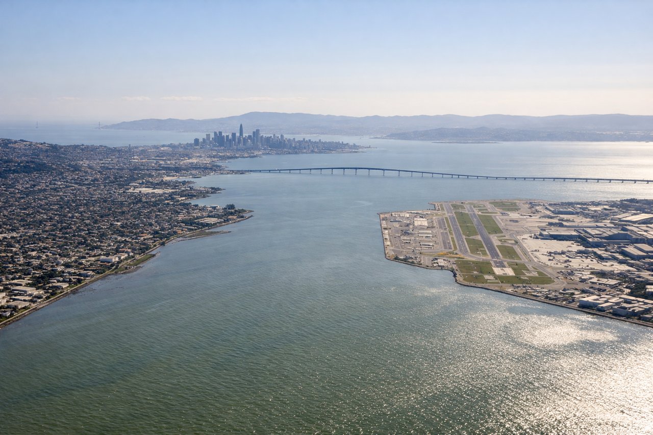
Landing at SFO
LEFTOn approach into SFO from the east, the left side captures the dramatic transition from the Sierra Nevada foothills into the Central Valley, then the final descent reveals San Francisco Bay, the city skyline, and the Golden Gate Bridge. The right side mostly shows the flatter East Bay hills with less variety.
Landmarks on this routeAll landmarks →
Will your flight be in sunlight?
Pick a date and time in the Sun Map to watch the sun move across your whole flight.
About This Route
Which side of the plane should I sit on flying from Nellis Afb (LSV) to San Francisco International (SFO)?
Sit on the Left side of the plane for the best views on flights from Las Vegas to San Francisco. The left side wins throughout the flight: a scenic Las Vegas takeoff, Sierra Nevada crossing mid-flight, and a spectacular San Francisco Bay approach with the Golden Gate Bridge and city skyline, compared to the plainer desert basin and East Bay hills seen from the right.
What can I see during takeoff from Nellis Afb in Las Vegas?
During takeoff from Nellis Afb (LSV), sit on the Left side for the best views. Departing LSV to the northwest, the left side offers a view back over the Las Vegas Strip and the Spring Mountains rising sharply from the valley floor. The right side shows only the flatter, less distinctive terrain toward Sunrise Mountain and the Basin and Range country to the east. Notable sights include: Las Vegas Strip skyline, Spring Mountains, Mount Charleston, Red Rock Canyon escarpment.
What can I see when landing at San Francisco International in San Francisco?
When landing at San Francisco International (SFO), sit on the Left side for the best views. On approach into SFO from the east, the left side captures the dramatic transition from the Sierra Nevada foothills into the Central Valley, then the final descent reveals San Francisco Bay, the city skyline, and the Golden Gate Bridge. The right side mostly shows the flatter East Bay hills with less variety. Notable sights include: Sierra Nevada foothills, San Francisco Bay, Golden Gate Bridge, San Francisco skyline.
How long is the flight from Las Vegas to San Francisco?
The flight from Nellis Afb (LSV) to San Francisco International (SFO) takes about 1 hour 15 minutes. The shortest flight path between them is 416 miles (670 km); winds and air traffic control usually add a few percent.
What does the Las Vegas to San Francisco flight path pass over?
Sierra Nevada high country near Mono Lake, Yosemite's eastern peaks, and the descent into California's Central Valley