The left side captures Melbourne's bay and skyline on departure and the Adelaide Hills plus Gulf St Vincent coastline on arrival, giving genuine terrain and water variety despite the short flight. The right side stays over flat inland farmland for nearly the entire route with no comparable landmarks.
Flown MEB to ADL? Did we get it right?
Flight Path
Melbourne to Adelaide is 403 miles (649 km), a flight of about 1 hour 5 minutes.
Wimmera plains of western Victoria with the Grampians (Gariwerd) range visible to the south, followed by the Murray River floodplain as the route crosses into South Australia.
Great circle distance and headings ›Phase by phase
Takeoff from MEB
LEFTDeparting Essendon on runway 26 into prevailing southwesterlies, the climb-out curves the aircraft onto a west-northwest heading, putting Melbourne's CBD skyline and the northern reaches of Port Phillip Bay on the left. The right side only shows flat northern suburbs and the Calder corridor.
Landing at ADL
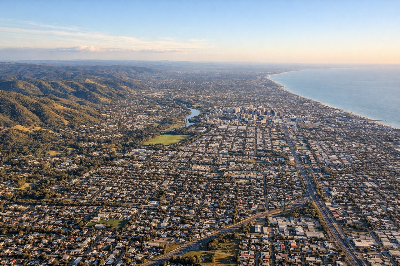
LEFTArrivals into Adelaide typically favor runway 23, bringing the aircraft in from the northeast over the Adelaide Hills and Mount Lofty Ranges before descending across the city toward Gulf St Vincent. This gives left-side passengers a sequence of forested ridgelines, the Adelaide CBD grid, and the coastline just before touchdown, while the right side faces flat inland plains.
Will your flight be in sunlight?
Pick a date and time in the Sun Map to watch the sun move across your whole flight.
About This Route
Which side of the plane should I sit on flying from Melbourne Essendon (MEB) to Adelaide International (ADL)?
Sit on the Left side of the plane for the best views on flights from Melbourne to Adelaide. The left side captures Melbourne's bay and skyline on departure and the Adelaide Hills plus Gulf St Vincent coastline on arrival, giving genuine terrain and water variety despite the short flight. The right side stays over flat inland farmland for nearly the entire route with no comparable landmarks.
What can I see during takeoff from Melbourne Essendon in Melbourne?
During takeoff from Melbourne Essendon (MEB), sit on the Left side for the best views. Departing Essendon on runway 26 into prevailing southwesterlies, the climb-out curves the aircraft onto a west-northwest heading, putting Melbourne's CBD skyline and the northern reaches of Port Phillip Bay on the left. The right side only shows flat northern suburbs and the Calder corridor. Notable sights include: Melbourne CBD skyline, Port Phillip Bay, You Yangs hills, Maribyrnong River valley.
What can I see when landing at Adelaide International in Adelaide?
When landing at Adelaide International (ADL), sit on the Left side for the best views. Arrivals into Adelaide typically favor runway 23, bringing the aircraft in from the northeast over the Adelaide Hills and Mount Lofty Ranges before descending across the city toward Gulf St Vincent. This gives left-side passengers a sequence of forested ridgelines, the Adelaide CBD grid, and the coastline just before touchdown, while the right side faces flat inland plains. Notable sights include: Mount Lofty Ranges, Adelaide CBD grid, Gulf St Vincent coastline, Torrens River.
How long is the flight from Melbourne to Adelaide?
The flight from Melbourne Essendon (MEB) to Adelaide International (ADL) takes about 1 hour 5 minutes. The shortest flight path between them is 403 miles (649 km); winds and air traffic control usually add a few percent.
What does the Melbourne to Adelaide flight path pass over?
Wimmera plains of western Victoria with the Grampians (Gariwerd) range visible to the south, followed by the Murray River floodplain as the route crosses into South Australia.