Right side scores higher (3.5 vs 2.5) due to superior landing experience with Table Mountain and the Cape Peninsula's dramatic topography, plus decent Melbourne departure views over Port Phillip Bay. Left side faces predominantly open Indian Ocean for most of cruise, limiting scenic value despite some coastal views near each airport.
Flown MEB to CPT? Did we get it right?
Flight Path
Melbourne to Cape Town is 6,402 miles (10,303 km), a flight of about 13 hours 20 minutes.
The flight crosses the Indian Ocean for approximately 11 hours. Notable waypoints include: departure over Port Phillip Bay and the Australian coast near Melbourne; the vast open Indian Ocean with no significant landmarks for the majority of cruise; approach to South Africa via the Agulhas Current region off the southern coast; final descent over the Cape Peninsula with views of Table Mountain, False Bay, and the Cape of Good Hope region. The route typically follows a great-circle path southwestward across the Indian Ocean, passing south of Madagascar and Mauritius (not visible at cruise altitude), before approaching the South African coast near Cape Agulhas and then turning northwest toward Cape Town.
Great circle distance and headings ›Phase by phase
Takeoff from MEB
RIGHTRight side captures Melbourne's urban sprawl and Port Phillip Bay during initial climb. Runway 26 (west-northwest heading) typical for prevailing winds means right-side passengers see the bay's eastern shoreline, suburban development, and the Dandenong Ranges to the east as the aircraft banks left and climbs.
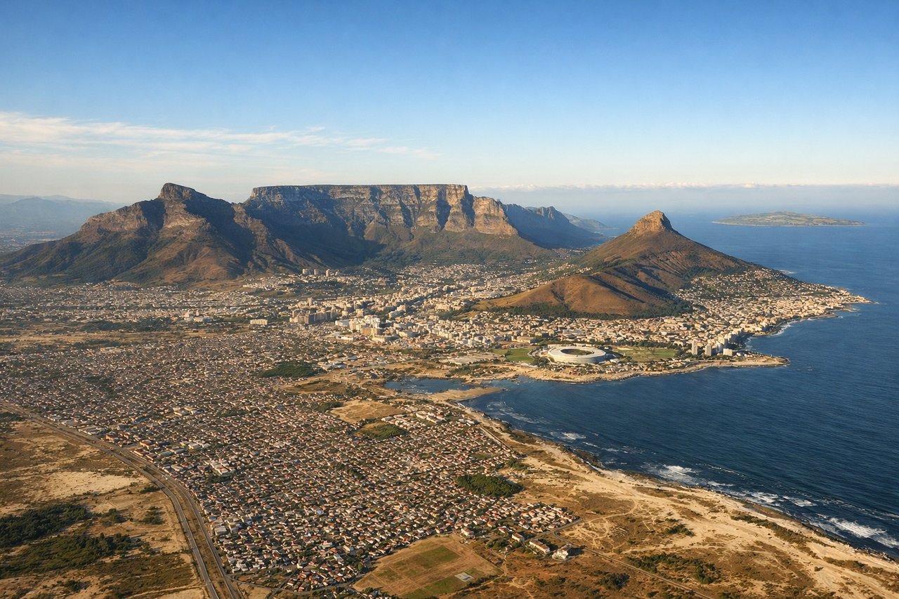
Landing at CPT
RIGHTRight side offers superior approach scenery into Cape Town. Runway 01 (northbound) is the primary runway under normal conditions. Aircraft descending from the northeast pass over the Cape Peninsula's eastern slopes, Table Mountain, and the city harbor. Right-side passengers see Table Mountain's dramatic flat-topped profile, the Twelve Apostles mountain chain, and False Bay's coastline.
Will your flight be in sunlight?
Pick a date and time in the Sun Map to watch the sun move across your whole flight.
About This Route
Which side of the plane should I sit on flying from Melbourne Essendon (MEB) to Cape Town International (CPT)?
Sit on the Right side of the plane for the best views on flights from Melbourne to Cape Town. Right side scores higher (3.5 vs 2.5) due to superior landing experience with Table Mountain and the Cape Peninsula's dramatic topography, plus decent Melbourne departure views over Port Phillip Bay. Left side faces predominantly open Indian Ocean for most of cruise, limiting scenic value despite some coastal views near each airport.
What can I see during takeoff from Melbourne Essendon in Melbourne?
During takeoff from Melbourne Essendon (MEB), sit on the Right side for the best views. Right side captures Melbourne's urban sprawl and Port Phillip Bay during initial climb. Runway 26 (west-northwest heading) typical for prevailing winds means right-side passengers see the bay's eastern shoreline, suburban development, and the Dandenong Ranges to the east as the aircraft banks left and climbs. Notable sights include: Port Phillip Bay, Melbourne CBD skyline, Dandenong Ranges, suburban sprawl of outer Melbourne.
What can I see when landing at Cape Town International in Cape Town?
When landing at Cape Town International (CPT), sit on the Right side for the best views. Right side offers superior approach scenery into Cape Town. Runway 01 (northbound) is the primary runway under normal conditions. Aircraft descending from the northeast pass over the Cape Peninsula's eastern slopes, Table Mountain, and the city harbor. Right-side passengers see Table Mountain's dramatic flat-topped profile, the Twelve Apostles mountain chain, and False Bay's coastline. Notable sights include: Table Mountain, Twelve Apostles peaks, False Bay coastline, Cape Town harbor and city lights.
How long is the flight from Melbourne to Cape Town?
The flight from Melbourne Essendon (MEB) to Cape Town International (CPT) takes about 13 hours 20 minutes. The shortest flight path between them is 6,402 miles (10,303 km); winds and air traffic control usually add a few percent.
What does the Melbourne to Cape Town flight path pass over?
The flight crosses the Indian Ocean for approximately 11 hours. Notable waypoints include: departure over Port Phillip Bay and the Australian coast near Melbourne; the vast open Indian Ocean with no significant landmarks for the majority of cruise; approach to South Africa via the Agulhas Current region off the southern coast; final descent over the Cape Peninsula with views of Table Mountain, False Bay, and the Cape of Good Hope region. The route typically follows a great-circle path southwestward across the Indian Ocean, passing south of Madagascar and Mauritius (not visible at cruise altitude), before approaching the South African coast near Cape Agulhas and then turning northwest toward Cape Town.