Right side scores 3.5 versus left's 2.5 due to superior scenic content on both legs. Takeoff captures Port Phillip Bay and Melbourne's urban interface; landing showcases the dramatic Red River delta agricultural landscape and Hanoi's sprawling cityscape. Left side is dominated by flat terrain and open water with minimal landmark density.
Flown MEB to HAN? Did we get it right?
Flight Path
Melbourne to Hanoi is 4,800 miles (7,725 km), a flight of about 9 hours 30 minutes.
Coral Sea and Arafura Sea (open water, minimal landmarks); Timor Sea crossing; Indonesian archipelago (Timor, Roti, Alor islands visible as small landmasses during cruise at altitude); transition into Vietnamese airspace over the Gulf of Tonkin with coastal lowlands appearing as the aircraft descends toward Hanoi
Great circle distance and headings ›Phase by phase
Takeoff from MEB
RIGHTRight side captures Melbourne's urban sprawl and Port Phillip Bay during initial climb. Left side faces inland toward flat plains with minimal visual interest during departure.
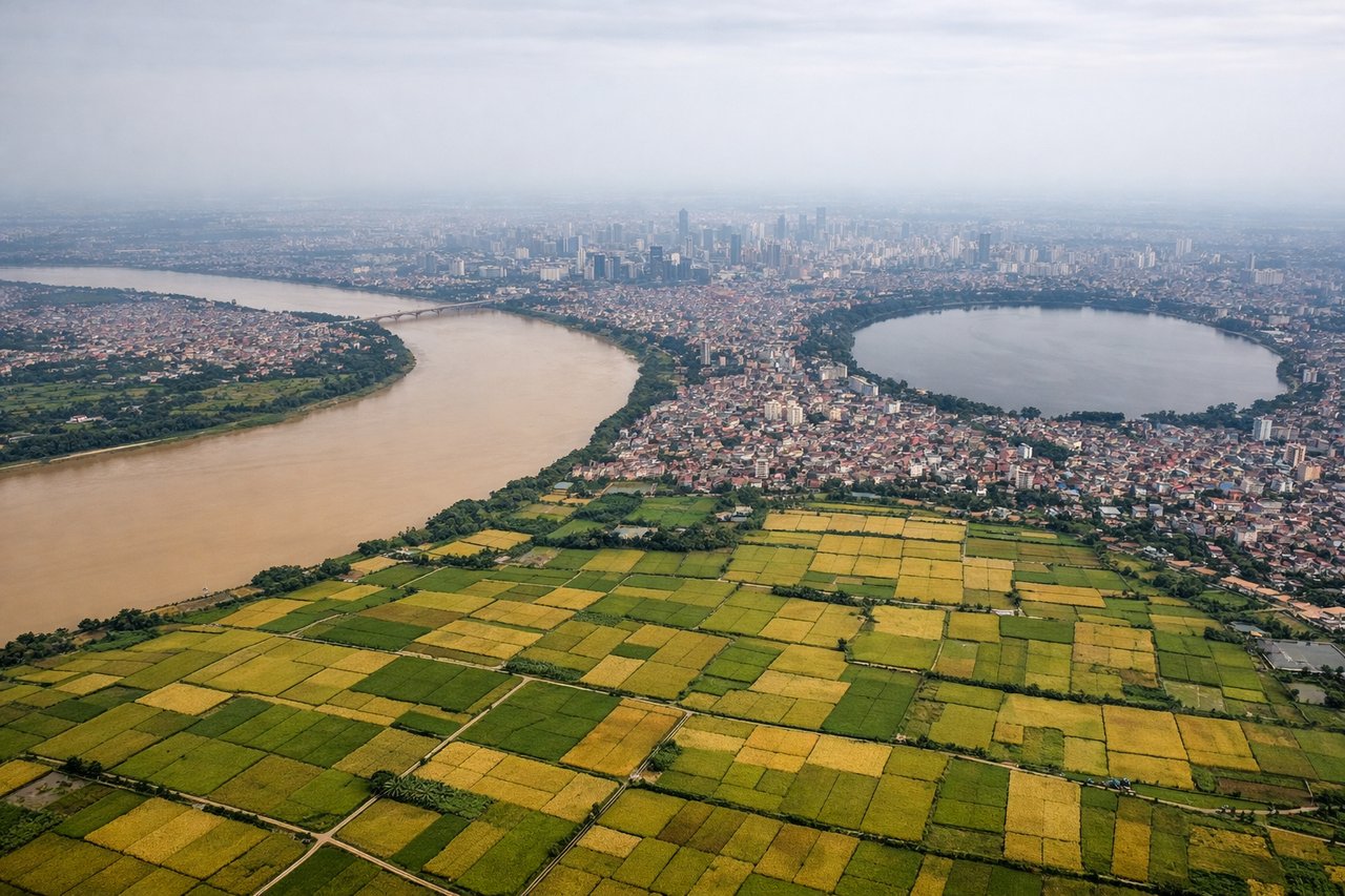
Landing at HAN
RIGHTRight side offers superior approach views of the Red River delta, Hanoi's urban landscape, and the transition from agricultural plains to city. Left side crosses open water and flat delta terrain with less visual distinction.
Will your flight be in sunlight?
Pick a date and time in the Sun Map to watch the sun move across your whole flight.
About This Route
Which side of the plane should I sit on flying from Melbourne Essendon (MEB) to Noibai International (HAN)?
Sit on the Right side of the plane for the best views on flights from Melbourne to Hanoi. Right side scores 3.5 versus left's 2.5 due to superior scenic content on both legs. Takeoff captures Port Phillip Bay and Melbourne's urban interface; landing showcases the dramatic Red River delta agricultural landscape and Hanoi's sprawling cityscape. Left side is dominated by flat terrain and open water with minimal landmark density.
What can I see during takeoff from Melbourne Essendon in Melbourne?
During takeoff from Melbourne Essendon (MEB), sit on the Right side for the best views. Right side captures Melbourne's urban sprawl and Port Phillip Bay during initial climb. Left side faces inland toward flat plains with minimal visual interest during departure. Notable sights include: Port Phillip Bay shoreline, Melbourne CBD skyline, Dandenong Ranges to the east.
What can I see when landing at Noibai International in Hanoi?
When landing at Noibai International (HAN), sit on the Right side for the best views. Right side offers superior approach views of the Red River delta, Hanoi's urban landscape, and the transition from agricultural plains to city. Left side crosses open water and flat delta terrain with less visual distinction. Notable sights include: Red River delta agricultural fields, Hanoi city sprawl, Tay Ho Lake, Noibai International runway approach.
How long is the flight from Melbourne to Hanoi?
The flight from Melbourne Essendon (MEB) to Noibai International (HAN) takes about 9 hours 30 minutes. The shortest flight path between them is 4,800 miles (7,725 km); winds and air traffic control usually add a few percent.
What does the Melbourne to Hanoi flight path pass over?
Coral Sea and Arafura Sea (open water, minimal landmarks); Timor Sea crossing; Indonesian archipelago (Timor, Roti, Alor islands visible as small landmasses during cruise at altitude); transition into Vietnamese airspace over the Gulf of Tonkin with coastal lowlands appearing as the aircraft descends toward Hanoi