The right side wins overall due to the spectacular departure views over Laguna de Bay and Metro Manila, which are genuinely dramatic and hard to beat. The landing advantage on the left is real but more modest — Cincinnati is a smaller skyline. For the full flight, the right side departure experience edges it out, and during the transpacific cruise the right side also faces south toward the Pacific, though at 35,000 feet over open ocean both sides are equally featureless.
Flight Path
The great circle route from Manila to Cincinnati tracks northeast across the Philippine Sea, over southern Japan (Kyushu and Honshu visible on clear days), across the North Pacific near the Aleutian Islands arc, then over the Gulf of Alaska, coastal British Columbia and the Canadian Rockies, the Great Plains of the US Midwest, and finally the Ohio Valley. The Canadian Rockies and the Aleutian island chain are the most visually striking features at cruise altitude on this routing.
Great circle distance and headings ›

Phase by phase
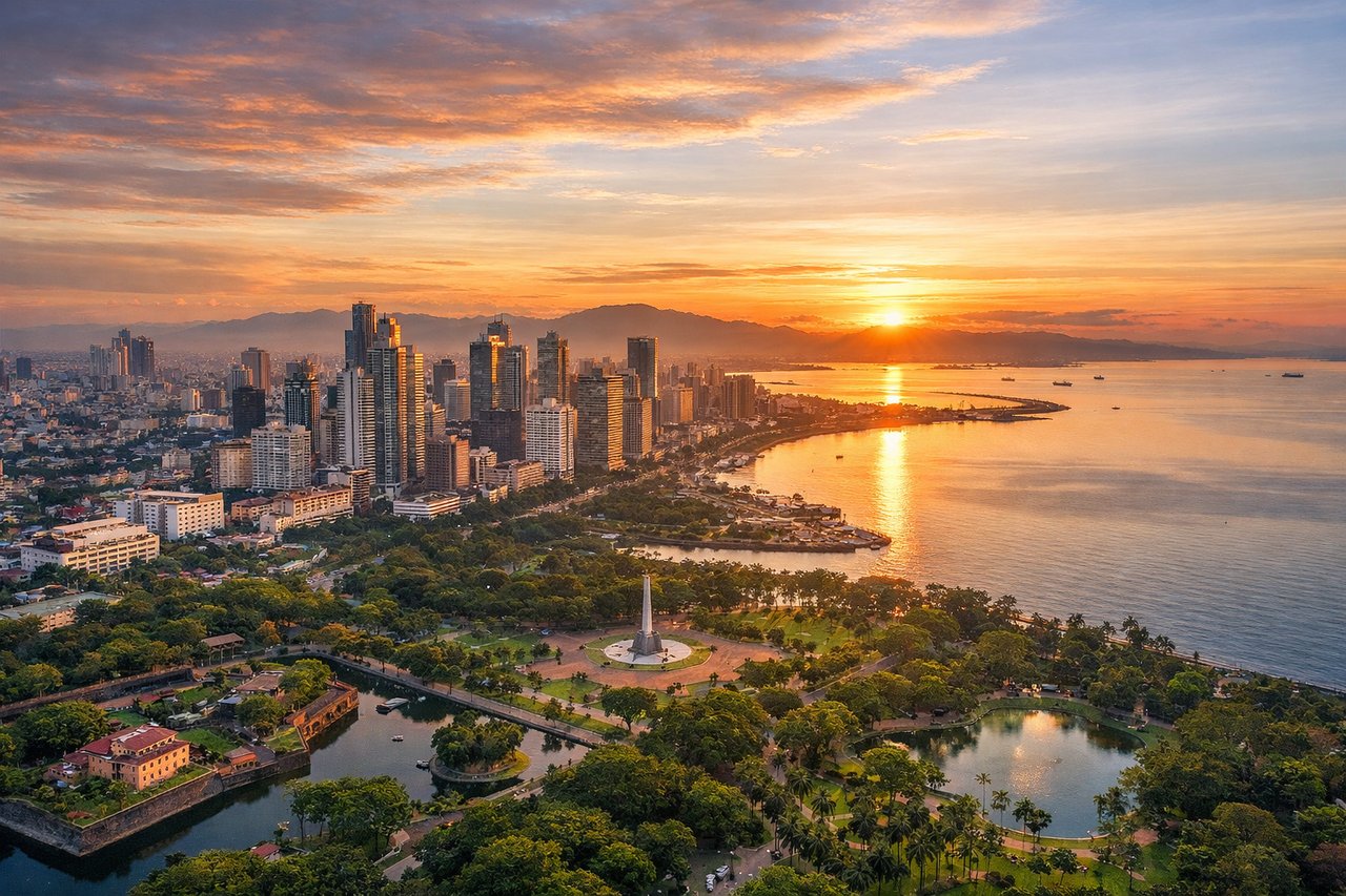
Takeoff from MNL
RIGHTNAIA's primary departure runway 06 sends aircraft northeast over Manila Bay on the left, but the right side captures Metro Manila's dense urban sprawl, the Pasig River winding through the city, and Laguna de Bay — one of Southeast Asia's largest lakes — coming into view as you climb. The right side gives you the more dramatic and varied geography.
Landing at CVG
LEFTCVG typically uses runway 18L/36R for arrivals from the west, with approaches often coming from the northwest. A left-side seat gives you the Ohio River valley, the Cincinnati skyline across the river in Ohio, and the Kentucky hills rolling south. The right side faces away from the city toward rural Kentucky farmland.
Landmarks on this routeAll landmarks →
Will your flight be in sunlight?
See exactly which side of the plane gets sun and shade at your departure time.
About This Route
Which side of the plane should I sit on flying from Ninoy Aquino International (MNL) to Cincinnati Northern Kentucky International (CVG)?
Sit on the Right side of the plane for the best views on flights from Manila to Cincinnati. The right side wins overall due to the spectacular departure views over Laguna de Bay and Metro Manila, which are genuinely dramatic and hard to beat. The landing advantage on the left is real but more modest — Cincinnati is a smaller skyline. For the full flight, the right side departure experience edges it out, and during the transpacific cruise the right side also faces south toward the Pacific, though at 35,000 feet over open ocean both sides are equally featureless.
What can I see during takeoff from Ninoy Aquino International in Manila?
During takeoff from Ninoy Aquino International (MNL), sit on the Right side for the best views. NAIA's primary departure runway 06 sends aircraft northeast over Manila Bay on the left, but the right side captures Metro Manila's dense urban sprawl, the Pasig River winding through the city, and Laguna de Bay — one of Southeast Asia's largest lakes — coming into view as you climb. The right side gives you the more dramatic and varied geography. Notable sights include: Laguna de Bay (massive lake southeast of Manila), Pasig River corridor through Metro Manila, Manila's urban grid and port district, Taal Volcano island visible to the south on clear days.
What can I see when landing at Cincinnati Northern Kentucky International in Cincinnati?
When landing at Cincinnati Northern Kentucky International (CVG), sit on the Left side for the best views. CVG typically uses runway 18L/36R for arrivals from the west, with approaches often coming from the northwest. A left-side seat gives you the Ohio River valley, the Cincinnati skyline across the river in Ohio, and the Kentucky hills rolling south. The right side faces away from the city toward rural Kentucky farmland. Notable sights include: Cincinnati skyline (across the Ohio River in Ohio), Ohio River bending through the valley, Northern Kentucky suburban grid, Kentucky hills and river bluffs.
How long is the flight from Manila to Cincinnati?
The flight from Ninoy Aquino International (MNL) to Cincinnati Northern Kentucky International (CVG) takes Approximately 16 to 17 hours nonstop, though most routings connect through Tokyo, Seoul, or a US West Coast hub, making total travel time 20 to 24 hours.
What does the Manila to Cincinnati flight path pass over?
The great circle route from Manila to Cincinnati tracks northeast across the Philippine Sea, over southern Japan (Kyushu and Honshu visible on clear days), across the North Pacific near the Aleutian Islands arc, then over the Gulf of Alaska, coastal British Columbia and the Canadian Rockies, the Great Plains of the US Midwest, and finally the Ohio Valley. The Canadian Rockies and the Aleutian island chain are the most visually striking features at cruise altitude on this routing.