The right side strings together a more varied sequence: Manila's skyline and Laguna de Bay at takeoff, the Okinawa island chain visible during cruise as the route passes just west of the islands, and a scenic bay-side approach into Fukuoka. The left side offers solid but comparatively static views—Manila Bay, then Taiwan's mountainous coastline from a distance, then open sea.
Flown MNL to FUK? Did we get it right?
Flight Path
Manila to Fukuoka is 1,444 miles (2,324 km), a flight of about 3 hours 40 minutes.
Luzon Strait and Bashi Channel between the Philippines and Taiwan, Taiwan's Central Mountain Range visible to the west, the Okinawa island chain (including Okinawa Hontō) to the east over the Philippine Sea/East China Sea boundary
Great circle distance and headings ›Phase by phase
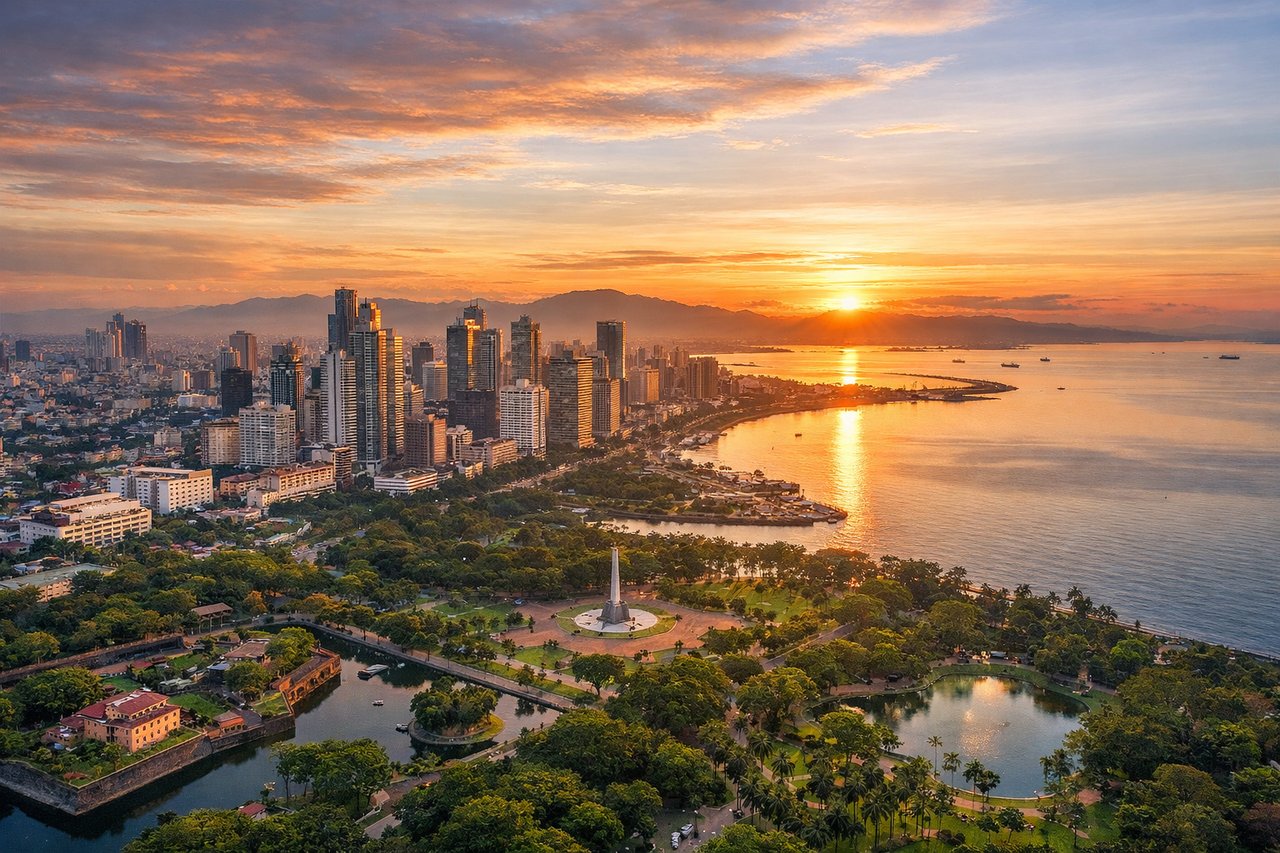
Takeoff from MNL
RIGHTClimbing out of NAIA on a northeast-bound departure, the right side looks back over Metro Manila's dense skyline and Laguna de Bay, with the Sierra Madre range rising on the horizon. The left side mostly shows Manila Bay's open water and the distant Bataan Peninsula, which is scenic but less varied.
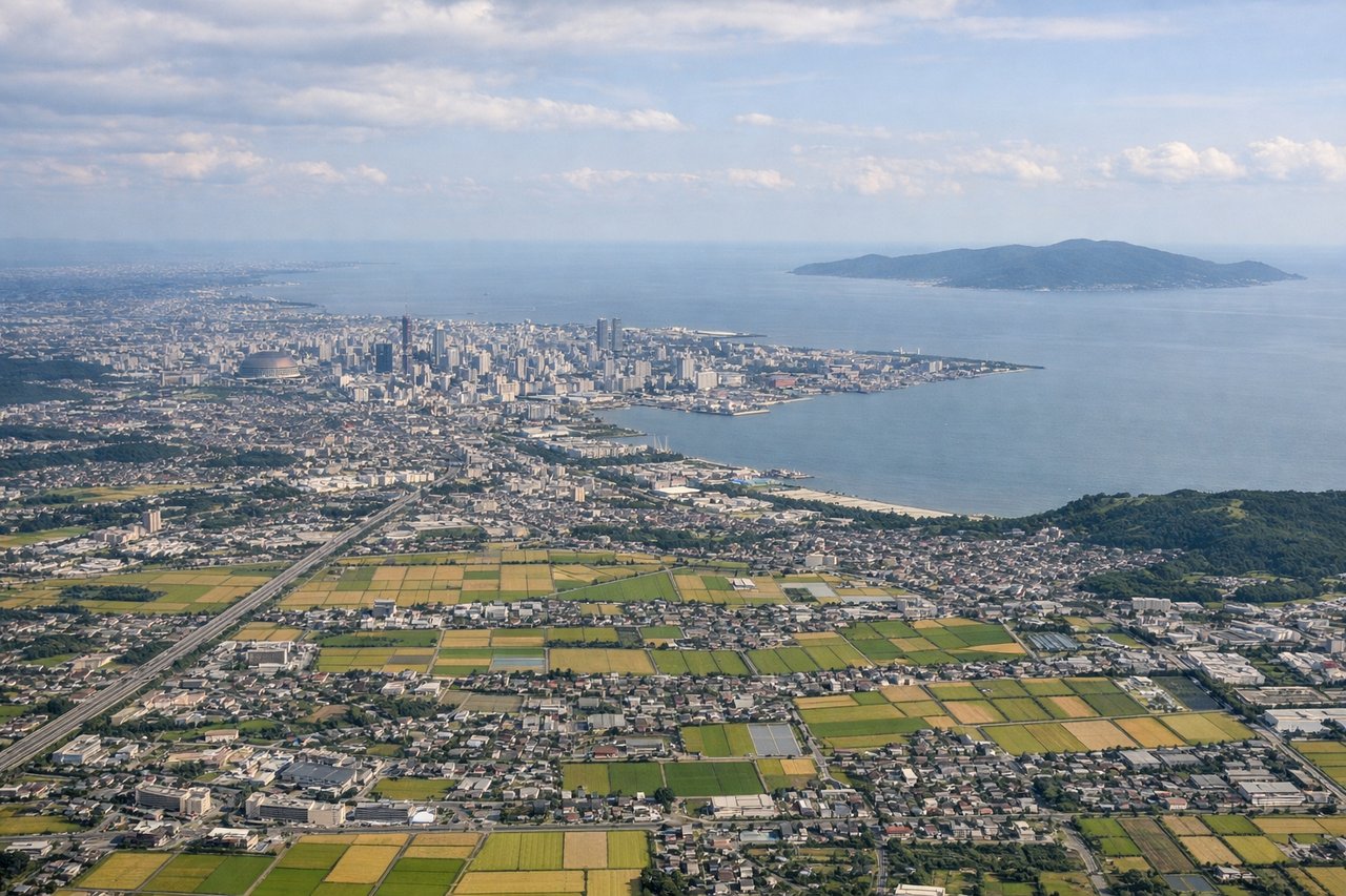
Landing at FUK
RIGHTOn approach into Fukuoka from the south, the right side offers views of Hakata Bay opening up ahead with the city's compact skyline along the waterfront, backed by the green hills of northern Kyushu. The left side during this phase mostly shows the tail end of open Genkai Sea water with less defined coastline detail.
Will your flight be in sunlight?
Pick a date and time in the Sun Map to watch the sun move across your whole flight.
About This Route
Which side of the plane should I sit on flying from Ninoy Aquino International (MNL) to Fukuoka (FUK)?
Sit on the Right side of the plane for the best views on flights from Manila to Fukuoka. The right side strings together a more varied sequence: Manila's skyline and Laguna de Bay at takeoff, the Okinawa island chain visible during cruise as the route passes just west of the islands, and a scenic bay-side approach into Fukuoka. The left side offers solid but comparatively static views—Manila Bay, then Taiwan's mountainous coastline from a distance, then open sea.
What can I see during takeoff from Ninoy Aquino International in Manila?
During takeoff from Ninoy Aquino International (MNL), sit on the Right side for the best views. Climbing out of NAIA on a northeast-bound departure, the right side looks back over Metro Manila's dense skyline and Laguna de Bay, with the Sierra Madre range rising on the horizon. The left side mostly shows Manila Bay's open water and the distant Bataan Peninsula, which is scenic but less varied. Notable sights include: Metro Manila skyline, Laguna de Bay, Sierra Madre mountains, Corregidor Island (distant left).
What can I see when landing at Fukuoka in Fukuoka?
When landing at Fukuoka (FUK), sit on the Right side for the best views. On approach into Fukuoka from the south, the right side offers views of Hakata Bay opening up ahead with the city's compact skyline along the waterfront, backed by the green hills of northern Kyushu. The left side during this phase mostly shows the tail end of open Genkai Sea water with less defined coastline detail. Notable sights include: Hakata Bay, Fukuoka city waterfront, Sefuri Mountains, Genkai Sea coastline.
How long is the flight from Manila to Fukuoka?
The flight from Ninoy Aquino International (MNL) to Fukuoka (FUK) takes about 3 hours 40 minutes. The shortest flight path between them is 1,444 miles (2,324 km); winds and air traffic control usually add a few percent.
What does the Manila to Fukuoka flight path pass over?
Luzon Strait and Bashi Channel between the Philippines and Taiwan, Taiwan's Central Mountain Range visible to the west, the Okinawa island chain (including Okinawa Hontō) to the east over the Philippine Sea/East China Sea boundary