While takeoff offers good Manila Bay views on the right, the landing approach into Portland on the left provides more dramatic and sustained scenery—Mount Hood, the Cascade Range, and the Columbia River Gorge are visually striking and iconic. The left side captures the most memorable portion of this transpacific route.
Flown MNL to PDX? Did we get it right?
Flight Path
Manila to Portland is 6,703 miles (10,787 km), a flight of about 14 hours 30 minutes.
The flight path crosses the North Pacific, passing north of Hawaii (typically 200+ miles north). Over open ocean, there are no visible landmarks. As the aircraft approaches North America, the Aleutian Islands may be visible on northern routes, followed by the Alaska coast and British Columbia's coastal ranges. The flight then transitions over the Pacific Northwest interior, with the Cascade Range becoming prominent during the final descent into Portland.
Great circle distance and headings ›Phase by phase
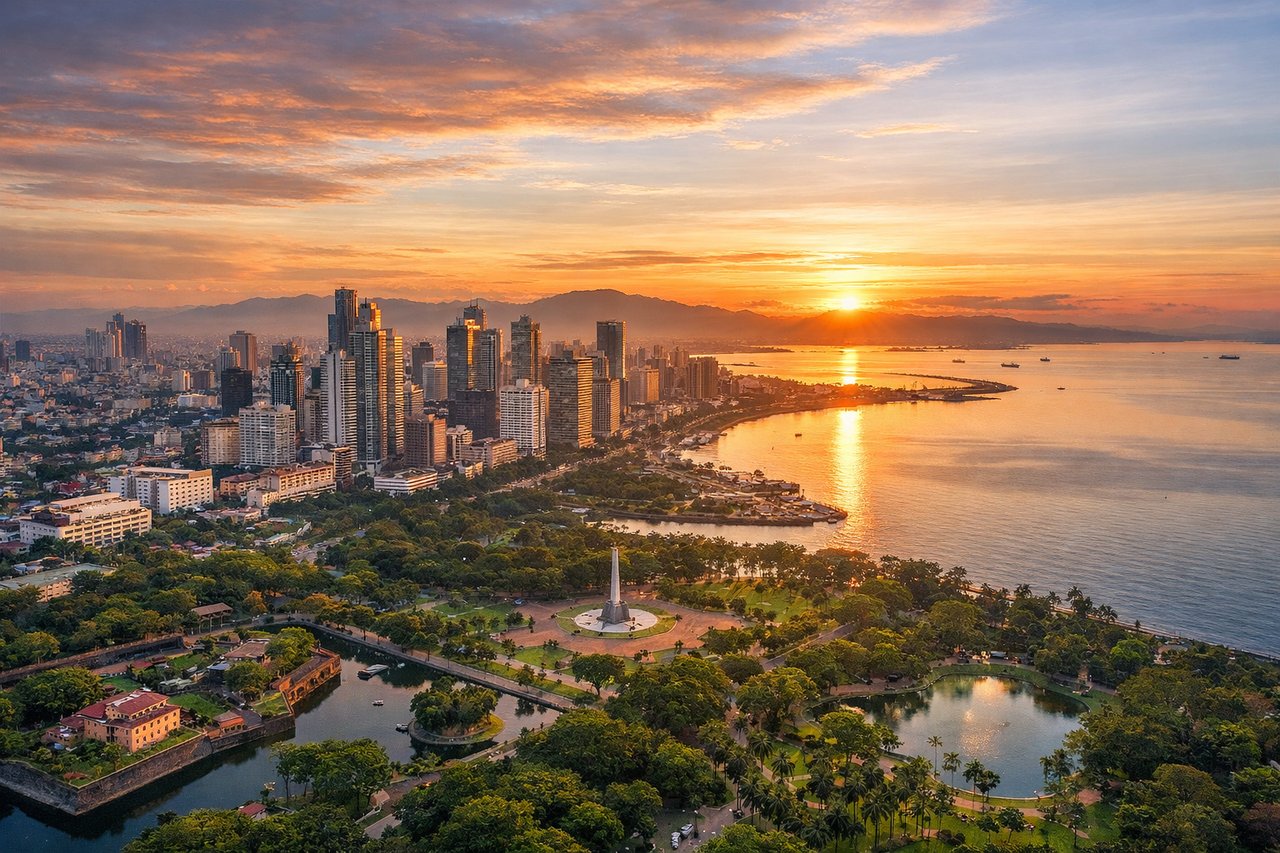
Takeoff from MNL
RIGHTRight-side seats offer views of Manila Bay and the Cordillera Central mountain range as the aircraft climbs northwestward. The bay's distinctive shape and the rugged terrain inland provide strong visual interest during the initial climb.
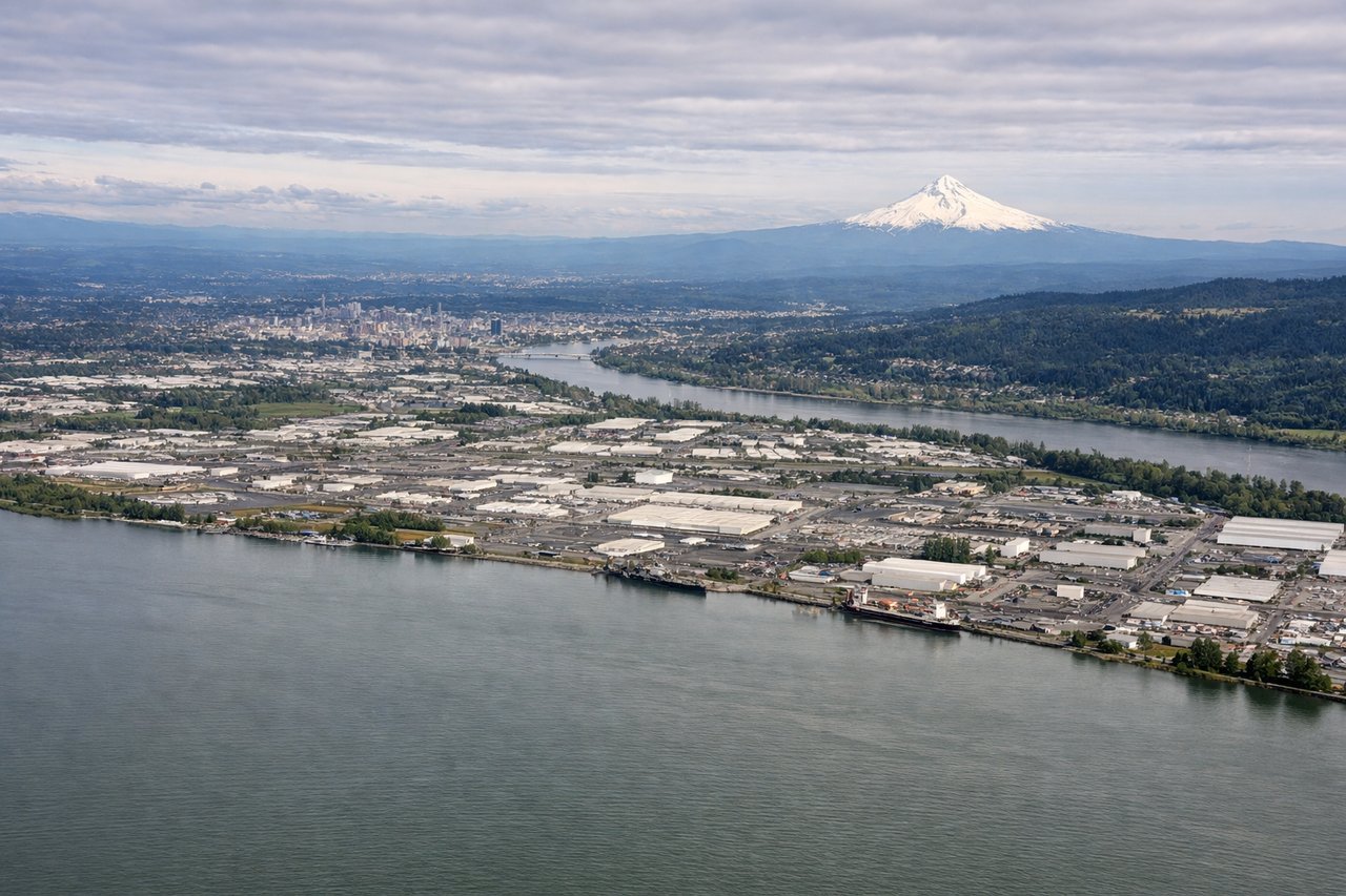
Landing at PDX
LEFTLeft-side seats provide excellent views of the Cascade Range and Mount Hood during descent into Portland. The volcanic peaks are prominent on approach from the east, and the Columbia River Gorge creates a dramatic natural corridor visible during final descent.
Will your flight be in sunlight?
Pick a date and time in the Sun Map to watch the sun move across your whole flight.
About This Route
Which side of the plane should I sit on flying from Ninoy Aquino International (MNL) to Portland International (PDX)?
Sit on the Left side of the plane for the best views on flights from Manila to Portland. While takeoff offers good Manila Bay views on the right, the landing approach into Portland on the left provides more dramatic and sustained scenery—Mount Hood, the Cascade Range, and the Columbia River Gorge are visually striking and iconic. The left side captures the most memorable portion of this transpacific route.
What can I see during takeoff from Ninoy Aquino International in Manila?
During takeoff from Ninoy Aquino International (MNL), sit on the Right side for the best views. Right-side seats offer views of Manila Bay and the Cordillera Central mountain range as the aircraft climbs northwestward. The bay's distinctive shape and the rugged terrain inland provide strong visual interest during the initial climb. Notable sights include: Manila Bay (immediate departure point), Cordillera Central mountain range (northeast), Laguna de Bay (southeast), Clark Air Base region (north).
What can I see when landing at Portland International in Portland?
When landing at Portland International (PDX), sit on the Left side for the best views. Left-side seats provide excellent views of the Cascade Range and Mount Hood during descent into Portland. The volcanic peaks are prominent on approach from the east, and the Columbia River Gorge creates a dramatic natural corridor visible during final descent. Notable sights include: Cascade Range (dominant eastern approach), Mount Hood (11,240 ft, visible as a snow-capped peak), Columbia River Gorge (west-southwest), Willamette Valley (immediate landing area).
How long is the flight from Manila to Portland?
The flight from Ninoy Aquino International (MNL) to Portland International (PDX) takes about 14 hours 30 minutes. The shortest flight path between them is 6,703 miles (10,787 km); winds and air traffic control usually add a few percent.
What does the Manila to Portland flight path pass over?
The flight path crosses the North Pacific, passing north of Hawaii (typically 200+ miles north). Over open ocean, there are no visible landmarks. As the aircraft approaches North America, the Aleutian Islands may be visible on northern routes, followed by the Alaska coast and British Columbia's coastal ranges. The flight then transitions over the Pacific Northwest interior, with the Cascade Range becoming prominent during the final descent into Portland.