The left side offers Taal Volcano and Manila Bay during departure and the Mekong Delta's rivers and Vung Tau coastline during arrival, giving genuine geographic variety on both ends of an otherwise ocean-dominated route. The right side faces mostly open South China Sea water with no comparable landmarks.
Flown MNL to SGN? Did we get it right?
Flight Path
Manila to Ho Chi Minh City is 1,001 miles (1,611 km), a flight of about 2 hours 20 minutes.
Open South China Sea (West Philippine Sea) with no significant landmarks visible; the route stays over water for the bulk of the cruise between the Philippine coast and the Vietnamese mainland
Great circle distance and headings ›Phase by phase
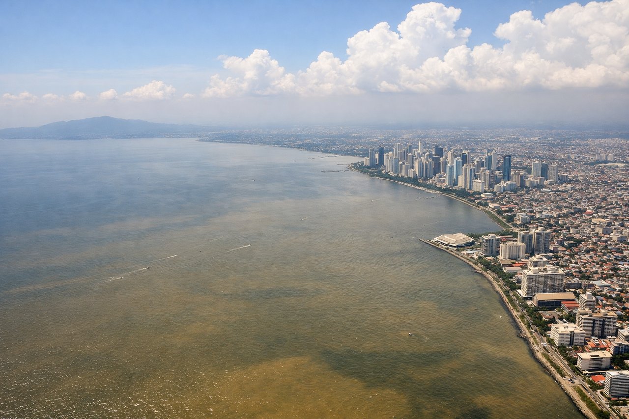
Takeoff from MNL
LEFTDeparting MNL toward the southwest, the left side looks south across Manila Bay toward Corregidor Island and the Cavite/Batangas coastline, with Taal Volcano's crater lake visible as a distinctive dark ring in the distance. The right side only shows the flatter Bataan Peninsula and open water to the north with far less to look at.

Landing at SGN
LEFTOn approach into SGN from the east, the left side faces south over the Mekong Delta's braided rivers, rice paddies, and the Vung Tau coastal peninsula jutting into the South China Sea. The right side mostly shows flatter inland terrain and the airport's industrial outskirts with less visual variety.
Will your flight be in sunlight?
Pick a date and time in the Sun Map to watch the sun move across your whole flight.
About This Route
Which side of the plane should I sit on flying from Ninoy Aquino International (MNL) to Tansonnhat International (SGN)?
Sit on the Left side of the plane for the best views on flights from Manila to Ho Chi Minh City. The left side offers Taal Volcano and Manila Bay during departure and the Mekong Delta's rivers and Vung Tau coastline during arrival, giving genuine geographic variety on both ends of an otherwise ocean-dominated route. The right side faces mostly open South China Sea water with no comparable landmarks.
What can I see during takeoff from Ninoy Aquino International in Manila?
During takeoff from Ninoy Aquino International (MNL), sit on the Left side for the best views. Departing MNL toward the southwest, the left side looks south across Manila Bay toward Corregidor Island and the Cavite/Batangas coastline, with Taal Volcano's crater lake visible as a distinctive dark ring in the distance. The right side only shows the flatter Bataan Peninsula and open water to the north with far less to look at. Notable sights include: Manila Bay, Corregidor Island, Taal Volcano crater lake, Cavite/Batangas coastline.
What can I see when landing at Tansonnhat International in Ho Chi Minh City?
When landing at Tansonnhat International (SGN), sit on the Left side for the best views. On approach into SGN from the east, the left side faces south over the Mekong Delta's braided rivers, rice paddies, and the Vung Tau coastal peninsula jutting into the South China Sea. The right side mostly shows flatter inland terrain and the airport's industrial outskirts with less visual variety. Notable sights include: Mekong Delta river channels, Vung Tau peninsula, rice paddies, Saigon River tributaries.
How long is the flight from Manila to Ho Chi Minh City?
The flight from Ninoy Aquino International (MNL) to Tansonnhat International (SGN) takes about 2 hours 20 minutes. The shortest flight path between them is 1,001 miles (1,611 km); winds and air traffic control usually add a few percent.
What does the Manila to Ho Chi Minh City flight path pass over?
Open South China Sea (West Philippine Sea) with no significant landmarks visible; the route stays over water for the bulk of the cruise between the Philippine coast and the Vietnamese mainland