Left side scores marginally higher due to the superior scenic quality of the Manila Bay departure with urban skyline and coastal features, which outweighs the modest advantage of the Cagayan Valley landing view on the right. Both sides are relatively equal for a short domestic flight over predominantly flat terrain, but the Manila Bay departure provides more visual interest and recognizable landmarks than the agricultural landing approach.
Flown MNL to TUG? Did we get it right?
Flight Path
Manila to Tuguegarao City is 222 miles (357 km), a flight of about 50 minutes.
Lingayen Gulf coastline (visible to the left/west during cruise), Nueva Ecija agricultural plains, Zambales mountain range (distant western horizon), transition from coastal lowlands to Cagayan Valley's broader floodplain
Great circle distance and headings ›Phase by phase
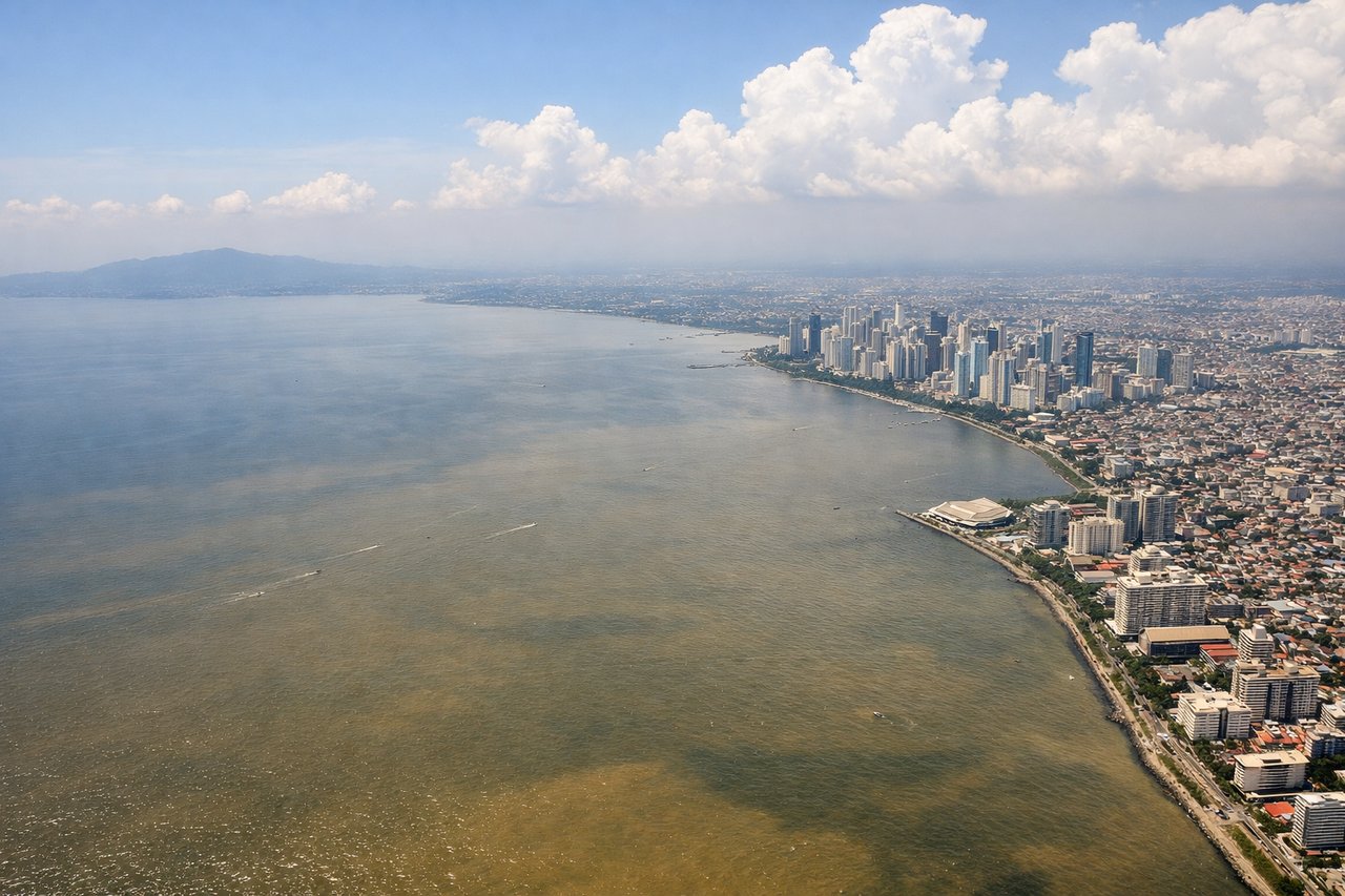
Takeoff from MNL
LEFTLeft side captures Manila Bay and the coastal urban sprawl of Metro Manila during departure, including Makati's skyline and the bay's eastern shoreline. Right side faces inland toward Laguna de Bay and flat agricultural plains with minimal visual interest.
Landing at TUG
RIGHTRight side offers views of the Cagayan Valley's agricultural landscape and the approach to Tuguegarao over the Cagayan River delta and surrounding lowlands. Left side faces the Sierra Madre mountain range but from a distance that renders it as a distant blue ridge with limited detail during final approach.
Will your flight be in sunlight?
Pick a date and time in the Sun Map to watch the sun move across your whole flight.
About This Route
Which side of the plane should I sit on flying from Ninoy Aquino International (MNL) to Tuguegarao Airport (TUG)?
Sit on the Left side of the plane for the best views on flights from Manila to Tuguegarao City. Left side scores marginally higher due to the superior scenic quality of the Manila Bay departure with urban skyline and coastal features, which outweighs the modest advantage of the Cagayan Valley landing view on the right. Both sides are relatively equal for a short domestic flight over predominantly flat terrain, but the Manila Bay departure provides more visual interest and recognizable landmarks than the agricultural landing approach.
What can I see during takeoff from Ninoy Aquino International in Manila?
During takeoff from Ninoy Aquino International (MNL), sit on the Left side for the best views. Left side captures Manila Bay and the coastal urban sprawl of Metro Manila during departure, including Makati's skyline and the bay's eastern shoreline. Right side faces inland toward Laguna de Bay and flat agricultural plains with minimal visual interest. Notable sights include: Manila Bay, Makati business district skyline, Corregidor Island (visible on clear days), Laguna de Bay shoreline.
What can I see when landing at Tuguegarao Airport in Tuguegarao City?
When landing at Tuguegarao Airport (TUG), sit on the Right side for the best views. Right side offers views of the Cagayan Valley's agricultural landscape and the approach to Tuguegarao over the Cagayan River delta and surrounding lowlands. Left side faces the Sierra Madre mountain range but from a distance that renders it as a distant blue ridge with limited detail during final approach. Notable sights include: Cagayan River delta and floodplain, Tuguegarao city grid, agricultural fields of Cagayan Valley, Sierra Madre range (distant eastern horizon).
How long is the flight from Manila to Tuguegarao City?
The flight from Ninoy Aquino International (MNL) to Tuguegarao Airport (TUG) takes about 50 minutes. The shortest flight path between them is 222 miles (357 km); winds and air traffic control usually add a few percent.
What does the Manila to Tuguegarao City flight path pass over?
Lingayen Gulf coastline (visible to the left/west during cruise), Nueva Ecija agricultural plains, Zambales mountain range (distant western horizon), transition from coastal lowlands to Cagayan Valley's broader floodplain