While the Fiji departure offers a brief mountainous coastline view, the Auckland arrival delivers a more prolonged and dramatic sequence over the Hauraki Gulf, Rangitoto's volcanic cone, and the city's harbour skyline, giving the right side the edge for the full flight.
Flight Path
Open South Pacific Ocean with no landmasses visible between Fiji and New Zealand
Great circle distance and headings ›Phase by phase
Takeoff from NAN
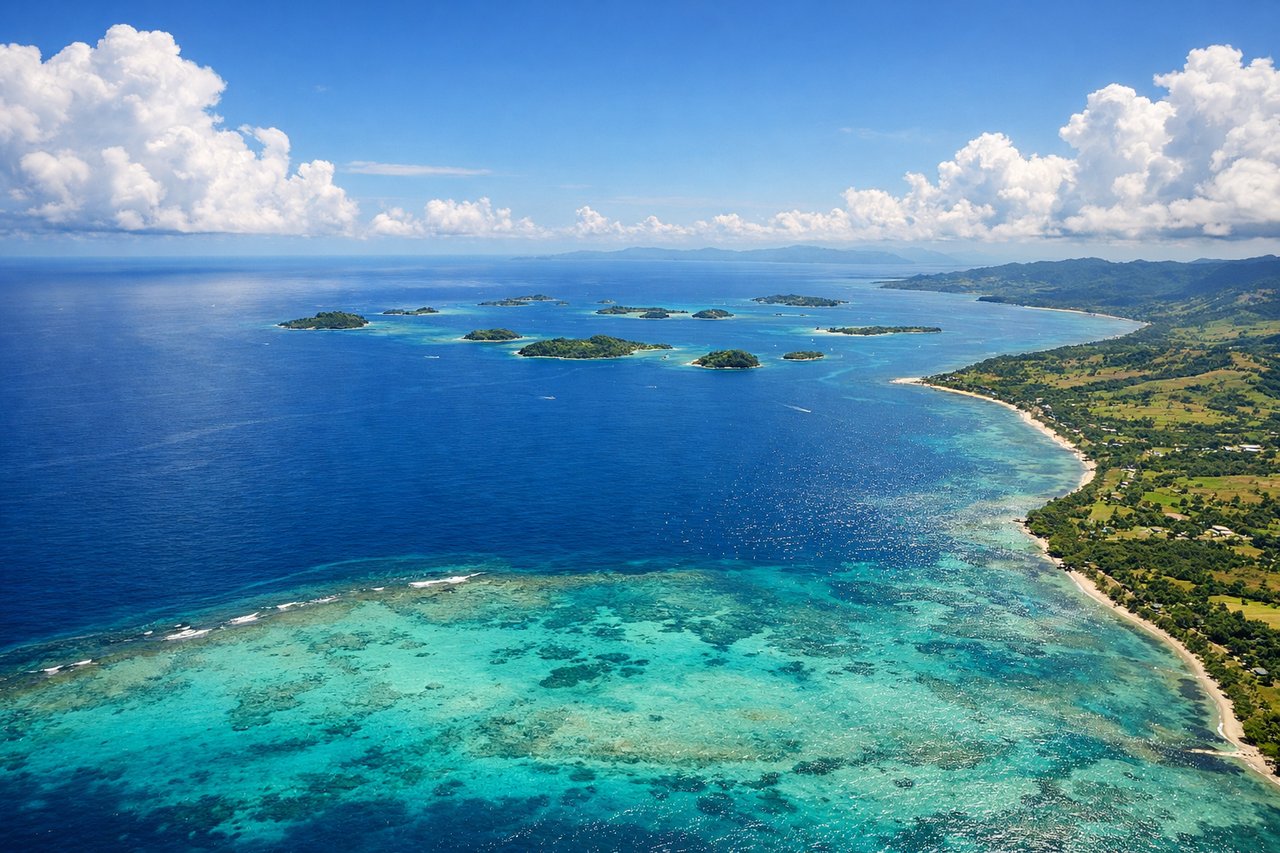
LEFTDeparting NAN on runway 20 heading southwest, the aircraft tracks along Viti Levu's coastline before turning out to sea. Passengers on the left get a good look at the island's interior highlands, including the rugged peaks around Nausori Highlands, before the land falls away.
Landing at AKL
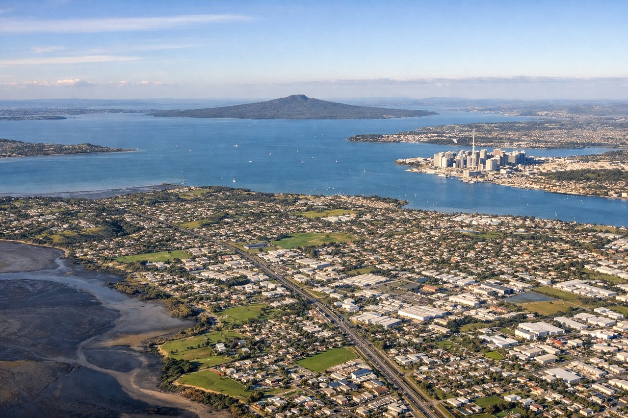
RIGHTOn approach into AKL runway 23L from the northeast, the flight path crosses the Hauraki Gulf, passing near Rangitoto's distinctive volcanic cone and then over Waitemata Harbour with the Auckland CBD skyline and harbour bridge visible on the right side as the aircraft lines up for landing.
Landmarks on this routeAll landmarks →
Will your flight be in sunlight?
See exactly which side of the plane gets sun and shade at your departure time.
About This Route
Which side of the plane should I sit on flying from Nadi International (NAN) to Auckland International (AKL)?
Sit on the Right side of the plane for the best views on flights from Nandi to Auckland. While the Fiji departure offers a brief mountainous coastline view, the Auckland arrival delivers a more prolonged and dramatic sequence over the Hauraki Gulf, Rangitoto's volcanic cone, and the city's harbour skyline, giving the right side the edge for the full flight.
What can I see during takeoff from Nadi International in Nandi?
During takeoff from Nadi International (NAN), sit on the Left side for the best views. Departing NAN on runway 20 heading southwest, the aircraft tracks along Viti Levu's coastline before turning out to sea. Passengers on the left get a good look at the island's interior highlands, including the rugged peaks around Nausori Highlands, before the land falls away. Notable sights include: Viti Levu interior mountains, Nadi Bay coastline, Mamanuca island fringe reefs.
What can I see when landing at Auckland International in Auckland?
When landing at Auckland International (AKL), sit on the Right side for the best views. On approach into AKL runway 23L from the northeast, the flight path crosses the Hauraki Gulf, passing near Rangitoto's distinctive volcanic cone and then over Waitemata Harbour with the Auckland CBD skyline and harbour bridge visible on the right side as the aircraft lines up for landing. Notable sights include: Rangitoto Island volcanic cone, Waitemata Harbour, Auckland Harbour Bridge, Sky Tower skyline.
How long is the flight from Nandi to Auckland?
The flight from Nadi International (NAN) to Auckland International (AKL) takes 2h 50m.
What does the Nandi to Auckland flight path pass over?
Open South Pacific Ocean with no landmasses visible between Fiji and New Zealand