Right side scores 3.5 vs left's 2.5. The right side captures two distinct scenic sequences: Fiji's volcanic archipelago and reef systems during departure, then Tokyo Bay's industrial waterfront and metropolitan skyline during arrival. Left side is dominated by open ocean for most of the 7+ hour flight, with minimal visual interest except during the initial climb-out over Fiji's western waters. Right offers genuine geographic variety and recognizable landmarks at both ends of the journey.
Flight Path
The flight path crosses the International Date Line and traverses the North Pacific. Notable features along the route include: the Fiji archipelago and reef systems during departure; the open North Pacific basin (5+ hours of ocean with occasional weather systems and cloud formations); the Izu Islands and Izu Peninsula volcanic chain approaching Japan from the south; Tokyo Bay and the Kanto Plain as the final descent begins. The route generally follows a great-circle path from southwest to northeast, passing east of the Philippines and Taiwan, then approaching Honshu from the Pacific side.
Great circle distance and headings ›

Phase by phase
Takeoff from NAN
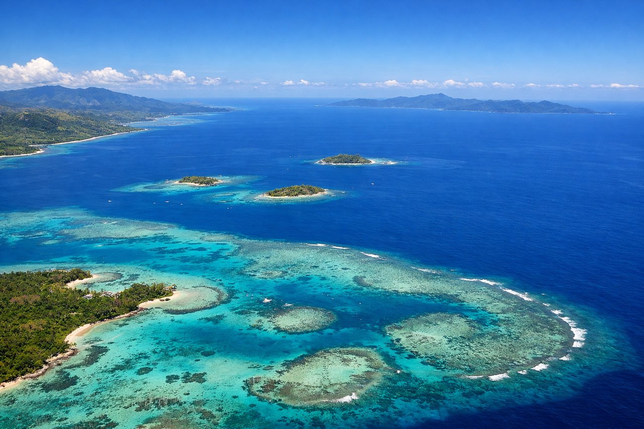
RIGHTRunway 20 departures from NAN head southwest over Viti Levu's western coast and the Fiji archipelago. Right-side passengers see the dramatic volcanic spine of Viti Levu, coastal reef systems, and scattered islands receding into the distance during climb-out. Left side faces open ocean immediately.
Landing at HND
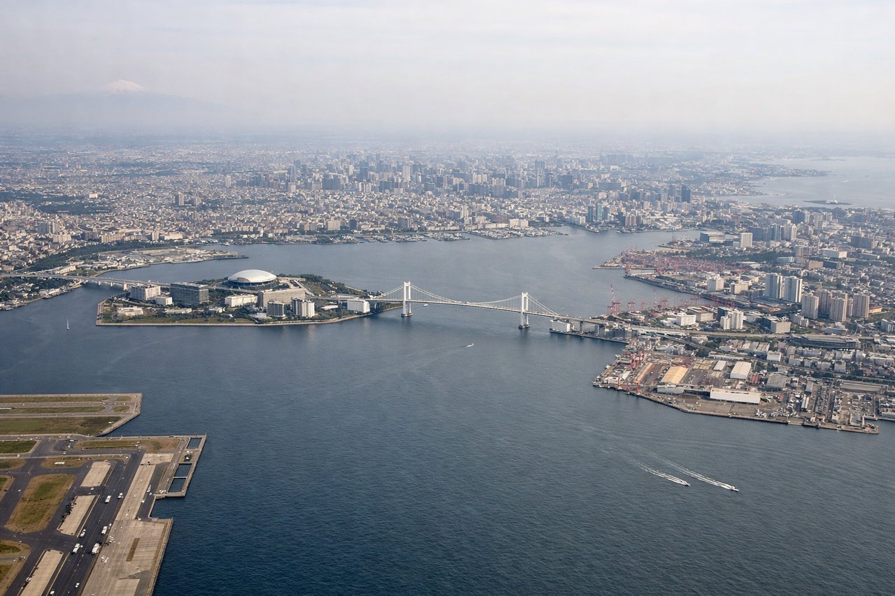
RIGHTHaneda arrivals in daytime south-wind conditions approach from the south over Tokyo Bay (runways 34L/34R). Right-side passengers see the bay's eastern shoreline, Chiba's industrial waterfront, and the approach path over water with Tokyo's urban sprawl visible inland. Left side faces open Pacific Ocean during the long descent and approach.
Landmarks on this routeAll landmarks →
Will your flight be in sunlight?
See exactly which side of the plane gets sun and shade at your departure time.
About This Route
Which side of the plane should I sit on flying from Nadi International (NAN) to Tokyo International (HND)?
Sit on the Right side of the plane for the best views on flights from Nandi to Tokyo. Right side scores 3.5 vs left's 2.5. The right side captures two distinct scenic sequences: Fiji's volcanic archipelago and reef systems during departure, then Tokyo Bay's industrial waterfront and metropolitan skyline during arrival. Left side is dominated by open ocean for most of the 7+ hour flight, with minimal visual interest except during the initial climb-out over Fiji's western waters. Right offers genuine geographic variety and recognizable landmarks at both ends of the journey.
What can I see during takeoff from Nadi International in Nandi?
During takeoff from Nadi International (NAN), sit on the Right side for the best views. Runway 20 departures from NAN head southwest over Viti Levu's western coast and the Fiji archipelago. Right-side passengers see the dramatic volcanic spine of Viti Levu, coastal reef systems, and scattered islands receding into the distance during climb-out. Left side faces open ocean immediately. Notable sights include: Viti Levu volcanic ridge, Fiji reef systems, Yasawa Islands chain to the northwest, Nadi Bay coastline.
What can I see when landing at Tokyo International in Tokyo?
When landing at Tokyo International (HND), sit on the Right side for the best views. Haneda arrivals in daytime south-wind conditions approach from the south over Tokyo Bay (runways 34L/34R). Right-side passengers see the bay's eastern shoreline, Chiba's industrial waterfront, and the approach path over water with Tokyo's urban sprawl visible inland. Left side faces open Pacific Ocean during the long descent and approach. Notable sights include: Tokyo Bay waters, Chiba industrial zone and port facilities, Tokyo metropolitan skyline and urban grid, Haneda Airport runways and taxiways.
How long is the flight from Nandi to Tokyo?
The flight from Nadi International (NAN) to Tokyo International (HND) takes 7h 25m.
What does the Nandi to Tokyo flight path pass over?
The flight path crosses the International Date Line and traverses the North Pacific. Notable features along the route include: the Fiji archipelago and reef systems during departure; the open North Pacific basin (5+ hours of ocean with occasional weather systems and cloud formations); the Izu Islands and Izu Peninsula volcanic chain approaching Japan from the south; Tokyo Bay and the Kanto Plain as the final descent begins. The route generally follows a great-circle path from southwest to northeast, passing east of the Philippines and Taiwan, then approaching Honshu from the Pacific side.