Oita to Osaka is 230 miles (370 km), a flight of about 55 minutes.
While takeoff favors the right for Beppu Bay views, the landing experience on the left is more dramatic and geographically informative—the Yodo River delta and Osaka Bay approach are visually distinctive. Left-side seats capture the most significant geographic feature of the entire route during descent.
Flight Path
The flight path crosses the Seto Inland Sea's northern waters, passing over or near Shikoku's northern coast. Visible features include small islands of the Seto Inland Sea, the Akashi Strait region (if routed south), and the transition from Oita Prefecture's coastal terrain to the Kansai region's geography. The Inland Sea's characteristic calm waters and island-dotted landscape dominate the midpoint of the route.
Great circle distance and headings ›Phase by phase
Takeoff from OIT
RIGHTRight-side seats capture the Beppu Bay coastline and thermal activity areas during the initial climb. Oita typically departs to the northeast, so right-side passengers get direct views of the bay's distinctive shape and the geothermal landscape around Beppu before turning westbound toward Osaka.
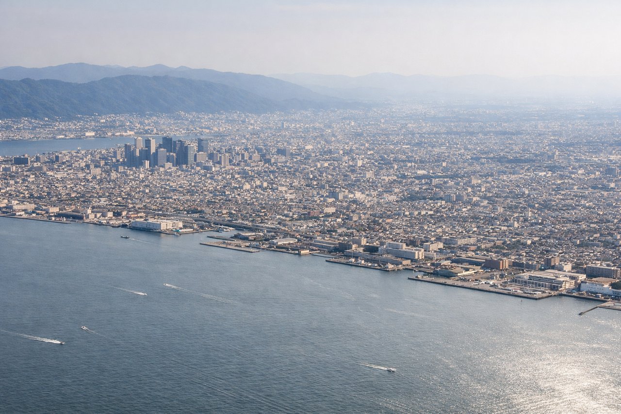
Landing at ITM
LEFTLeft-side seats offer superior views during the descent into Osaka International (Itami). Approaching from the east on typical landing runways (32L/32R), left-side passengers see the Yodo River delta, Osaka Bay's northern reaches, and the city's eastern districts before touchdown. This provides a full geographic context of the approach corridor.
Will your flight be in sunlight?
Pick a date and time in the Sun Map to watch the sun move across your whole flight.
About This Route
Which side of the plane should I sit on flying from Oita (OIT) to Osaka International (ITM)?
Sit on the Left side of the plane for the best views on flights from Oita to Osaka. While takeoff favors the right for Beppu Bay views, the landing experience on the left is more dramatic and geographically informative—the Yodo River delta and Osaka Bay approach are visually distinctive. Left-side seats capture the most significant geographic feature of the entire route during descent.
What can I see during takeoff from Oita in Oita?
During takeoff from Oita (OIT), sit on the Right side for the best views. Right-side seats capture the Beppu Bay coastline and thermal activity areas during the initial climb. Oita typically departs to the northeast, so right-side passengers get direct views of the bay's distinctive shape and the geothermal landscape around Beppu before turning westbound toward Osaka. Notable sights include: Beppu Bay (immediate offshore feature), Yufu Mountain (1,583m, visible as a prominent peak inland), Beppu city's coastal strip, geothermal steam vents around Beppu (visible as white plumes in clear conditions).
What can I see when landing at Osaka International in Osaka?
When landing at Osaka International (ITM), sit on the Left side for the best views. Left-side seats offer superior views during the descent into Osaka International (Itami). Approaching from the east on typical landing runways (32L/32R), left-side passengers see the Yodo River delta, Osaka Bay's northern reaches, and the city's eastern districts before touchdown. This provides a full geographic context of the approach corridor. Notable sights include: Yodo River delta and estuary (distinctive braided waterway pattern), Osaka Bay's northern shoreline, Osaka city's eastern urban sprawl, Ikeda city and surrounding hills to the north.
How long is the flight from Oita to Osaka?
The flight from Oita (OIT) to Osaka International (ITM) takes about 55 minutes. The shortest flight path between them is 230 miles (370 km); winds and air traffic control usually add a few percent.
What does the Oita to Osaka flight path pass over?
The flight path crosses the Seto Inland Sea's northern waters, passing over or near Shikoku's northern coast. Visible features include small islands of the Seto Inland Sea, the Akashi Strait region (if routed south), and the transition from Oita Prefecture's coastal terrain to the Kansai region's geography. The Inland Sea's characteristic calm waters and island-dotted landscape dominate the midpoint of the route.