Osaka to Oita is 230 miles (370 km), a flight of about 55 minutes.
Takeoff views from the right side are significantly more compelling, with Osaka Bay and the Kobe urban landscape providing strong visual interest. Landing views are more balanced, but the takeoff advantage outweighs the landing preference for left seats.
Flight Path
The flight path crosses the Seto Inland Sea (Seto Naikai) from northwest to southeast. Notable midpoint features include the Shikoku coastline to the south, numerous small islands dotting the Seto Inland Sea, and the transition from the Kobe-Osaka industrial zone to the more rural landscape of central Shikoku and eastern Kyushu. The Yoshii River delta and Okayama coastal plains are visible to the north during the cruise phase. Clear-weather flights offer views of multiple island chains and the gradual shift from developed western Honshu to the less densely populated regions of Shikoku and Kyushu.
Great circle distance and headings ›Phase by phase
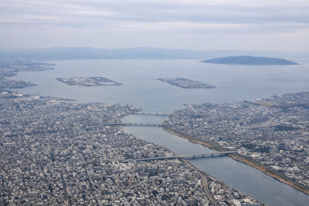
Takeoff from ITM
RIGHTITM typically departs runway 32L/R (northwest heading). Right-side seats offer immediate views of Osaka Bay and the Kobe-Osaka urban corridor as you climb out. Left seats face inland toward less distinctive terrain.
Landing at OIT
LEFTOita Airport (runway 16/34) typically receives aircraft from the northeast on approach. Left-side seats provide views of the Bungo Channel and Kyushu's eastern coastline during descent. Right seats face inland toward less visually distinctive forested terrain.
Will your flight be in sunlight?
Pick a date and time in the Sun Map to watch the sun move across your whole flight.
About This Route
Which side of the plane should I sit on flying from Osaka International (ITM) to Oita (OIT)?
Sit on the Right side of the plane for the best views on flights from Osaka to Oita. Takeoff views from the right side are significantly more compelling, with Osaka Bay and the Kobe urban landscape providing strong visual interest. Landing views are more balanced, but the takeoff advantage outweighs the landing preference for left seats.
What can I see during takeoff from Osaka International in Osaka?
During takeoff from Osaka International (ITM), sit on the Right side for the best views. ITM typically departs runway 32L/R (northwest heading). Right-side seats offer immediate views of Osaka Bay and the Kobe-Osaka urban corridor as you climb out. Left seats face inland toward less distinctive terrain. Notable sights include: Osaka Bay (immediate foreground), Kobe city district (northwest across the bay), Awaji Island (visible in the bay to the west), Rokko Mountains (distant ridge north of Kobe).
What can I see when landing at Oita in Oita?
When landing at Oita (OIT), sit on the Left side for the best views. Oita Airport (runway 16/34) typically receives aircraft from the northeast on approach. Left-side seats provide views of the Bungo Channel and Kyushu's eastern coastline during descent. Right seats face inland toward less visually distinctive forested terrain. Notable sights include: Bungo Channel (major water body between Shikoku and Kyushu), Oita city (visible on the coastal plain), Taketa Mountains (inland to the south), Kyushu's eastern coastline.
How long is the flight from Osaka to Oita?
The flight from Osaka International (ITM) to Oita (OIT) takes about 55 minutes. The shortest flight path between them is 230 miles (370 km); winds and air traffic control usually add a few percent.
What does the Osaka to Oita flight path pass over?
The flight path crosses the Seto Inland Sea (Seto Naikai) from northwest to southeast. Notable midpoint features include the Shikoku coastline to the south, numerous small islands dotting the Seto Inland Sea, and the transition from the Kobe-Osaka industrial zone to the more rural landscape of central Shikoku and eastern Kyushu. The Yoshii River delta and Okayama coastal plains are visible to the north during the cruise phase. Clear-weather flights offer views of multiple island chains and the gradual shift from developed western Honshu to the less densely populated regions of Shikoku and Kyushu.