Naha to Ishigaki is 246 miles (395 km), a flight of about 50 minutes.
Right-side seats capture the superior views on both legs: the Kerama Islands and East China Sea during departure, and the scenic Yaeyama Islands and coral reef waters during approach. The flight path itself runs southwest over open water, so right seats maintain better sightlines throughout the 50-minute flight.
Flight Path
The flight path crosses the East China Sea between Okinawa and the Yaeyama Islands. At cruise altitude (around 15,000-20,000 feet), passengers see open ocean with occasional small islands and atolls. The Kerama Islands remain visible off the left wing during early climb. The Yaeyama Islands become visible ahead as the aircraft descends toward Ishigaki, with Iriomote Island's larger landmass distinguishable from smaller neighboring islands.
Great circle distance and headings ›Phase by phase
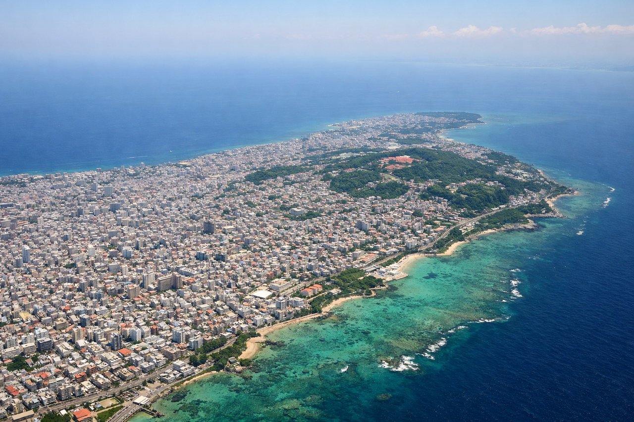
Takeoff from OKA
RIGHTNaha typically departs runway 32L/32R (northwesterly heading). Right-side seats face toward the Kerama Islands and the East China Sea immediately after liftoff, while left seats look back over Naha city and inland Okinawa.
Landing at ISG
LEFTIshigaki approaches from the southwest on runway 04 (northeasterly heading). Left-side seats during descent face the Yaeyama Islands chain and Ishigaki's distinctive terrain, while right seats look over open ocean.
Will your flight be in sunlight?
Pick a date and time in the Sun Map to watch the sun move across your whole flight.
About This Route
Which side of the plane should I sit on flying from Naha (OKA) to New Ishigaki Airport (ISG)?
Sit on the Right side of the plane for the best views on flights from Naha to Ishigaki. Right-side seats capture the superior views on both legs: the Kerama Islands and East China Sea during departure, and the scenic Yaeyama Islands and coral reef waters during approach. The flight path itself runs southwest over open water, so right seats maintain better sightlines throughout the 50-minute flight.
What can I see during takeoff from Naha in Naha?
During takeoff from Naha (OKA), sit on the Right side for the best views. Naha typically departs runway 32L/32R (northwesterly heading). Right-side seats face toward the Kerama Islands and the East China Sea immediately after liftoff, while left seats look back over Naha city and inland Okinawa. Notable sights include: Kerama Islands (small archipelago 30 miles west), East China Sea, Naha harbor and port facilities, inland Okinawa plateau.
What can I see when landing at New Ishigaki Airport in Ishigaki?
When landing at New Ishigaki Airport (ISG), sit on the Left side for the best views. Ishigaki approaches from the southwest on runway 04 (northeasterly heading). Left-side seats during descent face the Yaeyama Islands chain and Ishigaki's distinctive terrain, while right seats look over open ocean. Notable sights include: Yaeyama Islands (Iriomote, Taketomi visible as nearby islands), Ishigaki's central plateau and ridgeline, coral reef structures visible in shallow waters, Ishigaki harbor.
How long is the flight from Naha to Ishigaki?
The flight from Naha (OKA) to New Ishigaki Airport (ISG) takes about 50 minutes. The shortest flight path between them is 246 miles (395 km); winds and air traffic control usually add a few percent.
What does the Naha to Ishigaki flight path pass over?
The flight path crosses the East China Sea between Okinawa and the Yaeyama Islands. At cruise altitude (around 15,000-20,000 feet), passengers see open ocean with occasional small islands and atolls. The Kerama Islands remain visible off the left wing during early climb. The Yaeyama Islands become visible ahead as the aircraft descends toward Ishigaki, with Iriomote Island's larger landmass distinguishable from smaller neighboring islands.