Phoenix to Bakersfield is 425 miles (684 km), a flight of about 1 hour 15 minutes.
While the takeoff offers interesting Phoenix valley views on the left, the landing approach on the right provides more dramatic and varied scenery—the Kern River corridor, agricultural patchwork, and Sierra Nevada foothills create a more visually engaging descent than the relatively uniform climb-out.
Flight Path
The flight path crosses the Tehachapi Mountains and the southern Sierra Nevada range. You'll pass over the Mojave Desert transition zone, with views of scattered desert terrain, occasional ridgelines, and the gradual shift from Arizona's Sonoran Desert landscape to California's San Joaquin Valley agricultural region. The Kern County oil fields may be visible as geometric patterns in the terrain during the approach phase.
Great circle distance and headings ›Phase by phase
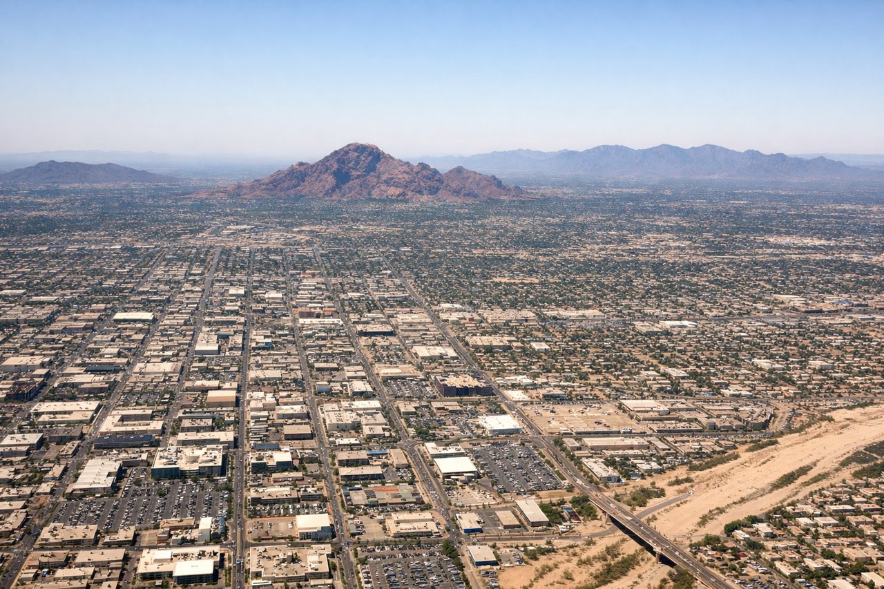
Takeoff from PHX
LEFTLeft-side seats offer views of the Salt River Valley and the northern Phoenix metro area during climb-out. You'll see the urban sprawl of Phoenix and Scottsdale spreading northward, with clear views of the valley floor and surrounding terrain.
Landing at BFL
RIGHTRight-side seats provide excellent views during descent into Bakersfield. You'll see the southern San Joaquin Valley, the Kern River, and the city of Bakersfield itself as you approach from the south. The terrain transitions from desert to agricultural land.
Will your flight be in sunlight?
Pick a date and time in the Sun Map to watch the sun move across your whole flight.
About This Route
Which side of the plane should I sit on flying from Phoenix Sky Harbor International (PHX) to Meadows Fld (BFL)?
Sit on the Right side of the plane for the best views on flights from Phoenix to Bakersfield. While the takeoff offers interesting Phoenix valley views on the left, the landing approach on the right provides more dramatic and varied scenery—the Kern River corridor, agricultural patchwork, and Sierra Nevada foothills create a more visually engaging descent than the relatively uniform climb-out.
What can I see during takeoff from Phoenix Sky Harbor International in Phoenix?
During takeoff from Phoenix Sky Harbor International (PHX), sit on the Left side for the best views. Left-side seats offer views of the Salt River Valley and the northern Phoenix metro area during climb-out. You'll see the urban sprawl of Phoenix and Scottsdale spreading northward, with clear views of the valley floor and surrounding terrain. Notable sights include: Phoenix metropolitan area (urban grid), Salt River Valley, McDowell Mountains (northeast), Camelback Mountain (north-northeast).
What can I see when landing at Meadows Fld in Bakersfield?
When landing at Meadows Fld (BFL), sit on the Right side for the best views. Right-side seats provide excellent views during descent into Bakersfield. You'll see the southern San Joaquin Valley, the Kern River, and the city of Bakersfield itself as you approach from the south. The terrain transitions from desert to agricultural land. Notable sights include: Kern River (visible as vegetation corridor), Bakersfield city grid, Southern Sierra Nevada foothills (distant, southeast), San Joaquin Valley agricultural fields.
How long is the flight from Phoenix to Bakersfield?
The flight from Phoenix Sky Harbor International (PHX) to Meadows Fld (BFL) takes about 1 hour 15 minutes. The shortest flight path between them is 425 miles (684 km); winds and air traffic control usually add a few percent.
What does the Phoenix to Bakersfield flight path pass over?
The flight path crosses the Tehachapi Mountains and the southern Sierra Nevada range. You'll pass over the Mojave Desert transition zone, with views of scattered desert terrain, occasional ridgelines, and the gradual shift from Arizona's Sonoran Desert landscape to California's San Joaquin Valley agricultural region. The Kern County oil fields may be visible as geometric patterns in the terrain during the approach phase.