Left side scores higher due to superior takeoff scenery from Phoenix Sky Harbor with visible urban development, Camelback Mountain, and the Salt River Valley. While landing views are comparable between sides (both show relatively flat terrain), the dramatic Phoenix departure outweighs the modest advantage of the Missouri River approach into Bismarck. This is a relatively flat, low-drama route overall—neither side offers exceptional scenic value, but left captures more visual interest during the critical first 30 minutes of flight.
Flown PHX to BIS? Did we get it right?
Flight Path
Phoenix to Bismarck is 1,094 miles (1,761 km), a flight of about 3 hours 15 minutes.
Colorado Plateau terrain including the Kaibab Plateau region, transition from Arizona high desert to New Mexico high plains, Rio Grande valley near Albuquerque area, Sangre de Cristo Mountains visible to the east, transition into the Great Plains of the Texas Panhandle and Oklahoma, Canadian River valley, Cimarron River drainage, gradual descent into the Missouri River basin as aircraft approaches North Dakota
Great circle distance and headings ›


Phase by phase
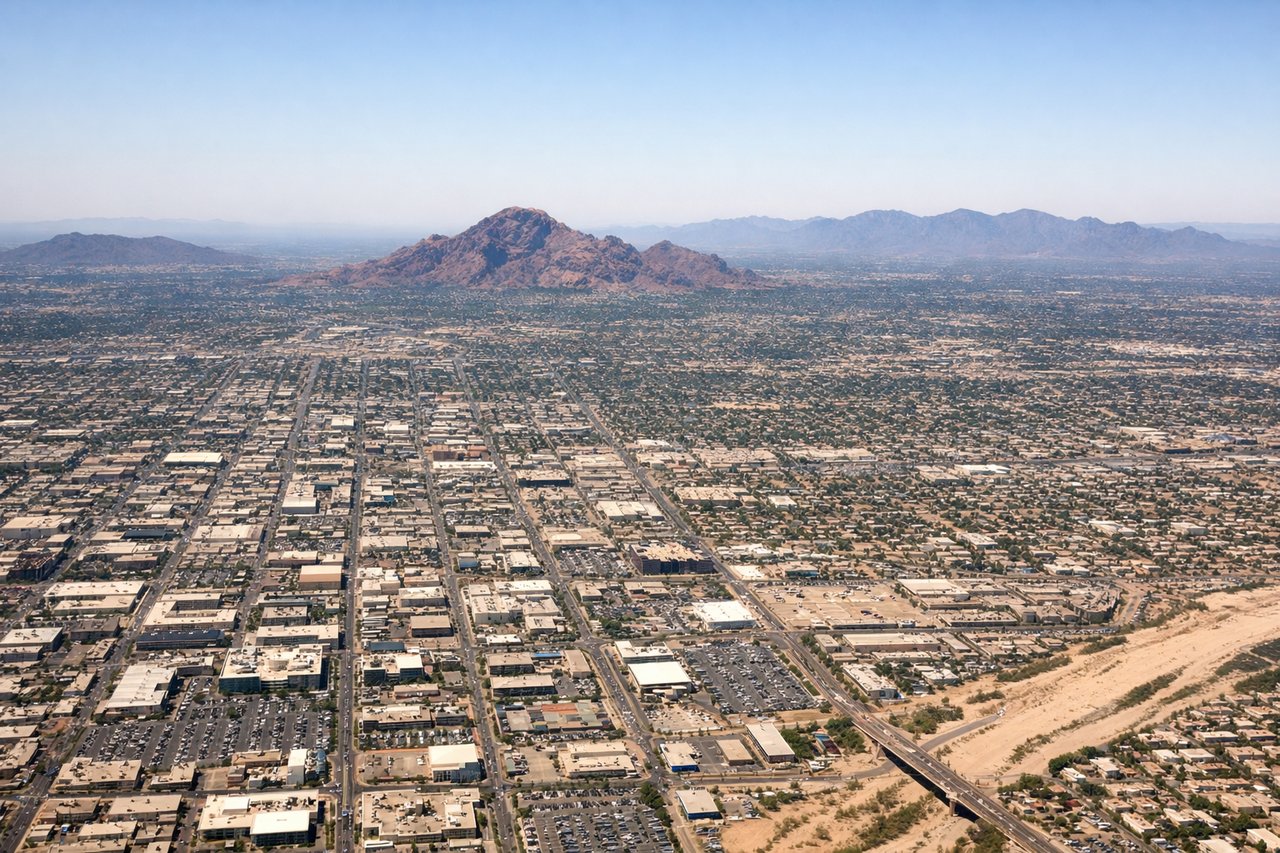
Takeoff from PHX
LEFTPhoenix Sky Harbor sits in the Salt River Valley with the Phoenix metropolitan area visible immediately after departure. Left-side departures heading northeast offer views of the city grid and surrounding desert terrain. Right side faces open desert with minimal urban features during initial climb.
Landing at BIS
RIGHTBismarck Municipal Airport sits on the Missouri River's eastern bank. Right-side approaches descending into Bismarck offer direct views of the river valley, the Missouri River itself, and the city's position along the waterway. Left side faces open Great Plains with minimal distinguishing features during final approach.
Will your flight be in sunlight?
Pick a date and time in the Sun Map to watch the sun move across your whole flight.
About This Route
Which side of the plane should I sit on flying from Phoenix Sky Harbor International (PHX) to Bismarck Municipal Airport (BIS)?
Sit on the Left side of the plane for the best views on flights from Phoenix to Bismarck. Left side scores higher due to superior takeoff scenery from Phoenix Sky Harbor with visible urban development, Camelback Mountain, and the Salt River Valley. While landing views are comparable between sides (both show relatively flat terrain), the dramatic Phoenix departure outweighs the modest advantage of the Missouri River approach into Bismarck. This is a relatively flat, low-drama route overall—neither side offers exceptional scenic value, but left captures more visual interest during the critical first 30 minutes of flight.
What can I see during takeoff from Phoenix Sky Harbor International in Phoenix?
During takeoff from Phoenix Sky Harbor International (PHX), sit on the Left side for the best views. Phoenix Sky Harbor sits in the Salt River Valley with the Phoenix metropolitan area visible immediately after departure. Left-side departures heading northeast offer views of the city grid and surrounding desert terrain. Right side faces open desert with minimal urban features during initial climb. Notable sights include: Phoenix downtown skyline, Salt River Valley floor, Camelback Mountain (east of downtown), surrounding Sonoran Desert.
What can I see when landing at Bismarck Municipal Airport in Bismarck?
When landing at Bismarck Municipal Airport (BIS), sit on the Right side for the best views. Bismarck Municipal Airport sits on the Missouri River's eastern bank. Right-side approaches descending into Bismarck offer direct views of the river valley, the Missouri River itself, and the city's position along the waterway. Left side faces open Great Plains with minimal distinguishing features during final approach. Notable sights include: Missouri River, Bismarck city center, Capitol building area, surrounding prairie grasslands.
How long is the flight from Phoenix to Bismarck?
The flight from Phoenix Sky Harbor International (PHX) to Bismarck Municipal Airport (BIS) takes about 3 hours 15 minutes. The shortest flight path between them is 1,094 miles (1,761 km); winds and air traffic control usually add a few percent.
What does the Phoenix to Bismarck flight path pass over?
Colorado Plateau terrain including the Kaibab Plateau region, transition from Arizona high desert to New Mexico high plains, Rio Grande valley near Albuquerque area, Sangre de Cristo Mountains visible to the east, transition into the Great Plains of the Texas Panhandle and Oklahoma, Canadian River valley, Cimarron River drainage, gradual descent into the Missouri River basin as aircraft approaches North Dakota