While takeoff offers good Phoenix valley views on the right, the landing approach on the left provides more visually distinctive features: the San Dieguito River valley, coastal terrain transition, and ocean views make the left side the better overall choice for this short flight.
Flown PHX to CLD? Did we get it right?
Flight Path
Phoenix to Carlsbad is 305 miles (491 km), a flight of about 1 hour 10 minutes.
The flight path heads southwest from Phoenix across the Sonoran Desert, passing over or near the Chocolate Mountains to the south and the Salton Sea region to the west. You'll cross into California over the Imperial County desert before turning toward the San Diego County coast. The terrain transitions from low desert basin to increasingly developed San Diego County foothills and chaparral as you approach Carlsbad.
Great circle distance and headings ›Phase by phase
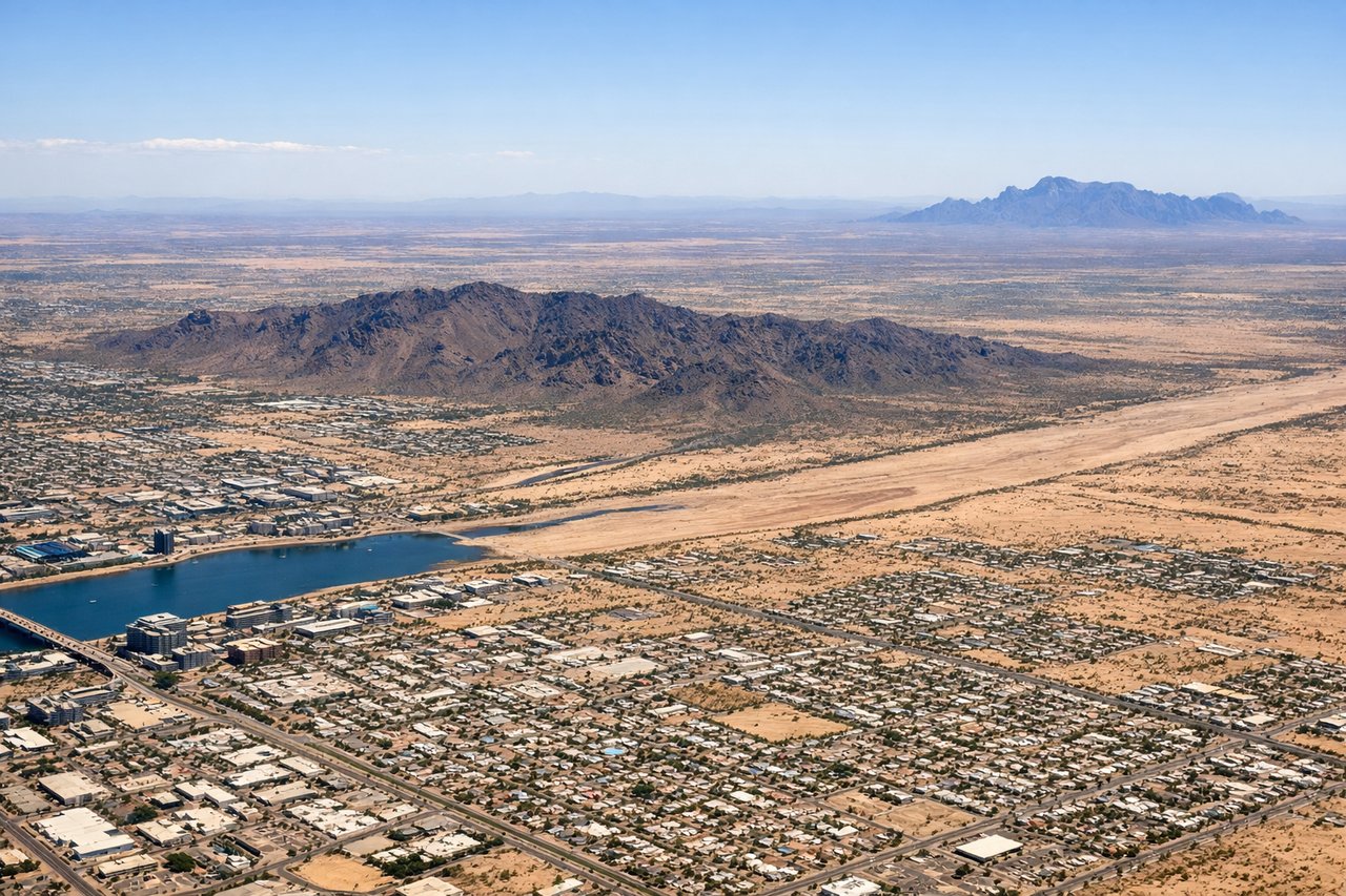
Takeoff from PHX
RIGHTRight-side seats offer views of the Salt River Valley and the Phoenix metropolitan area spreading south and west. You'll see the city grid and surrounding desert terrain as you climb out heading southwest toward Carlsbad.
Landing at CLD
LEFTLeft-side seats provide views of the San Dieguito River valley, coastal foothills, and the approach into McClellan-Palomar. You'll see the transition from inland San Diego County terrain down toward the Carlsbad area and Pacific coastal features.
Will your flight be in sunlight?
Pick a date and time in the Sun Map to watch the sun move across your whole flight.
About This Route
Which side of the plane should I sit on flying from Phoenix Sky Harbor International (PHX) to McClellan-Palomar Airport (CLD)?
Sit on the Left side of the plane for the best views on flights from Phoenix to Carlsbad. While takeoff offers good Phoenix valley views on the right, the landing approach on the left provides more visually distinctive features: the San Dieguito River valley, coastal terrain transition, and ocean views make the left side the better overall choice for this short flight.
What can I see during takeoff from Phoenix Sky Harbor International in Phoenix?
During takeoff from Phoenix Sky Harbor International (PHX), sit on the Right side for the best views. Right-side seats offer views of the Salt River Valley and the Phoenix metropolitan area spreading south and west. You'll see the city grid and surrounding desert terrain as you climb out heading southwest toward Carlsbad. Notable sights include: Phoenix city sprawl, Salt River Valley floor, South Mountain Park (dark ridge south of downtown), desert terrain extending toward the Gila River.
What can I see when landing at McClellan-Palomar Airport in Carlsbad?
When landing at McClellan-Palomar Airport (CLD), sit on the Left side for the best views. Left-side seats provide views of the San Dieguito River valley, coastal foothills, and the approach into McClellan-Palomar. You'll see the transition from inland San Diego County terrain down toward the Carlsbad area and Pacific coastal features. Notable sights include: San Dieguito River valley, Carlsbad coastal bluffs, Pacific Ocean horizon, inland San Diego County chaparral and development.
How long is the flight from Phoenix to Carlsbad?
The flight from Phoenix Sky Harbor International (PHX) to McClellan-Palomar Airport (CLD) takes about 1 hour 10 minutes. The shortest flight path between them is 305 miles (491 km); winds and air traffic control usually add a few percent.
What does the Phoenix to Carlsbad flight path pass over?
The flight path heads southwest from Phoenix across the Sonoran Desert, passing over or near the Chocolate Mountains to the south and the Salton Sea region to the west. You'll cross into California over the Imperial County desert before turning toward the San Diego County coast. The terrain transitions from low desert basin to increasingly developed San Diego County foothills and chaparral as you approach Carlsbad.