Left side wins at both ends of the flight. During the cruise over New Mexico and Texas, the left side also faces generally south-southeast, keeping the Rio Grande valley and the Edwards Plateau terrain in better view. Right side is mostly featureless desert and plains for the bulk of the route.
Flown PHX to EFD? Did we get it right?
Flight Path
Phoenix to Houston is 1,026 miles (1,651 km), a flight of about 2 hours 25 minutes.
The flight crosses southeastern Arizona desert, then the Rio Grande valley near Las Cruces or El Paso (visible as a green irrigated corridor cutting through brown desert), the Chihuahuan Desert of far west Texas, the Guadalupe Mountains and their escarpment near the TX/NM border, the Permian Basin oil fields of west Texas with visible pump jacks and tank farms, the Edwards Plateau limestone terrain of central Texas, and finally the flat coastal plain of southeast Texas approaching Houston.
Great circle distance and headings ›Phase by phase
Takeoff from PHX
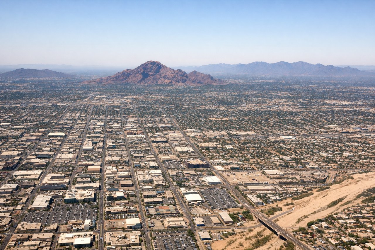
LEFTPHX primarily uses runways 7R/25L and 8/26. Departing eastbound toward Houston, a left-side seat faces north, giving you a clear view of the Phoenix metro grid, the South Mountains to the south-southwest, and the McDowell Mountains and Scottsdale sprawl to the northeast. The Salt River bed and Tempe Town Lake are also visible below during initial climb.
Landing at EFD
LEFTEllington Field sits on the southeast side of Houston. Aircraft typically approach from the west or northwest on runway 17/35 or 14/32. A left-side seat on approach gives views of the Houston Ship Channel, the industrial port complex, and the broader southeast Houston metro. Clear Lake and NASA Johnson Space Center are visible to the south on the left side during final approach.
Will your flight be in sunlight?
Pick a date and time in the Sun Map to watch the sun move across your whole flight.
About This Route
Which side of the plane should I sit on flying from Phoenix Sky Harbor International (PHX) to Ellington Fld (EFD)?
Sit on the Left side of the plane for the best views on flights from Phoenix to Houston. Left side wins at both ends of the flight. During the cruise over New Mexico and Texas, the left side also faces generally south-southeast, keeping the Rio Grande valley and the Edwards Plateau terrain in better view. Right side is mostly featureless desert and plains for the bulk of the route.
What can I see during takeoff from Phoenix Sky Harbor International in Phoenix?
During takeoff from Phoenix Sky Harbor International (PHX), sit on the Left side for the best views. PHX primarily uses runways 7R/25L and 8/26. Departing eastbound toward Houston, a left-side seat faces north, giving you a clear view of the Phoenix metro grid, the South Mountains to the south-southwest, and the McDowell Mountains and Scottsdale sprawl to the northeast. The Salt River bed and Tempe Town Lake are also visible below during initial climb. Notable sights include: South Mountains, Tempe Town Lake and Salt River bed, McDowell Mountains, Phoenix downtown skyline.
What can I see when landing at Ellington Fld in Houston?
When landing at Ellington Fld (EFD), sit on the Left side for the best views. Ellington Field sits on the southeast side of Houston. Aircraft typically approach from the west or northwest on runway 17/35 or 14/32. A left-side seat on approach gives views of the Houston Ship Channel, the industrial port complex, and the broader southeast Houston metro. Clear Lake and NASA Johnson Space Center are visible to the south on the left side during final approach. Notable sights include: Houston Ship Channel, Clear Lake, NASA Johnson Space Center campus, Southeast Houston industrial corridor.
How long is the flight from Phoenix to Houston?
The flight from Phoenix Sky Harbor International (PHX) to Ellington Fld (EFD) takes about 2 hours 25 minutes. The shortest flight path between them is 1,026 miles (1,651 km); winds and air traffic control usually add a few percent.
What does the Phoenix to Houston flight path pass over?
The flight crosses southeastern Arizona desert, then the Rio Grande valley near Las Cruces or El Paso (visible as a green irrigated corridor cutting through brown desert), the Chihuahuan Desert of far west Texas, the Guadalupe Mountains and their escarpment near the TX/NM border, the Permian Basin oil fields of west Texas with visible pump jacks and tank farms, the Edwards Plateau limestone terrain of central Texas, and finally the flat coastal plain of southeast Texas approaching Houston.