The right side scores higher due to the dramatic Cascade Range visible on approach to Eugene, which provides significant terrain variety and landmark density. While Phoenix's takeoff offers urban scenery, the cruise segment over central Oregon is relatively flat and featureless on both sides. The landing approach on the right side, with the Cascades as a prominent backdrop to the Willamette Valley, delivers more visual interest than the left side's lower Coast Range foothills.
Flown PHX to EUG? Did we get it right?
Flight Path
Phoenix to Eugene is 952 miles (1,532 km), a flight of about 2 hours 15 minutes.
Central Oregon high desert plateau (sparse vegetation, volcanic features), Deschutes River canyon (visible from altitude as a linear feature), transition from Sonoran Desert to ponderosa pine forests, the Cascade Range's western slope approaching Eugene
Great circle distance and headings ›


Phase by phase
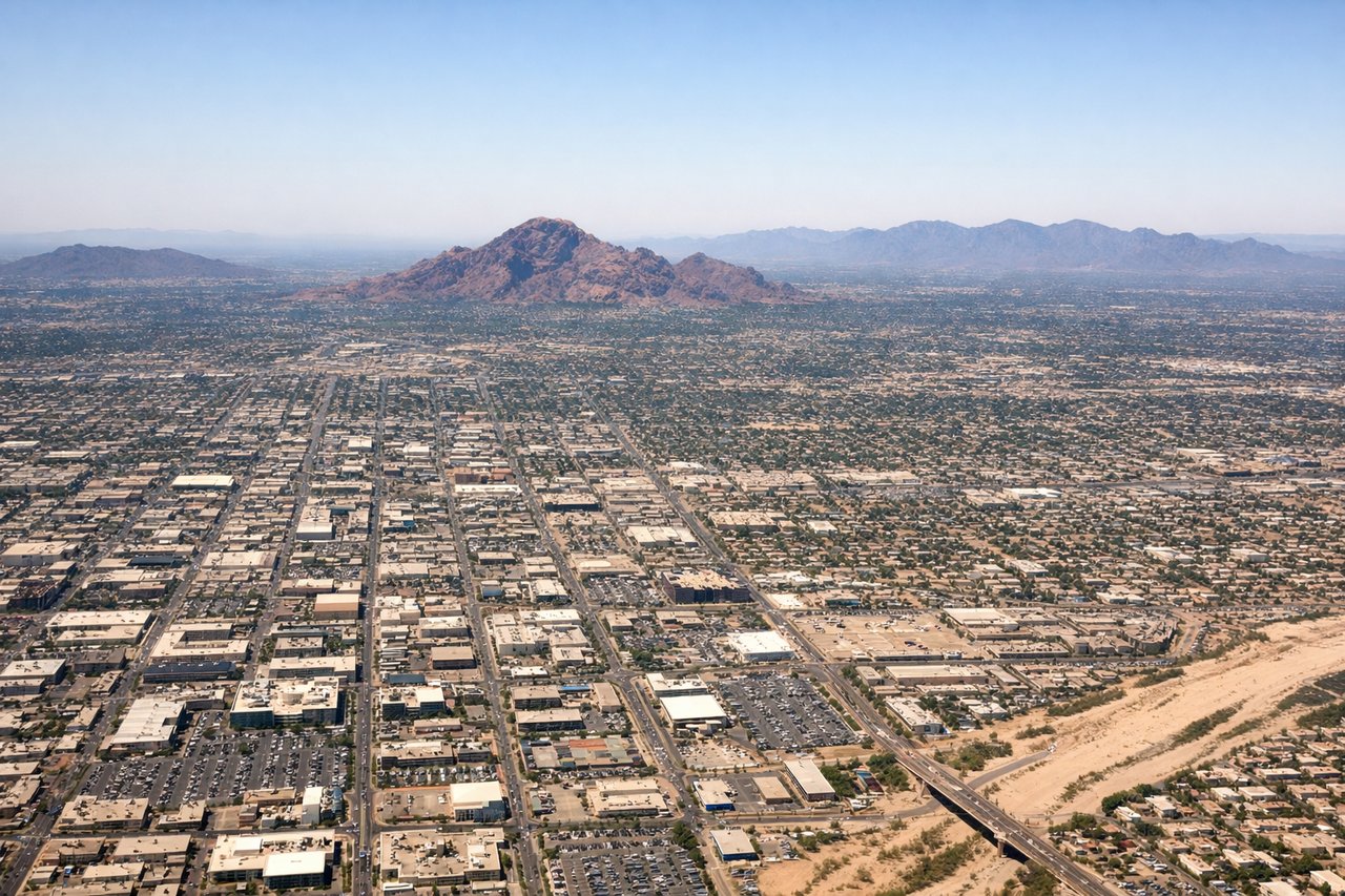
Takeoff from PHX
LEFTPhoenix Sky Harbor sits in the Salt River Valley with the Phoenix metropolitan area sprawling across the floor. Left (north/northwest) side captures the city grid, urban density, and the distant Sierra Ancha mountains to the northeast. Right side faces open desert with minimal urban features during initial climb.
Landing at EUG
RIGHTThe approach to Eugene from the south descends over the Willamette Valley's agricultural landscape, with the Cascade Range visible to the east and the valley floor's patchwork of farms and forests. Right (east) side captures the Cascades' dramatic ridgeline and the valley's eastern edge. Left (west) side faces the lower, forested Coast Range with less visual drama.
Will your flight be in sunlight?
Pick a date and time in the Sun Map to watch the sun move across your whole flight.
About This Route
Which side of the plane should I sit on flying from Phoenix Sky Harbor International (PHX) to Eugene Airport (EUG)?
Sit on the Right side of the plane for the best views on flights from Phoenix to Eugene. The right side scores higher due to the dramatic Cascade Range visible on approach to Eugene, which provides significant terrain variety and landmark density. While Phoenix's takeoff offers urban scenery, the cruise segment over central Oregon is relatively flat and featureless on both sides. The landing approach on the right side, with the Cascades as a prominent backdrop to the Willamette Valley, delivers more visual interest than the left side's lower Coast Range foothills.
What can I see during takeoff from Phoenix Sky Harbor International in Phoenix?
During takeoff from Phoenix Sky Harbor International (PHX), sit on the Left side for the best views. Phoenix Sky Harbor sits in the Salt River Valley with the Phoenix metropolitan area sprawling across the floor. Left (north/northwest) side captures the city grid, urban density, and the distant Sierra Ancha mountains to the northeast. Right side faces open desert with minimal urban features during initial climb. Notable sights include: Phoenix downtown skyline, Salt River, Sierra Ancha Mountains (distant northeast), Camelback Mountain.
What can I see when landing at Eugene Airport in Eugene?
When landing at Eugene Airport (EUG), sit on the Right side for the best views. The approach to Eugene from the south descends over the Willamette Valley's agricultural landscape, with the Cascade Range visible to the east and the valley floor's patchwork of farms and forests. Right (east) side captures the Cascades' dramatic ridgeline and the valley's eastern edge. Left (west) side faces the lower, forested Coast Range with less visual drama. Notable sights include: Cascade Range (Mount Hood visible on clear days far north), Willamette Valley farmland, Spencer Butte, McKenzie River.
How long is the flight from Phoenix to Eugene?
The flight from Phoenix Sky Harbor International (PHX) to Eugene Airport (EUG) takes about 2 hours 15 minutes. The shortest flight path between them is 952 miles (1,532 km); winds and air traffic control usually add a few percent.
What does the Phoenix to Eugene flight path pass over?
Central Oregon high desert plateau (sparse vegetation, volcanic features), Deschutes River canyon (visible from altitude as a linear feature), transition from Sonoran Desert to ponderosa pine forests, the Cascade Range's western slope approaching Eugene