The right side wins overall because the PHX departure delivers the most dramatic and immediate scenery — South Mountain, Tempe Town Lake, and the Superstition Mountains are all genuinely striking from low altitude. The landing views on the left are good but Lago de Chapala is distant and hazy on approach. The right side also captures the Sonoran Desert terrain and the Sierra Madre foothills during the cruise portion of the flight.
Flown PHX to GDL? Did we get it right?
Flight Path
Phoenix to Guadalajara is 1,039 miles (1,673 km), a flight of about 2 hours 15 minutes.
The flight tracks southeast from Phoenix across the Sonoran Desert into the Mexican state of Sonora, crossing the rugged Sierra Madre Occidental — a broad, deeply dissected mountain range with dramatic barrancas (canyons) visible from altitude. The route then descends over the high central Mexican plateau (Altiplano) through Jalisco state, with dry volcanic terrain and scattered agricultural valleys before the descent into Guadalajara's Valle de Atemajac.
Great circle distance and headings ›Phase by phase
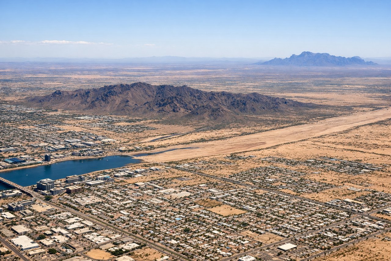
Takeoff from PHX
RIGHTPHX primarily uses runways 7R/25L and 8/26. Departing westbound (runway 25L/26) and banking south toward Mexico, the right side faces south and east, giving views over downtown Phoenix, Tempe Town Lake, and the South Mountain Park massif. Eastbound departures on runway 7R/8 also favor the right side for South Mountain and the Superstition Mountains to the southeast.
Landing at GDL
LEFTGDL's primary runway orientation is 10/28 (east-west). Aircraft typically approach from the north or northwest descending into Guadalajara, and on approach to runway 28 (landing westbound) the left side faces south toward the city center, Lago de Chapala, and the surrounding volcanic highlands. On approach to runway 10 (landing eastbound), the left side still captures the broad Valle de Atemajac where Guadalajara sits and the volcanic peaks to the north.
Will your flight be in sunlight?
Pick a date and time in the Sun Map to watch the sun move across your whole flight.
About This Route
Which side of the plane should I sit on flying from Phoenix Sky Harbor International (PHX) to Don Miguel Y Hidalgo International (GDL)?
Sit on the Right side of the plane for the best views on flights from Phoenix to Guadalajara. The right side wins overall because the PHX departure delivers the most dramatic and immediate scenery — South Mountain, Tempe Town Lake, and the Superstition Mountains are all genuinely striking from low altitude. The landing views on the left are good but Lago de Chapala is distant and hazy on approach. The right side also captures the Sonoran Desert terrain and the Sierra Madre foothills during the cruise portion of the flight.
What can I see during takeoff from Phoenix Sky Harbor International in Phoenix?
During takeoff from Phoenix Sky Harbor International (PHX), sit on the Right side for the best views. PHX primarily uses runways 7R/25L and 8/26. Departing westbound (runway 25L/26) and banking south toward Mexico, the right side faces south and east, giving views over downtown Phoenix, Tempe Town Lake, and the South Mountain Park massif. Eastbound departures on runway 7R/8 also favor the right side for South Mountain and the Superstition Mountains to the southeast. Notable sights include: South Mountain Park (largest municipal park in the US, clearly visible as a dark ridgeline south of the city), Tempe Town Lake (a bright blue ribbon along the Salt River), downtown Phoenix skyline, Superstition Mountains (rugged volcanic range 30 miles east).
What can I see when landing at Don Miguel Y Hidalgo International in Guadalajara?
When landing at Don Miguel Y Hidalgo International (GDL), sit on the Left side for the best views. GDL's primary runway orientation is 10/28 (east-west). Aircraft typically approach from the north or northwest descending into Guadalajara, and on approach to runway 28 (landing westbound) the left side faces south toward the city center, Lago de Chapala, and the surrounding volcanic highlands. On approach to runway 10 (landing eastbound), the left side still captures the broad Valle de Atemajac where Guadalajara sits and the volcanic peaks to the north. Notable sights include: Lago de Chapala (Mexico's largest lake, a massive blue expanse 30 miles south), Guadalajara city center and its dense urban grid in the Valle de Atemajac, Tequila Volcano (Volcán de Tequila, a prominent cone 35 miles northwest), the Sierra Madre Occidental foothills rising to the north and east.
How long is the flight from Phoenix to Guadalajara?
The flight from Phoenix Sky Harbor International (PHX) to Don Miguel Y Hidalgo International (GDL) takes about 2 hours 15 minutes. The shortest flight path between them is 1,039 miles (1,673 km); winds and air traffic control usually add a few percent.
What does the Phoenix to Guadalajara flight path pass over?
The flight tracks southeast from Phoenix across the Sonoran Desert into the Mexican state of Sonora, crossing the rugged Sierra Madre Occidental — a broad, deeply dissected mountain range with dramatic barrancas (canyons) visible from altitude. The route then descends over the high central Mexican plateau (Altiplano) through Jalisco state, with dry volcanic terrain and scattered agricultural valleys before the descent into Guadalajara's Valle de Atemajac.