Phoenix to Loreto is 516 miles (830 km), a flight of about 1 hour 15 minutes.
While takeoff offers some urban and mountain scenery, the landing approach provides the most visually distinctive views: the Sea of Cortez, the Loreto coastline, and the Sierra de la Giganta create a dramatic and geographically varied finale to the flight.
Flight Path
The flight path crosses the Sonoran Desert south of Phoenix, passing over the Pinacate Biosphere Reserve (volcanic landscape with dark lava fields visible from altitude), then over the Gulf of California's northern reaches before descending toward the Baja California peninsula. The Colorado River delta region lies to the west of the direct route. Visibility of these features depends on exact routing and atmospheric conditions, but the desert terrain dominates the middle portion of the flight.
Great circle distance and headings ›Phase by phase
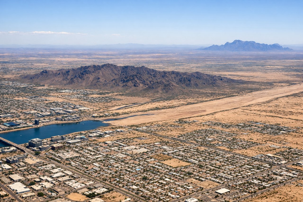
Takeoff from PHX
RIGHTRight-side seats capture the climb-out over Phoenix's urban sprawl and the distant Sierra Estrella Mountains to the south. The left side faces the flat desert to the north with minimal visual interest during initial climb.
Landing at LTO
LEFTLeft-side seats offer views of the Baja California coastline and the Sea of Cortez as the aircraft descends toward Loreto. The right side faces inland desert with less distinctive features during approach.
Will your flight be in sunlight?
Pick a date and time in the Sun Map to watch the sun move across your whole flight.
About This Route
Which side of the plane should I sit on flying from Phoenix Sky Harbor International (PHX) to Loreto International (LTO)?
Sit on the Left side of the plane for the best views on flights from Phoenix to Loreto. While takeoff offers some urban and mountain scenery, the landing approach provides the most visually distinctive views: the Sea of Cortez, the Loreto coastline, and the Sierra de la Giganta create a dramatic and geographically varied finale to the flight.
What can I see during takeoff from Phoenix Sky Harbor International in Phoenix?
During takeoff from Phoenix Sky Harbor International (PHX), sit on the Right side for the best views. Right-side seats capture the climb-out over Phoenix's urban sprawl and the distant Sierra Estrella Mountains to the south. The left side faces the flat desert to the north with minimal visual interest during initial climb. Notable sights include: Phoenix metropolitan area (grid of streets and development), Sierra Estrella Mountains (south-southwest), Salt River valley floor, Superstition Mountains (distant southeast).
What can I see when landing at Loreto International in Loreto?
When landing at Loreto International (LTO), sit on the Left side for the best views. Left-side seats offer views of the Baja California coastline and the Sea of Cortez as the aircraft descends toward Loreto. The right side faces inland desert with less distinctive features during approach. Notable sights include: Sea of Cortez (turquoise water), Loreto coastline and town, Sierra de la Giganta mountains (inland), Isla Coronado (offshore island).
How long is the flight from Phoenix to Loreto?
The flight from Phoenix Sky Harbor International (PHX) to Loreto International (LTO) takes about 1 hour 15 minutes. The shortest flight path between them is 516 miles (830 km); winds and air traffic control usually add a few percent.
What does the Phoenix to Loreto flight path pass over?
The flight path crosses the Sonoran Desert south of Phoenix, passing over the Pinacate Biosphere Reserve (volcanic landscape with dark lava fields visible from altitude), then over the Gulf of California's northern reaches before descending toward the Baja California peninsula. The Colorado River delta region lies to the west of the direct route. Visibility of these features depends on exact routing and atmospheric conditions, but the desert terrain dominates the middle portion of the flight.