Phoenix to Everett is 1,133 miles (1,824 km), a flight of about 2 hours 40 minutes.
The right side wins overall. Departing PHX you get South Mountain and the Estrella Mountains clearly. En route northward the right side tracks the Cascades and Sierra Nevada foothills, and over Oregon you get views of the Cascade volcanoes including Mount Jefferson and Mount Hood on the right. The landing view on the left is excellent but the sustained mountain scenery on the right during cruise gives it the edge.
Flight Path
The route tracks north-northwest over central Arizona desert, crossing the Mogollon Rim and the high plateau of northern Arizona. Over Nevada the Great Basin desert dominates with basin-and-range topography. Crossing into Oregon the Cascade Range becomes prominent on the right side, with Mount Shasta visible in northern California, followed by Crater Lake potentially visible on clear days, then Mount Jefferson, Mount Hood, and finally Mount Rainier and Mount Adams as you descend into Washington.
Great circle distance and headings ›.jpeg?width=600)

Phase by phase
Takeoff from PHX
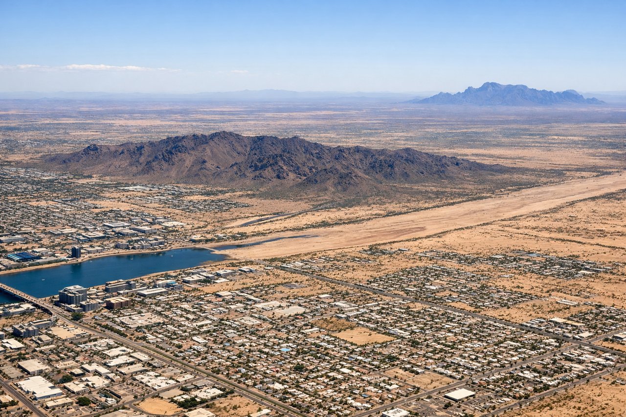
RIGHTPHX primarily departs westbound on runway 26 or northbound on runway 8R/26L. A right-side seat gives you a clear view of South Mountain Park and the Estrella Mountains to the south and southwest as you climb out. You also get a good look back at the dense Phoenix metro grid and Tempe Town Lake.
Landing at PAE
LEFTPAE typically lands on runway 34L/34R, approaching from the south over Puget Sound. A left-side seat gives you views of the Seattle skyline and Elliott Bay to the south, plus the Olympic Mountains across the Sound to the west. You also get a clear look at Paine Field's surroundings including the Boeing widebody assembly plant.
Landmarks on this routeAll landmarks →
Will your flight be in sunlight?
Pick a date and time in the Sun Map to watch the sun move across your whole flight.
About This Route
Which side of the plane should I sit on flying from Phoenix Sky Harbor International (PHX) to Snohomish Co (PAE)?
Sit on the Right side of the plane for the best views on flights from Phoenix to Everett. The right side wins overall. Departing PHX you get South Mountain and the Estrella Mountains clearly. En route northward the right side tracks the Cascades and Sierra Nevada foothills, and over Oregon you get views of the Cascade volcanoes including Mount Jefferson and Mount Hood on the right. The landing view on the left is excellent but the sustained mountain scenery on the right during cruise gives it the edge.
What can I see during takeoff from Phoenix Sky Harbor International in Phoenix?
During takeoff from Phoenix Sky Harbor International (PHX), sit on the Right side for the best views. PHX primarily departs westbound on runway 26 or northbound on runway 8R/26L. A right-side seat gives you a clear view of South Mountain Park and the Estrella Mountains to the south and southwest as you climb out. You also get a good look back at the dense Phoenix metro grid and Tempe Town Lake. Notable sights include: South Mountain Park, Estrella Mountains, Tempe Town Lake, Phoenix metro grid.
What can I see when landing at Snohomish Co in Everett?
When landing at Snohomish Co (PAE), sit on the Left side for the best views. PAE typically lands on runway 34L/34R, approaching from the south over Puget Sound. A left-side seat gives you views of the Seattle skyline and Elliott Bay to the south, plus the Olympic Mountains across the Sound to the west. You also get a clear look at Paine Field's surroundings including the Boeing widebody assembly plant. Notable sights include: Puget Sound, Seattle skyline, Olympic Mountains, Boeing Everett factory complex.
How long is the flight from Phoenix to Everett?
The flight from Phoenix Sky Harbor International (PHX) to Snohomish Co (PAE) takes about 2 hours 40 minutes. The shortest flight path between them is 1,133 miles (1,824 km); winds and air traffic control usually add a few percent.
What does the Phoenix to Everett flight path pass over?
The route tracks north-northwest over central Arizona desert, crossing the Mogollon Rim and the high plateau of northern Arizona. Over Nevada the Great Basin desert dominates with basin-and-range topography. Crossing into Oregon the Cascade Range becomes prominent on the right side, with Mount Shasta visible in northern California, followed by Crater Lake potentially visible on clear days, then Mount Jefferson, Mount Hood, and finally Mount Rainier and Mount Adams as you descend into Washington.