The right side combines Phoenix's urban and mountain scenery on departure with a near-overflight of Las Vegas, Lake Mead, and Hoover Dam during cruise, giving it more consistent landmark density across the whole flight than the left side, which is scenic mainly during the final Sierra Nevada approach.
Flown PHX to RNO? Did we get it right?
Flight Path
Phoenix to Reno is 601 miles (967 km), a flight of about 1 hour 55 minutes.
The flight's midpoint falls near the northern edge of the Las Vegas Valley, close to Lake Mead and the Desert National Wildlife Refuge's Sheep Range, before the route continues over Nevada's Great Basin desert toward the Sierra Nevada.
Great circle distance and headings ›


Phase by phase
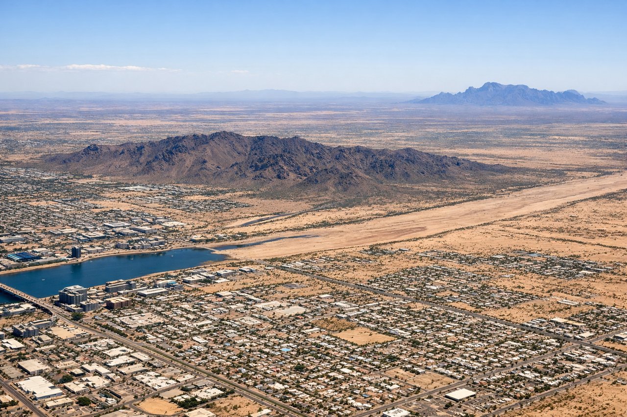
Takeoff from PHX
RIGHTDeparting PHX toward the northwest, the aircraft typically banks right onto its Reno heading, putting downtown Phoenix, Camelback Mountain, and the McDowell Mountains on the right side. The left side mostly shows the flatter West Valley suburbs and the White Tank Mountains fading into haze.
Landing at RNO
LEFTOn the descent into Reno from the southeast, the approach hugs the eastern base of the Sierra Nevada, so the left side gets clear views of snow-dusted peaks and forested ridgelines. The right side instead shows the drier, lower Virginia Range and high desert basin.
Will your flight be in sunlight?
Pick a date and time in the Sun Map to watch the sun move across your whole flight.
About This Route
Which side of the plane should I sit on flying from Phoenix Sky Harbor International (PHX) to Reno Tahoe International (RNO)?
Sit on the Right side of the plane for the best views on flights from Phoenix to Reno. The right side combines Phoenix's urban and mountain scenery on departure with a near-overflight of Las Vegas, Lake Mead, and Hoover Dam during cruise, giving it more consistent landmark density across the whole flight than the left side, which is scenic mainly during the final Sierra Nevada approach.
What can I see during takeoff from Phoenix Sky Harbor International in Phoenix?
During takeoff from Phoenix Sky Harbor International (PHX), sit on the Right side for the best views. Departing PHX toward the northwest, the aircraft typically banks right onto its Reno heading, putting downtown Phoenix, Camelback Mountain, and the McDowell Mountains on the right side. The left side mostly shows the flatter West Valley suburbs and the White Tank Mountains fading into haze. Notable sights include: Camelback Mountain, Downtown Phoenix skyline, Papago Park buttes, McDowell Mountains.
What can I see when landing at Reno Tahoe International in Reno?
When landing at Reno Tahoe International (RNO), sit on the Left side for the best views. On the descent into Reno from the southeast, the approach hugs the eastern base of the Sierra Nevada, so the left side gets clear views of snow-dusted peaks and forested ridgelines. The right side instead shows the drier, lower Virginia Range and high desert basin. Notable sights include: Sierra Nevada crest, Mount Rose, Truckee River valley, downtown Reno.
How long is the flight from Phoenix to Reno?
The flight from Phoenix Sky Harbor International (PHX) to Reno Tahoe International (RNO) takes about 1 hour 55 minutes. The shortest flight path between them is 601 miles (967 km); winds and air traffic control usually add a few percent.
What does the Phoenix to Reno flight path pass over?
The flight's midpoint falls near the northern edge of the Las Vegas Valley, close to Lake Mead and the Desert National Wildlife Refuge's Sheep Range, before the route continues over Nevada's Great Basin desert toward the Sierra Nevada.