While the left offers good Phoenix departure views, the right side dominates the longer portion of this flight with superior coastal and mountain scenery during the approach and landing into Santa Barbara, including the dramatic Santa Ynez Mountains and Pacific Ocean views.
Flown PHX to SBA? Did we get it right?
Flight Path
Phoenix to Santa Barbara is 454 miles (731 km), a flight of about 1 hour 10 minutes.
The flight path crosses northwest over the Mojave Desert and the San Gabriel Mountains. Midway through the flight, passengers may glimpse the San Gabriel Mountains as a distant ridge to the north, and the desert floor transitions from the Phoenix basin toward the coastal ranges. The Los Padres National Forest and chaparral-covered terrain become increasingly visible as the aircraft approaches the Santa Barbara coast.
Great circle distance and headings ›Phase by phase
Takeoff from PHX
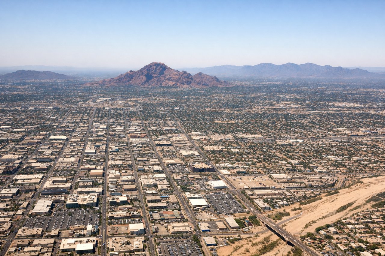
LEFTLeft side offers immediate views of the Phoenix metropolitan area and the surrounding desert basin. As the aircraft climbs northwestward out of PHX, the left wing reveals the urban sprawl of Phoenix and Scottsdale against the backdrop of the distant mountains that frame the valley.
Landing at SBA
RIGHTRight side provides excellent views during the descent into Santa Barbara. The aircraft approaches from the southeast over the Pacific Ocean and coastal terrain, and the right wing captures the Santa Ynez Mountains, the coastal bluffs, and the final approach over the ocean and beach areas near the airport.
Will your flight be in sunlight?
Pick a date and time in the Sun Map to watch the sun move across your whole flight.
About This Route
Which side of the plane should I sit on flying from Phoenix Sky Harbor International (PHX) to Santa Barbara Municipal Airport (SBA)?
Sit on the Right side of the plane for the best views on flights from Phoenix to Santa Barbara. While the left offers good Phoenix departure views, the right side dominates the longer portion of this flight with superior coastal and mountain scenery during the approach and landing into Santa Barbara, including the dramatic Santa Ynez Mountains and Pacific Ocean views.
What can I see during takeoff from Phoenix Sky Harbor International in Phoenix?
During takeoff from Phoenix Sky Harbor International (PHX), sit on the Left side for the best views. Left side offers immediate views of the Phoenix metropolitan area and the surrounding desert basin. As the aircraft climbs northwestward out of PHX, the left wing reveals the urban sprawl of Phoenix and Scottsdale against the backdrop of the distant mountains that frame the valley. Notable sights include: Phoenix metropolitan area (urban grid visible below), McDowell Mountains to the northeast, Superstition Mountains to the southeast, Salt River valley floor.
What can I see when landing at Santa Barbara Municipal Airport in Santa Barbara?
When landing at Santa Barbara Municipal Airport (SBA), sit on the Right side for the best views. Right side provides excellent views during the descent into Santa Barbara. The aircraft approaches from the southeast over the Pacific Ocean and coastal terrain, and the right wing captures the Santa Ynez Mountains, the coastal bluffs, and the final approach over the ocean and beach areas near the airport. Notable sights include: Santa Ynez Mountains (northern backdrop), Pacific Ocean and coastline, Santa Barbara city and harbor, Channel Islands visible on clear days.
How long is the flight from Phoenix to Santa Barbara?
The flight from Phoenix Sky Harbor International (PHX) to Santa Barbara Municipal Airport (SBA) takes about 1 hour 10 minutes. The shortest flight path between them is 454 miles (731 km); winds and air traffic control usually add a few percent.
What does the Phoenix to Santa Barbara flight path pass over?
The flight path crosses northwest over the Mojave Desert and the San Gabriel Mountains. Midway through the flight, passengers may glimpse the San Gabriel Mountains as a distant ridge to the north, and the desert floor transitions from the Phoenix basin toward the coastal ranges. The Los Padres National Forest and chaparral-covered terrain become increasingly visible as the aircraft approaches the Santa Barbara coast.