While the left side offers good Phoenix departure views, the right side during landing provides more dramatic and varied scenery with the St. Lawrence River, Quebec City, and Laurentian Mountains. The landing approach is longer and more visually rewarding than the takeoff climb.
Flown PHX to YQB? Did we get it right?
Flight Path
Phoenix to Quebec is 2,304 miles (3,708 km), a flight of about 4 hours 45 minutes.
The flight path crosses the Rocky Mountains (visible from both sides depending on altitude and exact routing—the Continental Divide near the Colorado-Wyoming border), the Great Plains of the central United States, and the Great Lakes region. Notable landmarks along the route include the Colorado Front Range, the Mississippi River valley, and Lake Michigan or Lake Huron depending on the specific flight corridor chosen by air traffic control.
Great circle distance and headings ›


Phase by phase
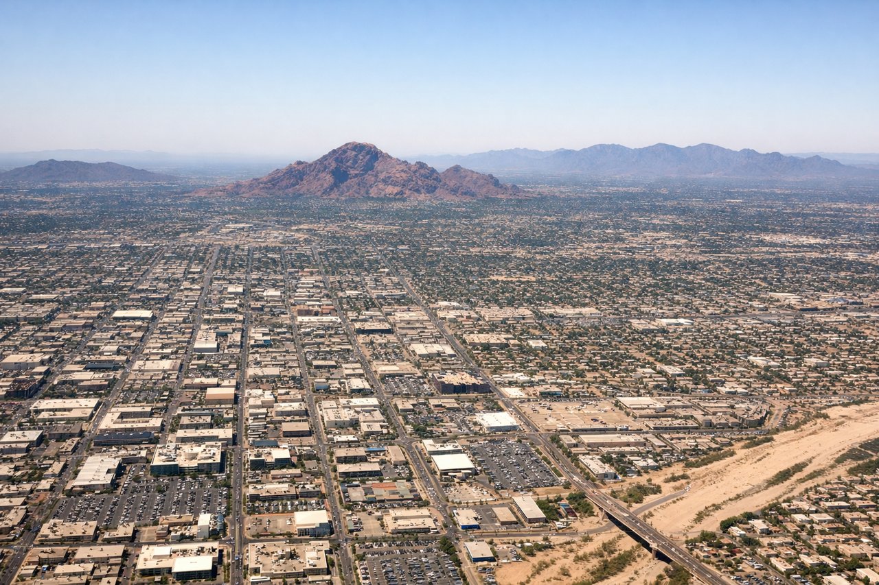
Takeoff from PHX
LEFTLeft side offers views of the Salt River Mountains and the Phoenix metropolitan sprawl extending northeast. The climb-out path typically heads northeast, making the left side ideal for seeing the city grid and surrounding desert terrain.
Landing at YQB
RIGHTRight side provides views of the St. Lawrence River, the Quebec City urban area, and the surrounding Laurentian landscape during descent. The approach typically comes from the southwest, making the right side optimal for seeing the river valley and city landmarks.
Will your flight be in sunlight?
Pick a date and time in the Sun Map to watch the sun move across your whole flight.
About This Route
Which side of the plane should I sit on flying from Phoenix Sky Harbor International (PHX) to Quebec Jean Lesage International (YQB)?
Sit on the Right side of the plane for the best views on flights from Phoenix to Quebec. While the left side offers good Phoenix departure views, the right side during landing provides more dramatic and varied scenery with the St. Lawrence River, Quebec City, and Laurentian Mountains. The landing approach is longer and more visually rewarding than the takeoff climb.
What can I see during takeoff from Phoenix Sky Harbor International in Phoenix?
During takeoff from Phoenix Sky Harbor International (PHX), sit on the Left side for the best views. Left side offers views of the Salt River Mountains and the Phoenix metropolitan sprawl extending northeast. The climb-out path typically heads northeast, making the left side ideal for seeing the city grid and surrounding desert terrain. Notable sights include: Salt River Mountains, Phoenix city grid and urban development, Superstition Mountains (distant southeast), Sonoran Desert scrubland.
What can I see when landing at Quebec Jean Lesage International in Quebec?
When landing at Quebec Jean Lesage International (YQB), sit on the Right side for the best views. Right side provides views of the St. Lawrence River, the Quebec City urban area, and the surrounding Laurentian landscape during descent. The approach typically comes from the southwest, making the right side optimal for seeing the river valley and city landmarks. Notable sights include: St. Lawrence River (fleuve Saint-Laurent), Quebec City urban core and Montmorency Falls area, Laurentian Mountains to the north, Île d'Orléans.
How long is the flight from Phoenix to Quebec?
The flight from Phoenix Sky Harbor International (PHX) to Quebec Jean Lesage International (YQB) takes about 4 hours 45 minutes. The shortest flight path between them is 2,304 miles (3,708 km); winds and air traffic control usually add a few percent.
What does the Phoenix to Quebec flight path pass over?
The flight path crosses the Rocky Mountains (visible from both sides depending on altitude and exact routing—the Continental Divide near the Colorado-Wyoming border), the Great Plains of the central United States, and the Great Lakes region. Notable landmarks along the route include the Colorado Front Range, the Mississippi River valley, and Lake Michigan or Lake Huron depending on the specific flight corridor chosen by air traffic control.