The left side wins on both ends of the flight — dramatic desert peaks around Phoenix at departure and a rare glimpse of the Toronto skyline and Lake Ontario on arrival — while the right side offers comparatively flat, unremarkable terrain during takeoff and landing, and the long cruise over the Great Plains is scenically neutral on both sides.
Flown PHX to YYZ? Did we get it right?
Flight Path
Phoenix to Toronto is 1,872 miles (3,013 km), a flight of about 3 hours 55 minutes.
After crossing the high desert and foothills near Albuquerque, the route flattens out over the Great Plains of eastern Colorado, Kansas, and Missouri, crossing the Mississippi River near St. Louis before flying over the farmland of Illinois, Indiana, and Ohio toward the Great Lakes region near Lake Erie.
Great circle distance and headings ›


Phase by phase
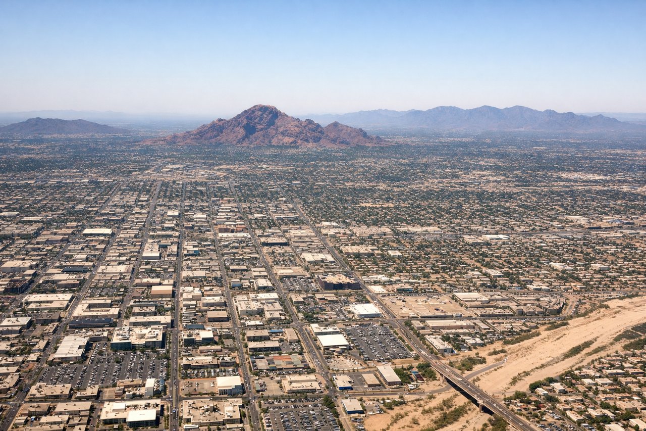
Takeoff from PHX
LEFTDeparting Phoenix Sky Harbor on an eastbound climb, the left side faces north toward Phoenix's iconic desert peaks — Camelback Mountain and the McDowell Mountains stand out sharply against the valley, with Four Peaks and the Superstition Mountains rising on the horizon as the plane turns northeast. The right side mostly shows South Mountain and the flatter, less distinctive Estrella foothills.

Landing at YYZ
LEFTOn approach into Toronto Pearson from the southwest, flights commonly swing near Lake Ontario before turning onto final approach, giving left-side passengers a view of the Toronto skyline — including the CN Tower and waterfront — with the lake stretching to the horizon. The right side typically shows only flat Ontario farmland and suburban sprawl north of the airport.
Will your flight be in sunlight?
Pick a date and time in the Sun Map to watch the sun move across your whole flight.
About This Route
Which side of the plane should I sit on flying from Phoenix Sky Harbor International (PHX) to Lester B Pearson International (YYZ)?
Sit on the Left side of the plane for the best views on flights from Phoenix to Toronto. The left side wins on both ends of the flight — dramatic desert peaks around Phoenix at departure and a rare glimpse of the Toronto skyline and Lake Ontario on arrival — while the right side offers comparatively flat, unremarkable terrain during takeoff and landing, and the long cruise over the Great Plains is scenically neutral on both sides.
What can I see during takeoff from Phoenix Sky Harbor International in Phoenix?
During takeoff from Phoenix Sky Harbor International (PHX), sit on the Left side for the best views. Departing Phoenix Sky Harbor on an eastbound climb, the left side faces north toward Phoenix's iconic desert peaks — Camelback Mountain and the McDowell Mountains stand out sharply against the valley, with Four Peaks and the Superstition Mountains rising on the horizon as the plane turns northeast. The right side mostly shows South Mountain and the flatter, less distinctive Estrella foothills. Notable sights include: Camelback Mountain, McDowell Mountains, Four Peaks, Superstition Mountains.
What can I see when landing at Lester B Pearson International in Toronto?
When landing at Lester B Pearson International (YYZ), sit on the Left side for the best views. On approach into Toronto Pearson from the southwest, flights commonly swing near Lake Ontario before turning onto final approach, giving left-side passengers a view of the Toronto skyline — including the CN Tower and waterfront — with the lake stretching to the horizon. The right side typically shows only flat Ontario farmland and suburban sprawl north of the airport. Notable sights include: CN Tower, Toronto Islands, Lake Ontario shoreline, downtown Toronto skyline.
How long is the flight from Phoenix to Toronto?
The flight from Phoenix Sky Harbor International (PHX) to Lester B Pearson International (YYZ) takes about 3 hours 55 minutes. The shortest flight path between them is 1,872 miles (3,013 km); winds and air traffic control usually add a few percent.
What does the Phoenix to Toronto flight path pass over?
After crossing the high desert and foothills near Albuquerque, the route flattens out over the Great Plains of eastern Colorado, Kansas, and Missouri, crossing the Mississippi River near St. Louis before flying over the farmland of Illinois, Indiana, and Ohio toward the Great Lakes region near Lake Erie.