While left offers good Shanghai departure views, right provides superior scenery on the longer descent phase with the dramatic Yinshan Mountains visible for an extended period during approach to Hohhot. The mountains are the most distinctive natural feature on this route.
Flown PVG to HET? Did we get it right?
Flight Path
Shanghai to Hohhot is 871 miles (1,402 km), a flight of about 2 hours 25 minutes.
North China Plain with scattered agricultural fields and small towns, transition from Yangtze River basin to Yellow River basin, gradual elevation gain toward the Inner Mongolian plateau, sparse vegetation and open terrain characteristic of northern China
Great circle distance and headings ›

Phase by phase
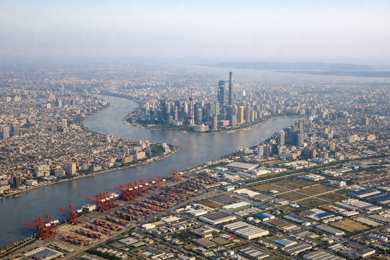
Takeoff from PVG
LEFTLeft side offers views of the Huangpu River winding through Shanghai's urban landscape and the Yangtze River estuary as the aircraft climbs northwestward. Right side faces the industrial suburbs and Hangzhou Bay, which are less visually distinctive.
Landing at HET
RIGHTRight side provides views of the Yinshan Mountains (Yin Mountains) as the aircraft descends toward Hohhot from the southeast. These mountains form a dramatic backdrop to the city and are the most visually striking feature on approach. Left side shows the Daqing Mountains further west, which are less prominent from this angle.
Will your flight be in sunlight?
Pick a date and time in the Sun Map to watch the sun move across your whole flight.
About This Route
Which side of the plane should I sit on flying from Shanghai Pudong International (PVG) to Hohhot Baita International Airport (HET)?
Sit on the Right side of the plane for the best views on flights from Shanghai to Hohhot. While left offers good Shanghai departure views, right provides superior scenery on the longer descent phase with the dramatic Yinshan Mountains visible for an extended period during approach to Hohhot. The mountains are the most distinctive natural feature on this route.
What can I see during takeoff from Shanghai Pudong International in Shanghai?
During takeoff from Shanghai Pudong International (PVG), sit on the Left side for the best views. Left side offers views of the Huangpu River winding through Shanghai's urban landscape and the Yangtze River estuary as the aircraft climbs northwestward. Right side faces the industrial suburbs and Hangzhou Bay, which are less visually distinctive. Notable sights include: Huangpu River (curving through Pudong and Puxi districts), Yangtze River estuary mudflats, Shanghai's high-rise skyline (Lujiazui financial district), Hangzhou Bay coastline.
What can I see when landing at Hohhot Baita International Airport in Hohhot?
When landing at Hohhot Baita International Airport (HET), sit on the Right side for the best views. Right side provides views of the Yinshan Mountains (Yin Mountains) as the aircraft descends toward Hohhot from the southeast. These mountains form a dramatic backdrop to the city and are the most visually striking feature on approach. Left side shows the Daqing Mountains further west, which are less prominent from this angle. Notable sights include: Yinshan Mountains (Yin Mountains) ridgeline, Hohhot urban area and grid pattern, Dahei River valley, Inner Mongolian grassland plateau.
How long is the flight from Shanghai to Hohhot?
The flight from Shanghai Pudong International (PVG) to Hohhot Baita International Airport (HET) takes about 2 hours 25 minutes. The shortest flight path between them is 871 miles (1,402 km); winds and air traffic control usually add a few percent.
What does the Shanghai to Hohhot flight path pass over?
North China Plain with scattered agricultural fields and small towns, transition from Yangtze River basin to Yellow River basin, gradual elevation gain toward the Inner Mongolian plateau, sparse vegetation and open terrain characteristic of northern China