Shanghai to Harbin is 1,029 miles (1,655 km), a flight of about 2 hours 15 minutes.
Right side captures Shanghai's coastal and river scenery during takeoff, which is the most visually distinctive segment. While the landing approach favors the left, the takeoff views are more dramatic and memorable.
Flight Path
The flight path runs roughly north-northwest from Shanghai across Jiangsu Province, passing east of Nanjing. Notable features include the Yangtze River crossing (visible around midpoint, approximately 1 hour into flight), the transition from the Yangtze River Delta's agricultural plains to the flatter terrain of Anhui and Jiangsu, and scattered lakes and waterways. The landscape becomes progressively flatter and more rural as the aircraft moves north toward Heilongjiang Province. No major mountain ranges are crossed on this route—the terrain remains predominantly low-lying plains throughout the flight.
Great circle distance and headings ›
.jpg?width=600)
Phase by phase
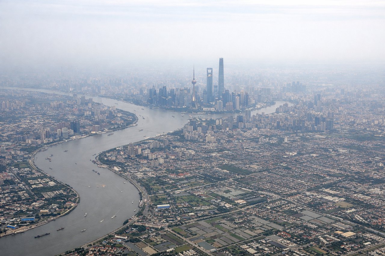
Takeoff from PVG
RIGHTRight side offers views of the Huangpu River winding through Shanghai's urban core and the East China Sea coastline. The left side faces inland toward flat agricultural plains with minimal visual interest during climb-out.
Landing at HRB
LEFTLeft side provides views of the Songhua River as it approaches Harbin, plus the city's urban layout spread across both banks. The right side faces open countryside and agricultural land with less distinctive features.
Landmarks on this routeAll landmarks →
Will your flight be in sunlight?
Pick a date and time in the Sun Map to watch the sun move across your whole flight.
About This Route
Which side of the plane should I sit on flying from Shanghai Pudong International (PVG) to Taiping (HRB)?
Sit on the Right side of the plane for the best views on flights from Shanghai to Harbin. Right side captures Shanghai's coastal and river scenery during takeoff, which is the most visually distinctive segment. While the landing approach favors the left, the takeoff views are more dramatic and memorable.
What can I see during takeoff from Shanghai Pudong International in Shanghai?
During takeoff from Shanghai Pudong International (PVG), sit on the Right side for the best views. Right side offers views of the Huangpu River winding through Shanghai's urban core and the East China Sea coastline. The left side faces inland toward flat agricultural plains with minimal visual interest during climb-out. Notable sights include: Huangpu River (curving through Pudong and Puxi districts), Shanghai's downtown skyline (Lujiazui financial district), East China Sea coastline, Hangzhou Bay to the south.
What can I see when landing at Taiping in Harbin?
When landing at Taiping (HRB), sit on the Left side for the best views. Left side provides views of the Songhua River as it approaches Harbin, plus the city's urban layout spread across both banks. The right side faces open countryside and agricultural land with less distinctive features. Notable sights include: Songhua River (major waterway through Harbin), Harbin city proper (urban sprawl across both banks), Sun Island (large island in the Songhua River), surrounding Heilongjiang plains.
How long is the flight from Shanghai to Harbin?
The flight from Shanghai Pudong International (PVG) to Taiping (HRB) takes about 2 hours 15 minutes. The shortest flight path between them is 1,029 miles (1,655 km); winds and air traffic control usually add a few percent.
What does the Shanghai to Harbin flight path pass over?
The flight path runs roughly north-northwest from Shanghai across Jiangsu Province, passing east of Nanjing. Notable features include the Yangtze River crossing (visible around midpoint, approximately 1 hour into flight), the transition from the Yangtze River Delta's agricultural plains to the flatter terrain of Anhui and Jiangsu, and scattered lakes and waterways. The landscape becomes progressively flatter and more rural as the aircraft moves north toward Heilongjiang Province. No major mountain ranges are crossed on this route—the terrain remains predominantly low-lying plains throughout the flight.