Shanghai to Phnom Penh is 1,734 miles (2,790 km), a flight of about 3 hours 55 minutes.
Left seats capture the Tonlé Sap Lake approach during landing, which is the most visually distinctive segment of this route. Takeoff views are comparable between sides, but the landing view decisively favors left.
Flight Path
The flight path crosses the Gulf of Tonkin and approaches Cambodia from the southeast. Notable features include the Mekong Delta's distributaries (visible as a braided water network during descent), extensive rice paddies and wetlands around the Tonlé Sap region, and scattered limestone karst formations near the Thai-Cambodian border (visible as low hills on the horizon during cruise). The route typically stays over water or sparsely populated areas, offering limited mid-flight landmarks from altitude.
Great circle distance and headings ›.jpg?width=600)

Phase by phase
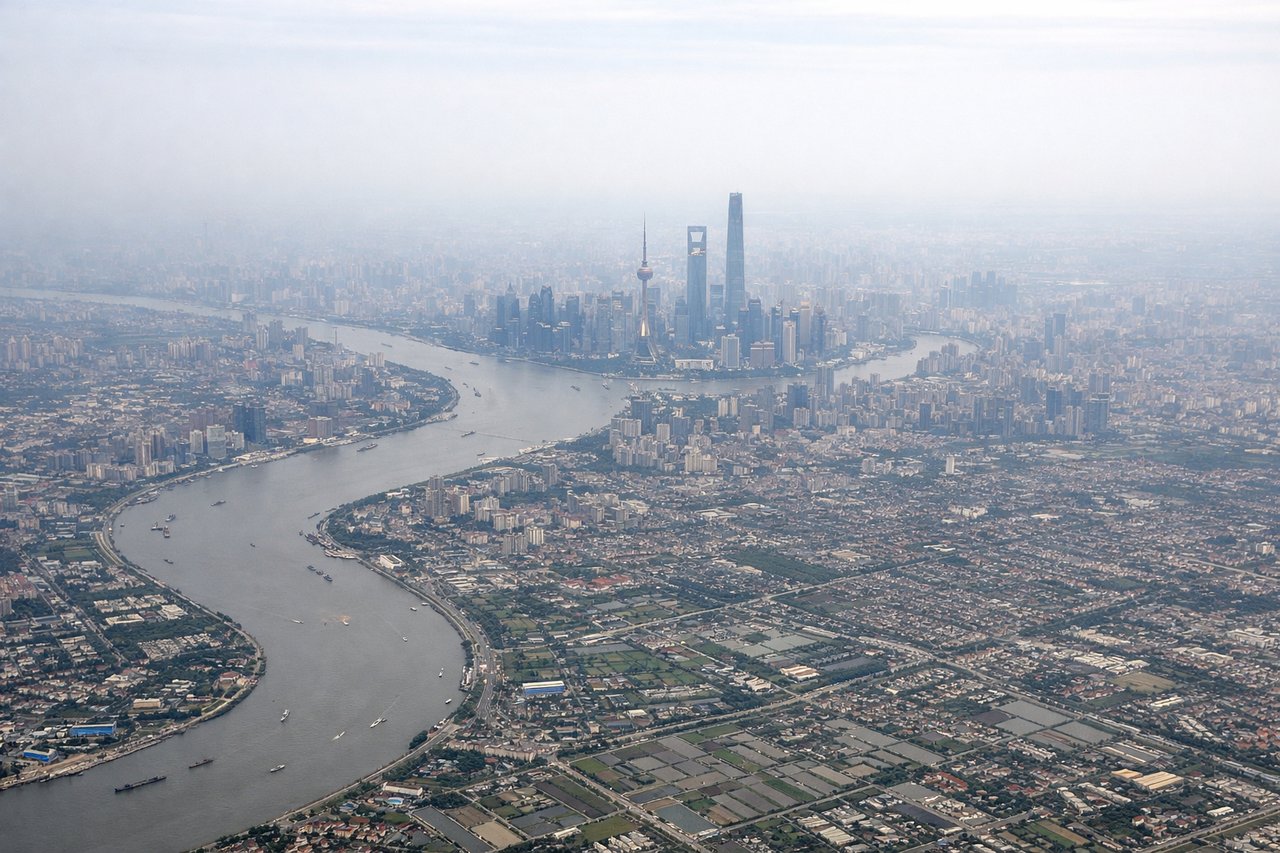
Takeoff from PVG
RIGHTPVG typically departs runways 08L/08R or 16L/16R heading east or northeast. Right-side seats offer views of the Huangpu River's eastern bend and Pudong's high-rise corridor receding westward, plus the East China Sea approaching the horizon. Left seats face inland toward industrial areas with less visual interest.
Landing at PNH
LEFTApproaching PNH typically uses runways 03L/03R or 21L/21R. Left-side seats during descent offer views of the Tonlé Sap Lake's northern reaches and the Mekong River's approach to Phnom Penh. Right seats face less distinctive terrain—mostly flat agricultural plains with scattered villages.
Landmarks on this routeAll landmarks →
Will your flight be in sunlight?
Pick a date and time in the Sun Map to watch the sun move across your whole flight.
About This Route
Which side of the plane should I sit on flying from Shanghai Pudong International (PVG) to Pochentong International (PNH)?
Sit on the Left side of the plane for the best views on flights from Shanghai to Phnom Penh. Left seats capture the Tonlé Sap Lake approach during landing, which is the most visually distinctive segment of this route. Takeoff views are comparable between sides, but the landing view decisively favors left.
What can I see during takeoff from Shanghai Pudong International in Shanghai?
During takeoff from Shanghai Pudong International (PVG), sit on the Right side for the best views. PVG typically departs runways 08L/08R or 16L/16R heading east or northeast. Right-side seats offer views of the Huangpu River's eastern bend and Pudong's high-rise corridor receding westward, plus the East China Sea approaching the horizon. Left seats face inland toward industrial areas with less visual interest. Notable sights include: Huangpu River (distinctive S-curve below), Pudong financial district skyline, East China Sea horizon, Hangzhou Bay (distant southern horizon).
What can I see when landing at Pochentong International in Phnom Penh?
When landing at Pochentong International (PNH), sit on the Left side for the best views. Approaching PNH typically uses runways 03L/03R or 21L/21R. Left-side seats during descent offer views of the Tonlé Sap Lake's northern reaches and the Mekong River's approach to Phnom Penh. Right seats face less distinctive terrain—mostly flat agricultural plains with scattered villages. Notable sights include: Tonlé Sap Lake (vast shallow water body), Mekong River (main channel approaching city), Phnom Penh urban area, surrounding rice paddies and wetlands.
How long is the flight from Shanghai to Phnom Penh?
The flight from Shanghai Pudong International (PVG) to Pochentong International (PNH) takes about 3 hours 55 minutes. The shortest flight path between them is 1,734 miles (2,790 km); winds and air traffic control usually add a few percent.
What does the Shanghai to Phnom Penh flight path pass over?
The flight path crosses the Gulf of Tonkin and approaches Cambodia from the southeast. Notable features include the Mekong Delta's distributaries (visible as a braided water network during descent), extensive rice paddies and wetlands around the Tonlé Sap region, and scattered limestone karst formations near the Thai-Cambodian border (visible as low hills on the horizon during cruise). The route typically stays over water or sparsely populated areas, offering limited mid-flight landmarks from altitude.